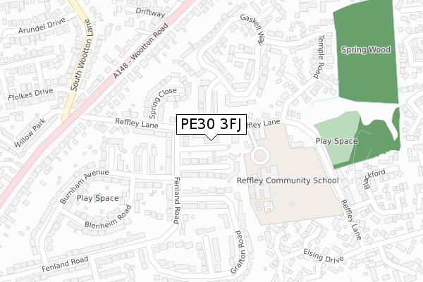
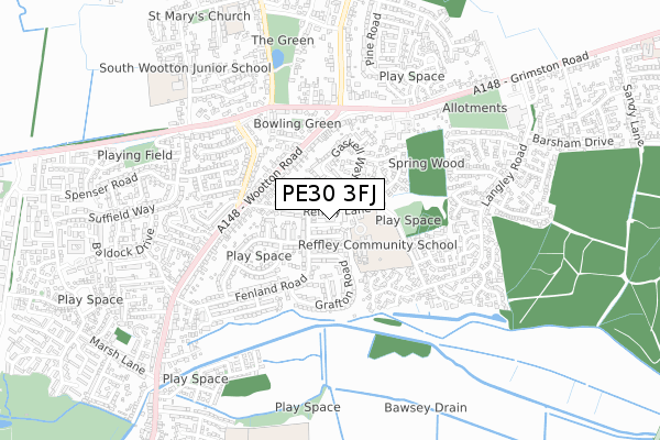
PE30 3FJ is located in the Gaywood North Bank electoral ward, within the local authority district of King's Lynn and West Norfolk and the English Parliamentary constituency of North West Norfolk. The Sub Integrated Care Board (ICB) Location is NHS Norfolk and Waveney ICB - 26A and the police force is Norfolk. This postcode has been in use since October 2019.


GetTheData
Source: OS Open Zoomstack (Ordnance Survey)
Licence: Open Government Licence (requires attribution)
Attribution: Contains OS data © Crown copyright and database right 2024
Source: Open Postcode Geo
Licence: Open Government Licence (requires attribution)
Attribution: Contains OS data © Crown copyright and database right 2024; Contains Royal Mail data © Royal Mail copyright and database right 2024; Source: Office for National Statistics licensed under the Open Government Licence v.3.0
| Easting | 564514 |
| Northing | 321975 |
| Latitude | 52.770331 |
| Longitude | 0.437173 |
GetTheData
Source: Open Postcode Geo
Licence: Open Government Licence
| Country | England |
| Postcode District | PE30 |
| ➜ PE30 open data dashboard ➜ See where PE30 is on a map ➜ Where is King's Lynn? | |
GetTheData
Source: Land Registry Price Paid Data
Licence: Open Government Licence
| Ward | Gaywood North Bank |
| Constituency | North West Norfolk |
GetTheData
Source: ONS Postcode Database
Licence: Open Government Licence
| January 2024 | Violence and sexual offences | On or near Willow Park | 421m |
| December 2023 | Violence and sexual offences | On or near Willow Park | 421m |
| September 2023 | Bicycle theft | On or near Willow Park | 421m |
| ➜ Get more crime data in our Crime section | |||
GetTheData
Source: data.police.uk
Licence: Open Government Licence
| Gresham Close (Fenland Road) | South Wootton | 110m |
| Gresham Close (Fenland Road) | South Wootton | 116m |
| Temple Road (Reffley Lane) | South Wootton | 140m |
| Temple Road (Reffley Lane) | South Wootton | 148m |
| Grafton Road (Fenland Road) | King's Lynn | 282m |
| Kings Lynn Station | 2.9km |
GetTheData
Source: NaPTAN
Licence: Open Government Licence
GetTheData
Source: ONS Postcode Database
Licence: Open Government Licence


➜ Get more ratings from the Food Standards Agency
GetTheData
Source: Food Standards Agency
Licence: FSA terms & conditions
| Last Collection | |||
|---|---|---|---|
| Location | Mon-Fri | Sat | Distance |
| Wootton Road-queen Elizabeth | 18:00 | 12:00 | 973m |
| St Augustines Way | 17:45 | 12:30 | 1,153m |
| Grimston Road | 17:45 | 12:15 | 1,227m |
GetTheData
Source: Dracos
Licence: Creative Commons Attribution-ShareAlike
| Facility | Distance |
|---|---|
| Reffley Academy Reffley Lane, King's Lynn Grass Pitches | 171m |
| St Marthas Catholic Primary School Field Lane, Gaywood, King's Lynn Grass Pitches, Sports Hall | 1.1km |
| Springwood High School Queensway, King's Lynn Grass Pitches, Sports Hall, Studio, Artificial Grass Pitch, Outdoor Tennis Courts | 1.2km |
GetTheData
Source: Active Places
Licence: Open Government Licence
| School | Phase of Education | Distance |
|---|---|---|
| Reffley Academy Reffley Lane, King's Lynn, PE30 3SF | Primary | 154m |
| South Wootton Junior School Hall Lane, South Wootton, King's Lynn, PE30 3JZ | Primary | 751m |
| South Wootton Infant School 9 Church Lane, South Wootton, King's Lynn, PE30 3LJ | Primary | 873m |
GetTheData
Source: Edubase
Licence: Open Government Licence
The below table lists the International Territorial Level (ITL) codes (formerly Nomenclature of Territorial Units for Statistics (NUTS) codes) and Local Administrative Units (LAU) codes for PE30 3FJ:
| ITL 1 Code | Name |
|---|---|
| TLH | East |
| ITL 2 Code | Name |
| TLH1 | East Anglia |
| ITL 3 Code | Name |
| TLH16 | North and West Norfolk |
| LAU 1 Code | Name |
| E07000146 | King's Lynn and West Norfolk |
GetTheData
Source: ONS Postcode Directory
Licence: Open Government Licence
The below table lists the Census Output Area (OA), Lower Layer Super Output Area (LSOA), and Middle Layer Super Output Area (MSOA) for PE30 3FJ:
| Code | Name | |
|---|---|---|
| OA | E00135542 | |
| LSOA | E01026671 | King's Lynn and West Norfolk 006C |
| MSOA | E02005556 | King's Lynn and West Norfolk 006 |
GetTheData
Source: ONS Postcode Directory
Licence: Open Government Licence
| PE30 3EQ | Reffley Lane | 59m |
| PE30 3SA | Reffley Lane | 61m |
| PE30 3EJ | Gresham Close | 80m |
| PE30 3EG | Houghton Avenue | 101m |
| PE30 3EH | Reffley Lane | 109m |
| PE30 3ER | Fenland Road | 111m |
| PE30 3ED | Spring Close | 147m |
| PE30 3HA | Grafton Road | 154m |
| PE30 3SU | Reffley Lane | 169m |
| PE30 3SG | Gaskell Way | 171m |
GetTheData
Source: Open Postcode Geo; Land Registry Price Paid Data
Licence: Open Government Licence