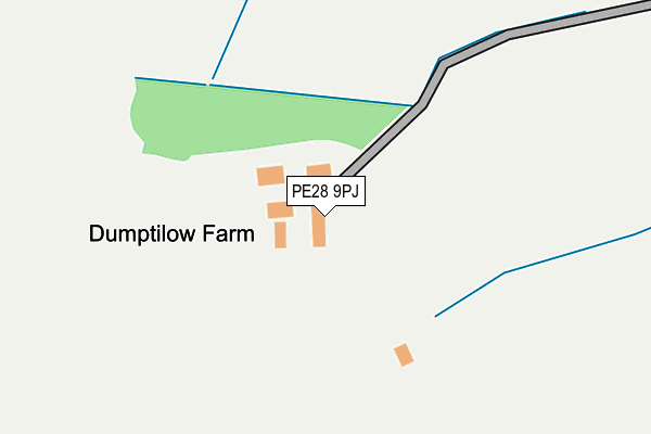
PE28 9PJ is located in the Caxton & Papworth electoral ward, within the local authority district of South Cambridgeshire and the English Parliamentary constituency of South Cambridgeshire. The Sub Integrated Care Board (ICB) Location is NHS Cambridgeshire and Peterborough ICB - 06H and the police force is Cambridgeshire. This postcode has been in use since March 2017.


GetTheData
Source: OS OpenMap – Local (Ordnance Survey)
Source: OS VectorMap District (Ordnance Survey)
Licence: Open Government Licence (requires attribution)
| Easting | 526233 |
| Northing | 266184 |
| Latitude | 52.279329 |
| Longitude | -0.151058 |
GetTheData
Source: Open Postcode Geo
Licence: Open Government Licence
| Country | England |
| Postcode District | PE28 |
| ➜ PE28 open data dashboard ➜ See where PE28 is on a map | |
GetTheData
Source: Land Registry Price Paid Data
Licence: Open Government Licence
| Ward | Caxton & Papworth |
| Constituency | South Cambridgeshire |
GetTheData
Source: ONS Postcode Database
Licence: Open Government Licence
| Main Road (Barnfield Lane) | Papworth St Agnes | 1,145m |
| Main Road (Barnfield Lane) | Papworth St Agnes | 1,150m |
GetTheData
Source: NaPTAN
Licence: Open Government Licence
| Percentage of properties with Next Generation Access | 0.0% |
| Percentage of properties with Superfast Broadband | 0.0% |
| Percentage of properties with Ultrafast Broadband | 0.0% |
| Percentage of properties with Full Fibre Broadband | 0.0% |
Superfast Broadband is between 30Mbps and 300Mbps
Ultrafast Broadband is > 300Mbps
| Percentage of properties unable to receive 2Mbps | 0.0% |
| Percentage of properties unable to receive 5Mbps | 0.0% |
| Percentage of properties unable to receive 10Mbps | 0.0% |
| Percentage of properties unable to receive 30Mbps | 100.0% |
GetTheData
Source: Ofcom
Licence: Ofcom Terms of Use (requires attribution)
GetTheData
Source: ONS Postcode Database
Licence: Open Government Licence
| Last Collection | |||
|---|---|---|---|
| Location | Mon-Fri | Sat | Distance |
| Papworth St Agnes Village | 12:30 | 09:30 | 1,714m |
| Graveley | 16:30 | 08:30 | 2,522m |
| Pendragon Hill | 17:00 | 10:00 | 3,422m |
GetTheData
Source: Dracos
Licence: Creative Commons Attribution-ShareAlike
| Facility | Distance |
|---|---|
| The David Wilson Homes Ground Bearscroft Lane, Godmanchester Grass Pitches | 3.4km |
| Hemingford Abbots Golf Course (Closed) Cambridge Road, Hemingford Abbots, Huntingdon Golf | 3.5km |
| Bridge Academy Butcher Drive, Godmanchester, Huntingdon Grass Pitches | 3.7km |
GetTheData
Source: Active Places
Licence: Open Government Licence
| School | Phase of Education | Distance |
|---|---|---|
| Pendragon Community Primary School Varrier-Jones Drive, Papworth Everard, Cambridge, CB23 3XQ | Primary | 3.5km |
| Godmanchester Bridge Academy 2 Butcher Drive, Godmanchester, PE29 2NL | Primary | 3.7km |
| St Anne's CofE Primary School London Road, Godmanchester, Huntingdon, PE29 2WW | Primary | 3.9km |
GetTheData
Source: Edubase
Licence: Open Government Licence
The below table lists the International Territorial Level (ITL) codes (formerly Nomenclature of Territorial Units for Statistics (NUTS) codes) and Local Administrative Units (LAU) codes for PE28 9PJ:
| ITL 1 Code | Name |
|---|---|
| TLH | East |
| ITL 2 Code | Name |
| TLH1 | East Anglia |
| ITL 3 Code | Name |
| TLH12 | Cambridgeshire CC |
| LAU 1 Code | Name |
| E07000012 | South Cambridgeshire |
GetTheData
Source: ONS Postcode Directory
Licence: Open Government Licence
The below table lists the Census Output Area (OA), Lower Layer Super Output Area (LSOA), and Middle Layer Super Output Area (MSOA) for PE28 9PJ:
| Code | Name | |
|---|---|---|
| OA | E00092188 | |
| LSOA | E01018278 | South Cambridgeshire 021C |
| MSOA | E02006874 | South Cambridgeshire 021 |
GetTheData
Source: ONS Postcode Directory
Licence: Open Government Licence
| CB23 3QZ | 1805m | |
| CB23 3QU | 1834m | |
| PE29 2LG | Silver Street | 1889m |
| PE19 6PH | Papworth Road | 2241m |
| PE19 6PJ | Manor Close | 2302m |
| PE19 5RJ | 2427m | |
| PE28 9QS | College Court | 2447m |
| PE28 9QA | Graveley Way | 2471m |
| PE19 6PN | Fieldings Place | 2487m |
| PE19 6PW | Church Lane | 2493m |
GetTheData
Source: Open Postcode Geo; Land Registry Price Paid Data
Licence: Open Government Licence