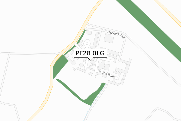
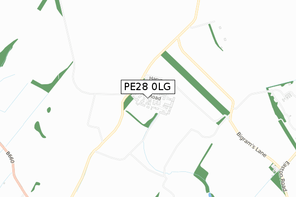
PE28 0LG is located in the Riseley electoral ward, within the unitary authority of Bedford and the English Parliamentary constituency of North East Bedfordshire. The Sub Integrated Care Board (ICB) Location is NHS Bedfordshire, Luton and Milton Keynes ICB - M1J4Y and the police force is Bedfordshire. This postcode has been in use since December 2018.


GetTheData
Source: OS Open Zoomstack (Ordnance Survey)
Licence: Open Government Licence (requires attribution)
Attribution: Contains OS data © Crown copyright and database right 2024
Source: Open Postcode Geo
Licence: Open Government Licence (requires attribution)
Attribution: Contains OS data © Crown copyright and database right 2024; Contains Royal Mail data © Royal Mail copyright and database right 2024; Source: Office for National Statistics licensed under the Open Government Licence v.3.0
| Easting | 505371 |
| Northing | 268781 |
| Latitude | 52.307060 |
| Longitude | -0.455917 |
GetTheData
Source: Open Postcode Geo
Licence: Open Government Licence
| Country | England |
| Postcode District | PE28 |
| ➜ PE28 open data dashboard ➜ See where PE28 is on a map ➜ Where is Lower Dean? | |
GetTheData
Source: Land Registry Price Paid Data
Licence: Open Government Licence
| Ward | Riseley |
| Constituency | North East Bedfordshire |
GetTheData
Source: ONS Postcode Database
Licence: Open Government Licence
| Chestnut Farmhouse (High Street) | Lower Dean | 206m |
| Chestnut Farmhouse (High Street) | Lower Dean | 209m |
| Shay Lane (High Street) | Upper Dean | 1,046m |
| Shay Lane (High Street) | Upper Dean | 1,051m |
| Dean Court (Brook Lane) | Upper Dean | 1,260m |
GetTheData
Source: NaPTAN
Licence: Open Government Licence
GetTheData
Source: ONS Postcode Database
Licence: Open Government Licence


➜ Get more ratings from the Food Standards Agency
GetTheData
Source: Food Standards Agency
Licence: FSA terms & conditions
| Last Collection | |||
|---|---|---|---|
| Location | Mon-Fri | Sat | Distance |
| Upper Dean Post Office | 16:30 | 09:00 | 1,352m |
| Shelton | 16:15 | 09:00 | 1,934m |
| Covington | 16:30 | 09:30 | 2,035m |
GetTheData
Source: Dracos
Licence: Creative Commons Attribution-ShareAlike
| Facility | Distance |
|---|---|
| Dalton Hall And Playing Fields Upper Dean, Huntingdon Grass Pitches | 551m |
| Kimbolton Prep School Tilbrook Road, Kimbolton, Huntingdon Grass Pitches, Sports Hall | 4.1km |
| Kimbolton Town Colts Fc Pound Lane, Kimbolton Grass Pitches | 4.2km |
GetTheData
Source: Active Places
Licence: Open Government Licence
| School | Phase of Education | Distance |
|---|---|---|
| Eileen Wade Primary School High Street, Upper Dean, Huntingdon, PE28 0ND | Primary | 1.3km |
| Kimbolton Primary Academy Newtown, Kimbolton, Huntingdon, PE28 0HY | Primary | 4.7km |
| Kimbolton School Kimbolton, Huntingdon, PE28 0EA | Not applicable | 4.7km |
GetTheData
Source: Edubase
Licence: Open Government Licence
The below table lists the International Territorial Level (ITL) codes (formerly Nomenclature of Territorial Units for Statistics (NUTS) codes) and Local Administrative Units (LAU) codes for PE28 0LG:
| ITL 1 Code | Name |
|---|---|
| TLH | East |
| ITL 2 Code | Name |
| TLH2 | Bedfordshire and Hertfordshire |
| ITL 3 Code | Name |
| TLH24 | Bedford |
| LAU 1 Code | Name |
| E06000055 | Bedford |
GetTheData
Source: ONS Postcode Directory
Licence: Open Government Licence
The below table lists the Census Output Area (OA), Lower Layer Super Output Area (LSOA), and Middle Layer Super Output Area (MSOA) for PE28 0LG:
| Code | Name | |
|---|---|---|
| OA | E00088546 | |
| LSOA | E01017540 | Bedford 001A |
| MSOA | E02003616 | Bedford 001 |
GetTheData
Source: ONS Postcode Directory
Licence: Open Government Licence
| PE28 0LN | 55m | |
| PE28 0LJ | Kimbolton Road | 333m |
| PE28 0LL | High Street | 409m |
| PE28 0LT | 889m | |
| PE28 0LU | Chapel Row | 1023m |
| PE28 0LX | The Row | 1029m |
| PE28 0LZ | Shay Lane | 1032m |
| PE28 0LY | High Street | 1137m |
| PE28 0NQ | Shelton Road | 1273m |
| PE28 0NG | Brook Lane | 1287m |
GetTheData
Source: Open Postcode Geo; Land Registry Price Paid Data
Licence: Open Government Licence