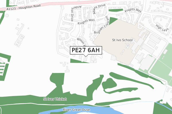
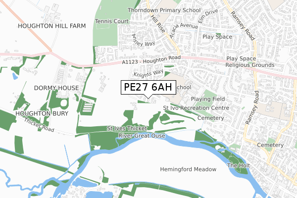
PE27 6AH is located in the St Ives South electoral ward, within the local authority district of Huntingdonshire and the English Parliamentary constituency of Huntingdon. The Sub Integrated Care Board (ICB) Location is NHS Cambridgeshire and Peterborough ICB - 06H and the police force is Cambridgeshire. This postcode has been in use since October 2019.


GetTheData
Source: OS Open Zoomstack (Ordnance Survey)
Licence: Open Government Licence (requires attribution)
Attribution: Contains OS data © Crown copyright and database right 2024
Source: Open Postcode Geo
Licence: Open Government Licence (requires attribution)
Attribution: Contains OS data © Crown copyright and database right 2024; Contains Royal Mail data © Royal Mail copyright and database right 2024; Source: Office for National Statistics licensed under the Open Government Licence v.3.0
| Easting | 530280 |
| Northing | 271985 |
| Latitude | 52.330511 |
| Longitude | -0.089528 |
GetTheData
Source: Open Postcode Geo
Licence: Open Government Licence
| Country | England |
| Postcode District | PE27 |
| ➜ PE27 open data dashboard ➜ See where PE27 is on a map ➜ Where is St Ives? | |
GetTheData
Source: Land Registry Price Paid Data
Licence: Open Government Licence
| Ward | St Ives South |
| Constituency | Huntingdon |
GetTheData
Source: ONS Postcode Database
Licence: Open Government Licence
| June 2022 | Anti-social behaviour | On or near Houghton Road | 404m |
| June 2022 | Violence and sexual offences | On or near Houghton Road | 404m |
| June 2022 | Anti-social behaviour | On or near High Leys | 478m |
| ➜ Get more crime data in our Crime section | |||
GetTheData
Source: data.police.uk
Licence: Open Government Licence
| St Ivo School (High Leys) | St Ives | 368m |
| Garner Drive (Houghton Road) | St Ives | 441m |
| Garner Drive (Houghton Road) | St Ives | 493m |
| Ansley Way (Hill Rise) | St Ives | 599m |
| Ansley Way (Hill Rise) | St Ives | 624m |
GetTheData
Source: NaPTAN
Licence: Open Government Licence
GetTheData
Source: ONS Postcode Database
Licence: Open Government Licence


➜ Get more ratings from the Food Standards Agency
GetTheData
Source: Food Standards Agency
Licence: FSA terms & conditions
| Last Collection | |||
|---|---|---|---|
| Location | Mon-Fri | Sat | Distance |
| Hill Rise | 17:30 | 11:30 | 724m |
| Shakespeare Road | 17:30 | 11:30 | 864m |
| The Waits | 17:30 | 11:30 | 907m |
GetTheData
Source: Dracos
Licence: Creative Commons Attribution-ShareAlike
| Facility | Distance |
|---|---|
| St Ives Golf Club (Closed) Westwood Road, St. Ives Golf | 151m |
| St Ivo Academy High Leys, St. Ives Sports Hall, Grass Pitches, Outdoor Tennis Courts | 291m |
| One Leisure St Ives (Indoor) Westwood Road, St. Ives Sports Hall, Swimming Pool, Health and Fitness Gym, Studio | 342m |
GetTheData
Source: Active Places
Licence: Open Government Licence
| School | Phase of Education | Distance |
|---|---|---|
| Aurora Fairway School Westwood Road, St Ives, PE27 6RS | Not applicable | 157m |
| St Ivo Academy High Leys, St Ives, PE27 6RR | Secondary | 290m |
| Thorndown Primary School Hill Rise, St Ives, PE27 6SE | Primary | 682m |
GetTheData
Source: Edubase
Licence: Open Government Licence
The below table lists the International Territorial Level (ITL) codes (formerly Nomenclature of Territorial Units for Statistics (NUTS) codes) and Local Administrative Units (LAU) codes for PE27 6AH:
| ITL 1 Code | Name |
|---|---|
| TLH | East |
| ITL 2 Code | Name |
| TLH1 | East Anglia |
| ITL 3 Code | Name |
| TLH12 | Cambridgeshire CC |
| LAU 1 Code | Name |
| E07000011 | Huntingdonshire |
GetTheData
Source: ONS Postcode Directory
Licence: Open Government Licence
The below table lists the Census Output Area (OA), Lower Layer Super Output Area (LSOA), and Middle Layer Super Output Area (MSOA) for PE27 6AH:
| Code | Name | |
|---|---|---|
| OA | E00091667 | |
| LSOA | E01018169 | Huntingdonshire 013D |
| MSOA | E02003765 | Huntingdonshire 013 |
GetTheData
Source: ONS Postcode Directory
Licence: Open Government Licence
| PE27 6TE | Brigham Crescent | 192m |
| PE27 6TB | Knights Way | 230m |
| PE27 6TF | Goodman Close | 331m |
| PE27 6TD | Adams Drive | 336m |
| PE27 6RN | Houghton Road | 359m |
| PE27 6RT | High Leys | 403m |
| PE27 6NY | Redwell Close | 433m |
| PE27 6RX | High Leys | 459m |
| PE27 6UJ | Audley Close | 488m |
| PE27 6AD | Clark Drive | 498m |
GetTheData
Source: Open Postcode Geo; Land Registry Price Paid Data
Licence: Open Government Licence