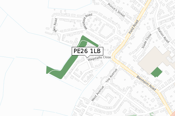
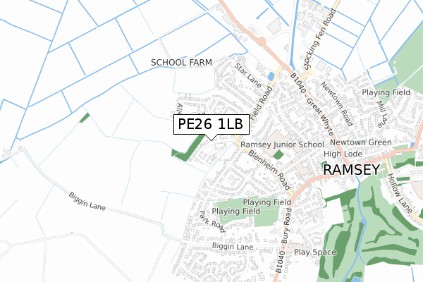
PE26 1LB is located in the Ramsey electoral ward, within the local authority district of Huntingdonshire and the English Parliamentary constituency of North West Cambridgeshire. The Sub Integrated Care Board (ICB) Location is NHS Cambridgeshire and Peterborough ICB - 06H and the police force is Cambridgeshire. This postcode has been in use since December 2018.


GetTheData
Source: OS Open Zoomstack (Ordnance Survey)
Licence: Open Government Licence (requires attribution)
Attribution: Contains OS data © Crown copyright and database right 2024
Source: Open Postcode Geo
Licence: Open Government Licence (requires attribution)
Attribution: Contains OS data © Crown copyright and database right 2024; Contains Royal Mail data © Royal Mail copyright and database right 2024; Source: Office for National Statistics licensed under the Open Government Licence v.3.0
| Easting | 527936 |
| Northing | 285211 |
| Latitude | 52.449903 |
| Longitude | -0.118862 |
GetTheData
Source: Open Postcode Geo
Licence: Open Government Licence
| Country | England |
| Postcode District | PE26 |
| ➜ PE26 open data dashboard ➜ See where PE26 is on a map ➜ Where is Ramsey? | |
GetTheData
Source: Land Registry Price Paid Data
Licence: Open Government Licence
| Ward | Ramsey |
| Constituency | North West Cambridgeshire |
GetTheData
Source: ONS Postcode Database
Licence: Open Government Licence
2023 28 JUL £332,500 |
2022 7 OCT £212,500 |
3, WAGSTAFFE CLOSE, RAMSEY, HUNTINGDON, PE26 1LB 2021 18 JUN £377,500 |
15, WAGSTAFFE CLOSE, RAMSEY, HUNTINGDON, PE26 1LB 2020 18 DEC £399,995 |
29, WAGSTAFFE CLOSE, RAMSEY, HUNTINGDON, PE26 1LB 2020 16 DEC £330,000 |
1, WAGSTAFFE CLOSE, RAMSEY, HUNTINGDON, PE26 1LB 2020 4 DEC £343,995 |
31, WAGSTAFFE CLOSE, RAMSEY, HUNTINGDON, PE26 1LB 2020 30 NOV £335,000 |
27, WAGSTAFFE CLOSE, RAMSEY, HUNTINGDON, PE26 1LB 2020 27 NOV £280,000 |
33, WAGSTAFFE CLOSE, RAMSEY, HUNTINGDON, PE26 1LB 2020 23 OCT £300,000 |
25, WAGSTAFFE CLOSE, RAMSEY, HUNTINGDON, PE26 1LB 2020 25 SEP £340,000 |
GetTheData
Source: HM Land Registry Price Paid Data
Licence: Contains HM Land Registry data © Crown copyright and database right 2024. This data is licensed under the Open Government Licence v3.0.
| June 2023 | Anti-social behaviour | On or near Prince'S Street | 352m |
| December 2022 | Public order | On or near Prince'S Street | 352m |
| June 2022 | Other theft | On or near Allen Road | 177m |
| ➜ Get more crime data in our Crime section | |||
GetTheData
Source: data.police.uk
Licence: Open Government Licence
| Charles Close (West Avenue) | Ramsey | 217m |
| Charles Close (West Avenue) | Ramsey | 226m |
| Westfield Road (Field Road) | Ramsey | 272m |
| Westfield Road (Field Road) | Ramsey | 273m |
| Fairfield Drive (Bury Road) | Ramsey | 607m |
GetTheData
Source: NaPTAN
Licence: Open Government Licence
| Percentage of properties with Next Generation Access | 100.0% |
| Percentage of properties with Superfast Broadband | 100.0% |
| Percentage of properties with Ultrafast Broadband | 100.0% |
| Percentage of properties with Full Fibre Broadband | 100.0% |
Superfast Broadband is between 30Mbps and 300Mbps
Ultrafast Broadband is > 300Mbps
| Percentage of properties unable to receive 2Mbps | 0.0% |
| Percentage of properties unable to receive 5Mbps | 0.0% |
| Percentage of properties unable to receive 10Mbps | 0.0% |
| Percentage of properties unable to receive 30Mbps | 0.0% |
GetTheData
Source: Ofcom
Licence: Ofcom Terms of Use (requires attribution)
GetTheData
Source: ONS Postcode Database
Licence: Open Government Licence


➜ Get more ratings from the Food Standards Agency
GetTheData
Source: Food Standards Agency
Licence: FSA terms & conditions
| Last Collection | |||
|---|---|---|---|
| Location | Mon-Fri | Sat | Distance |
| Westfield Estate Ramsey | 16:40 | 12:00 | 193m |
| Field Road Ramsey | 16:40 | 12:00 | 219m |
| Park Road Ramsey | 16:35 | 12:00 | 373m |
GetTheData
Source: Dracos
Licence: Creative Commons Attribution-ShareAlike
| Facility | Distance |
|---|---|
| Ramsey Town Football Club Cricketfield Lane, Ramsey, Huntingdon Grass Pitches | 508m |
| Ramsey Cricket Club Cricketfield Lane, Ramsey, Huntingdon Grass Pitches | 513m |
| Ramsey Community Junior School Station Road, Ramsey, Huntingdon Grass Pitches | 529m |
GetTheData
Source: Active Places
Licence: Open Government Licence
| School | Phase of Education | Distance |
|---|---|---|
| Ramsey Junior School Station Road, Ramsey, Huntingdon, PE26 1JA | Primary | 529m |
| Ramsey Spinning Infant School High Street, Ramsey, Huntingdon, PE26 1AD | Primary | 626m |
| Bury CofE Primary School Owls End, Bury, Huntingdon, PE26 2NJ | Primary | 1.5km |
GetTheData
Source: Edubase
Licence: Open Government Licence
The below table lists the International Territorial Level (ITL) codes (formerly Nomenclature of Territorial Units for Statistics (NUTS) codes) and Local Administrative Units (LAU) codes for PE26 1LB:
| ITL 1 Code | Name |
|---|---|
| TLH | East |
| ITL 2 Code | Name |
| TLH1 | East Anglia |
| ITL 3 Code | Name |
| TLH12 | Cambridgeshire CC |
| LAU 1 Code | Name |
| E07000011 | Huntingdonshire |
GetTheData
Source: ONS Postcode Directory
Licence: Open Government Licence
The below table lists the Census Output Area (OA), Lower Layer Super Output Area (LSOA), and Middle Layer Super Output Area (MSOA) for PE26 1LB:
| Code | Name | |
|---|---|---|
| OA | E00091611 | |
| LSOA | E01018159 | Huntingdonshire 003D |
| MSOA | E02003755 | Huntingdonshire 003 |
GetTheData
Source: ONS Postcode Directory
Licence: Open Government Licence
| PE26 1JX | Hawthorn Road | 161m |
| PE26 1AP | The Avenue | 169m |
| PE26 1AW | Blenheim Road | 195m |
| PE26 1JU | Allen Road | 201m |
| PE26 1JS | South Walk | 212m |
| PE26 1AY | West Avenue | 215m |
| PE26 1JT | North Walk | 237m |
| PE26 1JR | Westfield Road | 250m |
| PE26 1AR | The Avenue | 252m |
| PE26 1JY | Meadow Walk | 253m |
GetTheData
Source: Open Postcode Geo; Land Registry Price Paid Data
Licence: Open Government Licence