PE25 2BF maps, stats, and open data
- Home
- Postcode
- PE
- PE25
- PE25 2
PE25 2BF is located in the St Clement's electoral ward, within the local authority district of East Lindsey and the English Parliamentary constituency of Boston and Skegness. The Sub Integrated Care Board (ICB) Location is NHS Lincolnshire ICB - 71E and the police force is Lincolnshire. This postcode has been in use since January 2018.
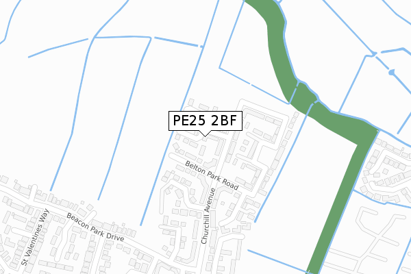
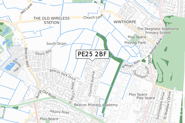
PE25 2BF maps


Source: OS Open Zoomstack (Ordnance Survey)
Licence: Open Government Licence (requires attribution)
Attribution: Contains OS data © Crown copyright and database right 2025
Source: Open Postcode GeoLicence: Open Government Licence (requires attribution)
Attribution: Contains OS data © Crown copyright and database right 2025; Contains Royal Mail data © Royal Mail copyright and database right 2025; Source: Office for National Statistics licensed under the Open Government Licence v.3.0
PE25 2BF geodata
| Easting | 555951 |
| Northing | 365013 |
| Latitude | 53.159436 |
| Longitude | 0.331056 |
Where is PE25 2BF?
| Country | England |
| Postcode District | PE25 |
Politics
| Ward | St Clement's |
|---|
| Constituency | Boston And Skegness |
|---|
Transport
Nearest bus stops to PE25 2BF
| Harrow Road (Beacon Park Drive) | Skegness | 306m |
| St Marys Road (Beacon Park Drive) | Skegness | 336m |
| James Avenue (Beacon Park Drive) | Skegness | 383m |
| St Margarets Avenue (St Marys Road) | Skegness | 482m |
| Beacon Medical Practice (Churchill Avenue) | Skegness | 557m |
Nearest railway stations to PE25 2BF
Broadband
Broadband access in PE25 2BF (2020 data)
| Percentage of properties with Next Generation Access | 100.0% |
| Percentage of properties with Superfast Broadband | 100.0% |
| Percentage of properties with Ultrafast Broadband | 0.0% |
| Percentage of properties with Full Fibre Broadband | 0.0% |
Superfast Broadband is between 30Mbps and 300Mbps
Ultrafast Broadband is > 300Mbps
Broadband speed in PE25 2BF (2019 data)
Download
| Median download speed | 23.0Mbps |
| Average download speed | 23.6Mbps |
| Maximum download speed | 42.77Mbps |
Upload
| Median upload speed | 4.3Mbps |
| Average upload speed | 4.9Mbps |
| Maximum upload speed | 9.35Mbps |
Broadband limitations in PE25 2BF (2020 data)
| Percentage of properties unable to receive 2Mbps | 0.0% |
| Percentage of properties unable to receive 5Mbps | 0.0% |
| Percentage of properties unable to receive 10Mbps | 0.0% |
| Percentage of properties unable to receive 30Mbps | 0.0% |
Deprivation
79.1% of English postcodes are less deprived than
PE25 2BF:
Food Standards Agency
Three nearest food hygiene ratings to PE25 2BF (metres)
Blakemore Retail
Aspen Lodge Nursing Home
Aspen Lodge Care Home
713m
Churchill Service Station
Churchill Service Station
746m
➜ Get more ratings from the Food Standards Agency
Nearest post box to PE25 2BF
| | Last Collection | |
|---|
| Location | Mon-Fri | Sat | Distance |
|---|
| Lumley Road-lloyds Bank | 17:30 | 11:45 | 1,911m |
| South Parade | 17:30 | 11:45 | 2,413m |
Environment
| Risk of PE25 2BF flooding from rivers and sea | Low |
PE25 2BF ITL and PE25 2BF LAU
The below table lists the International Territorial Level (ITL) codes (formerly Nomenclature of Territorial Units for Statistics (NUTS) codes) and Local Administrative Units (LAU) codes for PE25 2BF:
| ITL 1 Code | Name |
|---|
| TLF | East Midlands (England) |
| ITL 2 Code | Name |
|---|
| TLF3 | Lincolnshire |
| ITL 3 Code | Name |
|---|
| TLF30 | Lincolnshire CC |
| LAU 1 Code | Name |
|---|
| E07000137 | East Lindsey |
PE25 2BF census areas
The below table lists the Census Output Area (OA), Lower Layer Super Output Area (LSOA), and Middle Layer Super Output Area (MSOA) for PE25 2BF:
| Code | Name |
|---|
| OA | E00169338 | |
|---|
| LSOA | E01026085 | East Lindsey 012B |
|---|
| MSOA | E02005435 | East Lindsey 012 |
|---|
Nearest postcodes to PE25 2BF


