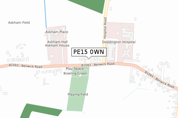
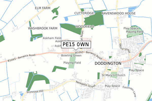
PE15 0WN is located in the Doddington & Wimblington electoral ward, within the local authority district of Fenland and the English Parliamentary constituency of North East Cambridgeshire. The Sub Integrated Care Board (ICB) Location is NHS Cambridgeshire and Peterborough ICB - 06H and the police force is Cambridgeshire. This postcode has been in use since August 2018.


GetTheData
Source: OS Open Zoomstack (Ordnance Survey)
Licence: Open Government Licence (requires attribution)
Attribution: Contains OS data © Crown copyright and database right 2024
Source: Open Postcode Geo
Licence: Open Government Licence (requires attribution)
Attribution: Contains OS data © Crown copyright and database right 2024; Contains Royal Mail data © Royal Mail copyright and database right 2024; Source: Office for National Statistics licensed under the Open Government Licence v.3.0
| Easting | 539422 |
| Northing | 290961 |
| Latitude | 52.498755 |
| Longitude | 0.052440 |
GetTheData
Source: Open Postcode Geo
Licence: Open Government Licence
| Country | England |
| Postcode District | PE15 |
| ➜ PE15 open data dashboard ➜ See where PE15 is on a map ➜ Where is Doddington? | |
GetTheData
Source: Land Registry Price Paid Data
Licence: Open Government Licence
| Ward | Doddington & Wimblington |
| Constituency | North East Cambridgeshire |
GetTheData
Source: ONS Postcode Database
Licence: Open Government Licence
3, ASKHAM ROW, DODDINGTON, MARCH, PE15 0WN 2021 3 JUN £590,000 |
1, ASKHAM ROW, DODDINGTON, MARCH, PE15 0WN 2021 16 APR £650,000 |
2, ASKHAM ROW, DODDINGTON, MARCH, PE15 0WN 2021 6 APR £575,000 |
5, ASKHAM ROW, DODDINGTON, MARCH, PE15 0WN 2020 18 NOV £595,000 |
4, ASKHAM ROW, DODDINGTON, MARCH, PE15 0WN 2020 7 FEB £625,000 |
8, ASKHAM ROW BENWICK ROAD, DODDINGTON, MARCH, PE15 0WN 2019 24 MAY £565,000 |
7, ASKHAM ROW, DODDINGTON, MARCH, PE15 0WN 2019 16 MAY £618,750 |
9 ASKHAM ROW, BENWICK ROAD, DODDINGTON, MARCH, PE15 0WN 2018 12 SEP £555,000 |
10 ASKHAM ROW, BENWICK ROAD, DODDINGTON, MARCH, PE15 0WN 2018 13 JUL £640,000 |
GetTheData
Source: HM Land Registry Price Paid Data
Licence: Contains HM Land Registry data © Crown copyright and database right 2024. This data is licensed under the Open Government Licence v3.0.
| June 2022 | Violence and sexual offences | On or near Oaktree Close | 439m |
| May 2022 | Other theft | On or near Sports/Recreation Area | 173m |
| April 2022 | Criminal damage and arson | On or near Sports/Recreation Area | 173m |
| ➜ Get more crime data in our Crime section | |||
GetTheData
Source: data.police.uk
Licence: Open Government Licence
| County Hospital (Benwick Road) | Doddington | 143m |
| County Hospital (Benwick Road) | Doddington | 148m |
| Cook's Green (Newgate Street) | Doddington | 557m |
| New Street (Benwick Road) | Doddington | 564m |
| Cook's Green (Newgate Street) | Doddington | 566m |
GetTheData
Source: NaPTAN
Licence: Open Government Licence
| Percentage of properties with Next Generation Access | 100.0% |
| Percentage of properties with Superfast Broadband | 100.0% |
| Percentage of properties with Ultrafast Broadband | 100.0% |
| Percentage of properties with Full Fibre Broadband | 100.0% |
Superfast Broadband is between 30Mbps and 300Mbps
Ultrafast Broadband is > 300Mbps
| Percentage of properties unable to receive 2Mbps | 0.0% |
| Percentage of properties unable to receive 5Mbps | 0.0% |
| Percentage of properties unable to receive 10Mbps | 0.0% |
| Percentage of properties unable to receive 30Mbps | 0.0% |
GetTheData
Source: Ofcom
Licence: Ofcom Terms of Use (requires attribution)
GetTheData
Source: ONS Postcode Database
Licence: Open Government Licence


➜ Get more ratings from the Food Standards Agency
GetTheData
Source: Food Standards Agency
Licence: FSA terms & conditions
| Last Collection | |||
|---|---|---|---|
| Location | Mon-Fri | Sat | Distance |
| Benwick Road | 16:30 | 07:00 | 76m |
| Doddington Post Office | 17:15 | 11:00 | 590m |
| Ancaster Way | 17:00 | 11:00 | 635m |
GetTheData
Source: Dracos
Licence: Creative Commons Attribution-ShareAlike
| Facility | Distance |
|---|---|
| Doddington Recreation Ground Benwick Road, Doddington, March Grass Pitches, Outdoor Tennis Courts | 202m |
| Dack Field Beech Avenue, Doddington Grass Pitches | 1km |
| Wimblington War Memorial Playing Field Wimblington, March Grass Pitches | 2km |
GetTheData
Source: Active Places
Licence: Open Government Licence
| School | Phase of Education | Distance |
|---|---|---|
| Lionel Walden Primary School High Street, Doddington, March, PE15 0TF | Primary | 919m |
| Thomas Eaton Primary Academy Church Street, Wimblington, March, PE15 0QS | Primary | 2.5km |
| Kingsfield Primary School Burnsfield Street, Chatteris, PE16 6ET | Primary | 4.8km |
GetTheData
Source: Edubase
Licence: Open Government Licence
The below table lists the International Territorial Level (ITL) codes (formerly Nomenclature of Territorial Units for Statistics (NUTS) codes) and Local Administrative Units (LAU) codes for PE15 0WN:
| ITL 1 Code | Name |
|---|---|
| TLH | East |
| ITL 2 Code | Name |
| TLH1 | East Anglia |
| ITL 3 Code | Name |
| TLH12 | Cambridgeshire CC |
| LAU 1 Code | Name |
| E07000010 | Fenland |
GetTheData
Source: ONS Postcode Directory
Licence: Open Government Licence
The below table lists the Census Output Area (OA), Lower Layer Super Output Area (LSOA), and Middle Layer Super Output Area (MSOA) for PE15 0WN:
| Code | Name | |
|---|---|---|
| OA | E00091142 | |
| LSOA | E01018065 | Fenland 010A |
| MSOA | E02003751 | Fenland 010 |
GetTheData
Source: ONS Postcode Directory
Licence: Open Government Licence
| PE15 0TX | Benwick Road | 248m |
| PE15 0SJ | Hospital Road | 284m |
| PE15 0TG | Benwick Road | 406m |
| PE15 0TZ | Oaktree Close | 443m |
| PE15 0LA | Cornfields | 473m |
| PE15 0SR | Newgate Street | 570m |
| PE15 0NU | Thistledown | 588m |
| PE15 0FH | Cowslip Close | 604m |
| PE15 0SP | New Street | 626m |
| PE15 0ST | Primrose Hill | 648m |
GetTheData
Source: Open Postcode Geo; Land Registry Price Paid Data
Licence: Open Government Licence