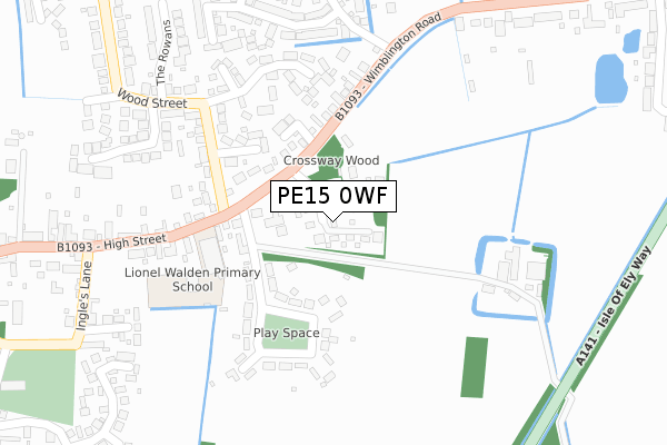
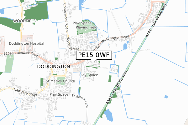
PE15 0WF is located in the Doddington & Wimblington electoral ward, within the local authority district of Fenland and the English Parliamentary constituency of North East Cambridgeshire. The Sub Integrated Care Board (ICB) Location is NHS Cambridgeshire and Peterborough ICB - 06H and the police force is Cambridgeshire. This postcode has been in use since February 2018.


GetTheData
Source: OS Open Zoomstack (Ordnance Survey)
Licence: Open Government Licence (requires attribution)
Attribution: Contains OS data © Crown copyright and database right 2024
Source: Open Postcode Geo
Licence: Open Government Licence (requires attribution)
Attribution: Contains OS data © Crown copyright and database right 2024; Contains Royal Mail data © Royal Mail copyright and database right 2024; Source: Office for National Statistics licensed under the Open Government Licence v.3.0
| Easting | 540503 |
| Northing | 290801 |
| Latitude | 52.497041 |
| Longitude | 0.068286 |
GetTheData
Source: Open Postcode Geo
Licence: Open Government Licence
| Country | England |
| Postcode District | PE15 |
| ➜ PE15 open data dashboard ➜ See where PE15 is on a map | |
GetTheData
Source: Land Registry Price Paid Data
Licence: Open Government Licence
| Ward | Doddington & Wimblington |
| Constituency | North East Cambridgeshire |
GetTheData
Source: ONS Postcode Database
Licence: Open Government Licence
| October 2022 | Other crime | On or near Beech Avenue | 317m |
| June 2022 | Violence and sexual offences | On or near Beech Avenue | 317m |
| June 2022 | Violence and sexual offences | On or near High Street | 338m |
| ➜ Get more crime data in our Crime section | |||
GetTheData
Source: data.police.uk
Licence: Open Government Licence
| Childs Lane (Wimblington Road) | Doddington | 108m |
| Childs Lane (Wimblington Road) | Doddington | 115m |
| Wimblington Road | Doddington | 337m |
| Wimblington Road | Doddington | 345m |
| Ingle's Lane (High Street) | Doddington | 421m |
GetTheData
Source: NaPTAN
Licence: Open Government Licence
➜ Broadband speed and availability dashboard for PE15 0WF
| Percentage of properties with Next Generation Access | 100.0% |
| Percentage of properties with Superfast Broadband | 100.0% |
| Percentage of properties with Ultrafast Broadband | 0.0% |
| Percentage of properties with Full Fibre Broadband | 0.0% |
Superfast Broadband is between 30Mbps and 300Mbps
Ultrafast Broadband is > 300Mbps
| Median download speed | 47.5Mbps |
| Average download speed | 49.4Mbps |
| Maximum download speed | 80.00Mbps |
| Median upload speed | 10.0Mbps |
| Average upload speed | 11.1Mbps |
| Maximum upload speed | 20.00Mbps |
| Percentage of properties unable to receive 2Mbps | 0.0% |
| Percentage of properties unable to receive 5Mbps | 0.0% |
| Percentage of properties unable to receive 10Mbps | 0.0% |
| Percentage of properties unable to receive 30Mbps | 0.0% |
➜ Broadband speed and availability dashboard for PE15 0WF
GetTheData
Source: Ofcom
Licence: Ofcom Terms of Use (requires attribution)
GetTheData
Source: ONS Postcode Database
Licence: Open Government Licence


➜ Get more ratings from the Food Standards Agency
GetTheData
Source: Food Standards Agency
Licence: FSA terms & conditions
| Last Collection | |||
|---|---|---|---|
| Location | Mon-Fri | Sat | Distance |
| High Street | 17:00 | 09:00 | 126m |
| Brickmakers Arm | 17:00 | 09:00 | 537m |
| Doddington Post Office | 17:15 | 11:00 | 573m |
GetTheData
Source: Dracos
Licence: Creative Commons Attribution-ShareAlike
| Facility | Distance |
|---|---|
| Dack Field Beech Avenue, Doddington Grass Pitches | 452m |
| Doddington Recreation Ground Benwick Road, Doddington, March Grass Pitches, Outdoor Tennis Courts | 1.1km |
| Parkfield Sports Club Chapel Lane, Wimblington Grass Pitches, Outdoor Tennis Courts | 1.4km |
GetTheData
Source: Active Places
Licence: Open Government Licence
| School | Phase of Education | Distance |
|---|---|---|
| Lionel Walden Primary School High Street, Doddington, March, PE15 0TF | Primary | 196m |
| Thomas Eaton Primary Academy Church Street, Wimblington, March, PE15 0QS | Primary | 1.7km |
| Neale-Wade Academy Wimblington Road, March, PE15 9PX | Secondary | 4.7km |
GetTheData
Source: Edubase
Licence: Open Government Licence
The below table lists the International Territorial Level (ITL) codes (formerly Nomenclature of Territorial Units for Statistics (NUTS) codes) and Local Administrative Units (LAU) codes for PE15 0WF:
| ITL 1 Code | Name |
|---|---|
| TLH | East |
| ITL 2 Code | Name |
| TLH1 | East Anglia |
| ITL 3 Code | Name |
| TLH12 | Cambridgeshire CC |
| LAU 1 Code | Name |
| E07000010 | Fenland |
GetTheData
Source: ONS Postcode Directory
Licence: Open Government Licence
The below table lists the Census Output Area (OA), Lower Layer Super Output Area (LSOA), and Middle Layer Super Output Area (MSOA) for PE15 0WF:
| Code | Name | |
|---|---|---|
| OA | E00091138 | |
| LSOA | E01018065 | Fenland 010A |
| MSOA | E02003751 | Fenland 010 |
GetTheData
Source: ONS Postcode Directory
Licence: Open Government Licence
| PE15 0TN | Manor Estate | 132m |
| PE15 0TQ | Childs Lane | 137m |
| PE15 0TJ | Wimblington Road | 143m |
| PE15 0SQ | Dexter Close | 166m |
| PE15 0SD | Knights Close | 183m |
| PE15 0LH | The Grange | 227m |
| PE15 0SB | Wood Side | 232m |
| PE15 0RZ | Carpenters Way | 239m |
| PE15 0TF | High Street | 259m |
| PE15 0RY | Drivers Close | 286m |
GetTheData
Source: Open Postcode Geo; Land Registry Price Paid Data
Licence: Open Government Licence