PE14 8BF maps, stats, and open data
PE14 8BF is located in the Tilney, Mershe Lande & Wiggenhall electoral ward, within the local authority district of King's Lynn and West Norfolk and the English Parliamentary constituency of South West Norfolk. The Sub Integrated Care Board (ICB) Location is NHS Norfolk and Waveney ICB - 26A and the police force is Norfolk. This postcode has been in use since April 2018.
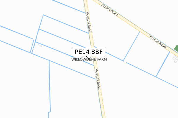
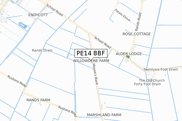
PE14 8BF maps


Licence: Open Government Licence (requires attribution)
Attribution: Contains OS data © Crown copyright and database right 2025
Source: Open Postcode Geo
Licence: Open Government Licence (requires attribution)
Attribution: Contains OS data © Crown copyright and database right 2025; Contains Royal Mail data © Royal Mail copyright and database right 2025; Source: Office for National Statistics licensed under the Open Government Licence v.3.0
PE14 8BF geodata
| Easting | 553403 |
| Northing | 308872 |
| Latitude | 52.655898 |
| Longitude | 0.266511 |
Where is PE14 8BF?
| Country | England |
| Postcode District | PE14 |
Politics
| Ward | Tilney, Mershe Lande & Wiggenhall |
|---|---|
| Constituency | South West Norfolk |
Transport
Nearest bus stops to PE14 8BF
| School Road (Smeeth Road) | Marshland St James | 1,450m |
| School Road (Smeeth Road) | Marshland St James | 1,457m |
Deprivation
77.2% of English postcodes are less deprived than PE14 8BF:Food Standards Agency
Three nearest food hygiene ratings to PE14 8BF (metres)


➜ Get more ratings from the Food Standards Agency
Nearest post box to PE14 8BF
| Last Collection | |||
|---|---|---|---|
| Location | Mon-Fri | Sat | Distance |
| Smeeth Road Emneth | 16:00 | 09:30 | 1,757m |
| Trinity Road Walpole Highway | 09:30 | 09:30 | 2,973m |
| Lords Bridge | 16:45 | 10:00 | 5,184m |
Environment
| Risk of PE14 8BF flooding from rivers and sea | Medium |
PE14 8BF ITL and PE14 8BF LAU
The below table lists the International Territorial Level (ITL) codes (formerly Nomenclature of Territorial Units for Statistics (NUTS) codes) and Local Administrative Units (LAU) codes for PE14 8BF:
| ITL 1 Code | Name |
|---|---|
| TLH | East |
| ITL 2 Code | Name |
| TLH1 | East Anglia |
| ITL 3 Code | Name |
| TLH16 | North and West Norfolk |
| LAU 1 Code | Name |
| E07000146 | King's Lynn and West Norfolk |
PE14 8BF census areas
The below table lists the Census Output Area (OA), Lower Layer Super Output Area (LSOA), and Middle Layer Super Output Area (MSOA) for PE14 8BF:
| Code | Name | |
|---|---|---|
| OA | E00135622 | |
| LSOA | E01026684 | King's Lynn and West Norfolk 013A |
| MSOA | E02005563 | King's Lynn and West Norfolk 013 |
Nearest postcodes to PE14 8BF
| PE14 8HA | Rands Drove | 721m |
| PE14 8JS | Church Bank | 849m |
| PE14 8JR | School Road | 1029m |
| PE14 8EY | School Road | 1173m |
| PE14 8JD | Jubilee Lane | 1278m |
| PE14 8HG | Rustons Road | 1285m |
| PE14 8ER | Ruston Road | 1295m |
| PE14 8EX | Hickathrift Field | 1372m |
| PE14 8EZ | School Road | 1395m |
| PE14 8ES | Smeeth Road | 1419m |