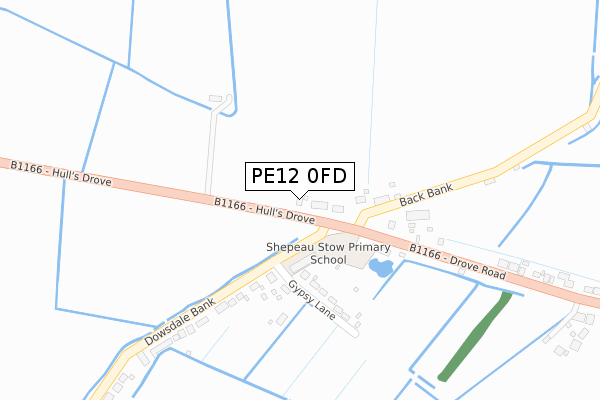
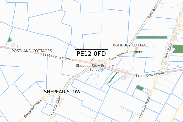
PE12 0FD is located in the The Saints electoral ward, within the local authority district of South Holland and the English Parliamentary constituency of South Holland and The Deepings. The Sub Integrated Care Board (ICB) Location is NHS Lincolnshire ICB - 71E and the police force is Lincolnshire. This postcode has been in use since April 2019.


GetTheData
Source: OS Open Zoomstack (Ordnance Survey)
Licence: Open Government Licence (requires attribution)
Attribution: Contains OS data © Crown copyright and database right 2024
Source: Open Postcode Geo
Licence: Open Government Licence (requires attribution)
Attribution: Contains OS data © Crown copyright and database right 2024; Contains Royal Mail data © Royal Mail copyright and database right 2024; Source: Office for National Statistics licensed under the Open Government Licence v.3.0
| Easting | 538943 |
| Northing | 318242 |
| Latitude | 52.743971 |
| Longitude | 0.056842 |
GetTheData
Source: Open Postcode Geo
Licence: Open Government Licence
| Country | England |
| Postcode District | PE12 |
| ➜ PE12 open data dashboard ➜ See where PE12 is on a map ➜ Where is Sutton St James? | |
GetTheData
Source: Land Registry Price Paid Data
Licence: Open Government Licence
| Ward | The Saints |
| Constituency | South Holland And The Deepings |
GetTheData
Source: ONS Postcode Database
Licence: Open Government Licence
| May 2022 | Other crime | On or near Chapel Gate | 368m |
| May 2022 | Burglary | On or near Chapel Gate | 368m |
| May 2022 | Anti-social behaviour | On or near Chapel Gate | 368m |
| ➜ Get more crime data in our Crime section | |||
GetTheData
Source: data.police.uk
Licence: Open Government Licence
| St Ives Cross (Fishergate) | Sutton St James | 98m |
| St Ives Cross (Fishergate) | Sutton St James | 111m |
| St James's Church (Draw Dike) | Sutton St James | 717m |
| Demand Responsive Area | Sutton St James | 719m |
| St James's Church (Draw Dike) | Sutton St James | 723m |
GetTheData
Source: NaPTAN
Licence: Open Government Licence
GetTheData
Source: ONS Postcode Database
Licence: Open Government Licence


➜ Get more ratings from the Food Standards Agency
GetTheData
Source: Food Standards Agency
Licence: FSA terms & conditions
| Last Collection | |||
|---|---|---|---|
| Location | Mon-Fri | Sat | Distance |
| St Ives Cross | 15:45 | 07:30 | 103m |
| Sutton St James Post Office | 15:45 | 09:15 | 614m |
| Bells Bridge | 15:45 | 10:00 | 1,726m |
GetTheData
Source: Dracos
Licence: Creative Commons Attribution-ShareAlike
| Facility | Distance |
|---|---|
| Sutton St James Indoor Bowls Club Fishergate, Sutton St James, Spalding Indoor Bowls | 177m |
| Tydd St Giles Community Centre And Playing Fields Broad Drove East, Tydd St Giles Grass Pitches | 3.8km |
| Tydd St Giles Golf And Country Club Kirkgate, Tydd St. Giles, Wisbech Health and Fitness Gym, Swimming Pool, Golf | 4.7km |
GetTheData
Source: Active Places
Licence: Open Government Licence
| School | Phase of Education | Distance |
|---|---|---|
| Sutton St James Community Primary School Bells Drove, Sutton St James, Spalding, PE12 0JG | Primary | 871m |
| Kinderley Primary School Church Lane, Tydd St Giles, Church Lane, Wisbech, PE13 5LG | Primary | 4.4km |
| Long Sutton County Primary School Dick Turpin Way, Long Sutton, Spalding, PE12 9EP | Primary | 6.2km |
GetTheData
Source: Edubase
Licence: Open Government Licence
The below table lists the International Territorial Level (ITL) codes (formerly Nomenclature of Territorial Units for Statistics (NUTS) codes) and Local Administrative Units (LAU) codes for PE12 0FD:
| ITL 1 Code | Name |
|---|---|
| TLF | East Midlands (England) |
| ITL 2 Code | Name |
| TLF3 | Lincolnshire |
| ITL 3 Code | Name |
| TLF30 | Lincolnshire CC |
| LAU 1 Code | Name |
| E07000140 | South Holland |
GetTheData
Source: ONS Postcode Directory
Licence: Open Government Licence
The below table lists the Census Output Area (OA), Lower Layer Super Output Area (LSOA), and Middle Layer Super Output Area (MSOA) for PE12 0FD:
| Code | Name | |
|---|---|---|
| OA | E00133484 | |
| LSOA | E01026280 | South Holland 010C |
| MSOA | E02005474 | South Holland 010 |
GetTheData
Source: ONS Postcode Directory
Licence: Open Government Licence
| PE12 0EN | Fishergate | 161m |
| PE12 0EJ | Mill Lane | 260m |
| PE12 0EL | Broadgate | 287m |
| PE12 0JS | Broadgate | 304m |
| PE12 0JX | Baulkins Drove | 467m |
| PE12 0JY | Birds Drove | 531m |
| PE12 0EF | Chapelgate | 583m |
| PE12 0EE | Chapelgate | 641m |
| PE12 0EG | Needham Drive | 659m |
| PE12 0EY | Horse Moor Drove | 688m |
GetTheData
Source: Open Postcode Geo; Land Registry Price Paid Data
Licence: Open Government Licence