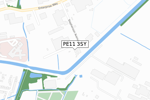
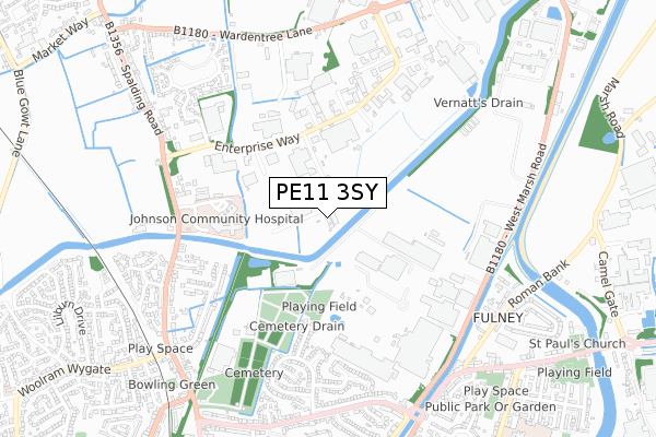
PE11 3SY is located in the Pinchbeck and Surfleet electoral ward, within the local authority district of South Holland and the English Parliamentary constituency of South Holland and The Deepings. The Sub Integrated Care Board (ICB) Location is NHS Lincolnshire ICB - 71E and the police force is Lincolnshire. This postcode has been in use since July 2019.


GetTheData
Source: OS Open Zoomstack (Ordnance Survey)
Licence: Open Government Licence (requires attribution)
Attribution: Contains OS data © Crown copyright and database right 2025
Source: Open Postcode Geo
Licence: Open Government Licence (requires attribution)
Attribution: Contains OS data © Crown copyright and database right 2025; Contains Royal Mail data © Royal Mail copyright and database right 2025; Source: Office for National Statistics licensed under the Open Government Licence v.3.0
| Easting | 525192 |
| Northing | 324291 |
| Latitude | 52.801678 |
| Longitude | -0.144433 |
GetTheData
Source: Open Postcode Geo
Licence: Open Government Licence
| Country | England |
| Postcode District | PE11 |
➜ See where PE11 is on a map ➜ Where is Pinchbeck? | |
GetTheData
Source: Land Registry Price Paid Data
Licence: Open Government Licence
| Ward | Pinchbeck And Surfleet |
| Constituency | South Holland And The Deepings |
GetTheData
Source: ONS Postcode Database
Licence: Open Government Licence
| Johnson Hospital (Pinchbeck Road) | Spalding | 413m |
| Beck Road (Pinchbeck Road) | Spalding | 703m |
| Oakley Drive (West Elloe Avenue) | Spalding | 713m |
| Beck Road (Pinchbeck Road) | Spalding | 716m |
| Oakley Drive (West Elloe Avenue) | Spalding | 727m |
| Spalding Station | 1.7km |
GetTheData
Source: NaPTAN
Licence: Open Government Licence
GetTheData
Source: ONS Postcode Database
Licence: Open Government Licence


➜ Get more ratings from the Food Standards Agency
GetTheData
Source: Food Standards Agency
Licence: FSA terms & conditions
| Last Collection | |||
|---|---|---|---|
| Location | Mon-Fri | Sat | Distance |
| Springfields | 17:40 | 12:00 | 1,120m |
| Spalding Delivery Office | 18:15 | 12:00 | 1,346m |
| Horseshoe Road Bridge | 16:00 | 11:00 | 1,350m |
GetTheData
Source: Dracos
Licence: Creative Commons Attribution-ShareAlike
| Risk of PE11 3SY flooding from rivers and sea | Low |
| ➜ PE11 3SY flood map | |
GetTheData
Source: Open Flood Risk by Postcode
Licence: Open Government Licence
The below table lists the International Territorial Level (ITL) codes (formerly Nomenclature of Territorial Units for Statistics (NUTS) codes) and Local Administrative Units (LAU) codes for PE11 3SY:
| ITL 1 Code | Name |
|---|---|
| TLF | East Midlands (England) |
| ITL 2 Code | Name |
| TLF3 | Lincolnshire |
| ITL 3 Code | Name |
| TLF30 | Lincolnshire CC |
| LAU 1 Code | Name |
| E07000140 | South Holland |
GetTheData
Source: ONS Postcode Directory
Licence: Open Government Licence
The below table lists the Census Output Area (OA), Lower Layer Super Output Area (LSOA), and Middle Layer Super Output Area (MSOA) for PE11 3SY:
| Code | Name | |
|---|---|---|
| OA | E00133375 | |
| LSOA | E01026258 | South Holland 005B |
| MSOA | E02005469 | South Holland 005 |
GetTheData
Source: ONS Postcode Directory
Licence: Open Government Licence
| PE11 3SW | Stephenson Avenue | 35m |
| PE11 3FX | Edison Court | 421m |
| PE11 3YR | Enterprise Way | 448m |
| PE11 2DD | Chiltern Drive | 462m |
| PE11 2DE | Penny Hill Close | 499m |
| PE11 1QP | Sherwood Drive | 525m |
| PE11 1UF | St Helena Drive | 560m |
| PE11 3PB | Spalding Road | 566m |
| PE11 3TY | Cresswell Close | 590m |
| PE11 2DB | Pennine Way | 591m |
GetTheData
Source: Open Postcode Geo; Land Registry Price Paid Data
Licence: Open Government Licence