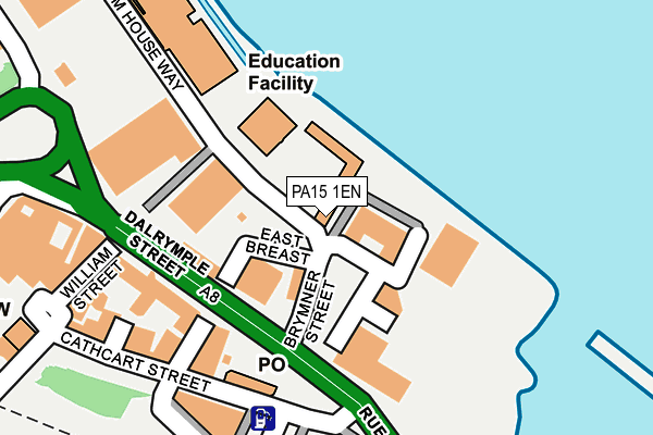
PA15 1EN is located in the Inverclyde North electoral ward, within the council area of Inverclyde and the Scottish Parliamentary constituency of Inverclyde. The Community Health Partnership is Inverclyde Community Health Partnership and the police force is Scotland. This postcode has been in use since June 2018.


GetTheData
Source: OS OpenMap – Local (Ordnance Survey)
Source: OS VectorMap District (Ordnance Survey)
Licence: Open Government Licence (requires attribution)
| Easting | 228235 |
| Northing | 676160 |
| Latitude | 55.947678 |
| Longitude | -4.752220 |
GetTheData
Source: Open Postcode Geo
Licence: Open Government Licence
| Country | Scotland |
| Postcode District | PA15 |
| ➜ PA15 open data dashboard ➜ See where PA15 is on a map | |
GetTheData
Source: Land Registry Price Paid Data
Licence: Open Government Licence
| Ward | Inverclyde North |
| Constituency | Inverclyde |
GetTheData
Source: ONS Postcode Database
Licence: Open Government Licence
| Terrace Road (Dalrymple Street) | Greenock | 56m |
| Terrace Road (Dalrymple Street) | Greenock | 122m |
| Cathcart Street (Rue End Street) | Greenock | 198m |
| Well Park (Regent Street) | Greenock | 341m |
| Well Park (Regent Street) | Greenock | 355m |
| Greenock Central Station | 0.3km |
| Greenock West Station | 1km |
| Whinhill Station | 1.1km |
GetTheData
Source: NaPTAN
Licence: Open Government Licence
Estimated total energy consumption in PA15 1EN by fuel type, 2015.
| Consumption (kWh) | 626,656 |
|---|---|
| Meter count | 41 |
| Mean (kWh/meter) | 15,284 |
| Median (kWh/meter) | 6,335 |
GetTheData
Source: Postcode level gas estimates: 2015 (experimental)
Source: Postcode level electricity estimates: 2015 (experimental)
Licence: Open Government Licence
GetTheData
Source: ONS Postcode Database
Licence: Open Government Licence


➜ Get more ratings from the Food Standards Agency
GetTheData
Source: Food Standards Agency
Licence: FSA terms & conditions
| Last Collection | |||
|---|---|---|---|
| Location | Mon-Fri | Sat | Distance |
| Glendouglas Road | 17:00 | 12:00 | 1,024m |
| Post Office | 17:00 | 12:00 | 1,030m |
| Union St/Ardgowan Square | 17:00 | 12:00 | 1,159m |
GetTheData
Source: Dracos
Licence: Creative Commons Attribution-ShareAlike
The below table lists the International Territorial Level (ITL) codes (formerly Nomenclature of Territorial Units for Statistics (NUTS) codes) and Local Administrative Units (LAU) codes for PA15 1EN:
| ITL 1 Code | Name |
|---|---|
| TLM | Scotland |
| ITL 2 Code | Name |
| TLM8 | West Central Scotland |
| ITL 3 Code | Name |
| TLM83 | Inverclyde, East Renfrewshire, and Renfrewshire |
| LAU 1 Code | Name |
| S30000022 | Inverclyde |
GetTheData
Source: ONS Postcode Directory
Licence: Open Government Licence
The below table lists the Census Output Area (OA), Lower Layer Super Output Area (LSOA), and Middle Layer Super Output Area (MSOA) for PA15 1EN:
| Code | Name | |
|---|---|---|
| OA | S00119780 | |
| LSOA | S01010891 | Greenock Town Centre and East Central - 02 |
| MSOA | S02002046 | Greenock Town Centre and East Central |
GetTheData
Source: ONS Postcode Directory
Licence: Open Government Licence