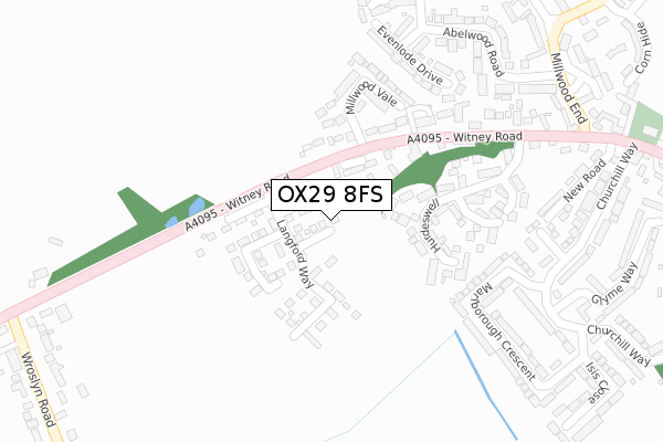
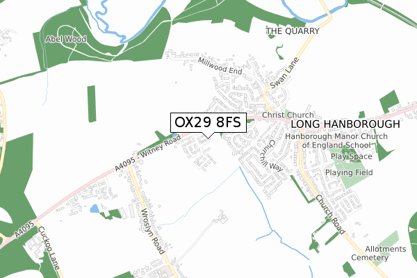
OX29 8FS is located in the Freeland and Hanborough electoral ward, within the local authority district of West Oxfordshire and the English Parliamentary constituency of Witney. The Sub Integrated Care Board (ICB) Location is NHS Buckinghamshire, Oxfordshire and Berkshire West ICB - 10Q and the police force is Thames Valley. This postcode has been in use since May 2018.


GetTheData
Source: OS Open Zoomstack (Ordnance Survey)
Licence: Open Government Licence (requires attribution)
Attribution: Contains OS data © Crown copyright and database right 2024
Source: Open Postcode Geo
Licence: Open Government Licence (requires attribution)
Attribution: Contains OS data © Crown copyright and database right 2024; Contains Royal Mail data © Royal Mail copyright and database right 2024; Source: Office for National Statistics licensed under the Open Government Licence v.3.0
| Easting | 441345 |
| Northing | 214053 |
| Latitude | 51.823582 |
| Longitude | -1.401504 |
GetTheData
Source: Open Postcode Geo
Licence: Open Government Licence
| Country | England |
| Postcode District | OX29 |
| ➜ OX29 open data dashboard ➜ See where OX29 is on a map ➜ Where is Long Hanborough? | |
GetTheData
Source: Land Registry Price Paid Data
Licence: Open Government Licence
| Ward | Freeland And Hanborough |
| Constituency | Witney |
GetTheData
Source: ONS Postcode Database
Licence: Open Government Licence
| December 2023 | Violence and sexual offences | On or near Slatters Court | 103m |
| December 2023 | Violence and sexual offences | On or near Slatters Court | 103m |
| November 2023 | Public order | On or near Abelwood Road | 341m |
| ➜ Get more crime data in our Crime section | |||
GetTheData
Source: data.police.uk
Licence: Open Government Licence
| Millwood Vale (Witney Road) | Long Hanborough | 161m |
| Millwood Vale (Witney Road) | Long Hanborough | 170m |
| New Road (Witney Road) | Long Hanborough | 299m |
| New Road (Witney Road) | Long Hanborough | 398m |
| Freeland Turn (Witney Road) | Freeland | 528m |
| Combe (Oxon) Station | 1.1km |
| Hanborough Station | 1.9km |
| Finstock Station | 5.7km |
GetTheData
Source: NaPTAN
Licence: Open Government Licence
| Percentage of properties with Next Generation Access | 100.0% |
| Percentage of properties with Superfast Broadband | 100.0% |
| Percentage of properties with Ultrafast Broadband | 100.0% |
| Percentage of properties with Full Fibre Broadband | 100.0% |
Superfast Broadband is between 30Mbps and 300Mbps
Ultrafast Broadband is > 300Mbps
| Percentage of properties unable to receive 2Mbps | 0.0% |
| Percentage of properties unable to receive 5Mbps | 0.0% |
| Percentage of properties unable to receive 10Mbps | 0.0% |
| Percentage of properties unable to receive 30Mbps | 0.0% |
GetTheData
Source: Ofcom
Licence: Ofcom Terms of Use (requires attribution)
GetTheData
Source: ONS Postcode Database
Licence: Open Government Licence


➜ Get more ratings from the Food Standards Agency
GetTheData
Source: Food Standards Agency
Licence: FSA terms & conditions
| Last Collection | |||
|---|---|---|---|
| Location | Mon-Fri | Sat | Distance |
| Hurdswell | 16:30 | 09:30 | 260m |
| Roslyn Road Freeland | 16:15 | 07:30 | 532m |
| Parklands Freeland | 16:15 | 09:00 | 830m |
GetTheData
Source: Dracos
Licence: Creative Commons Attribution-ShareAlike
| Facility | Distance |
|---|---|
| Hanborough Manor Ce School Riely Close, Long Hanborough, Witney Grass Pitches | 711m |
| Hanborough Playing Fields Roosevelt Road, Long Hanborough, Witney Grass Pitches, Outdoor Tennis Courts | 808m |
| Freeland Playing Field Wroslyn Road, Freeland, Witney Grass Pitches | 1.3km |
GetTheData
Source: Active Places
Licence: Open Government Licence
| School | Phase of Education | Distance |
|---|---|---|
| Hanborough Manor CofE School Riely Close, Long Hanborough, Witney, OX29 8DJ | Primary | 711m |
| Freeland Church of England Primary School Parklands, Freeland, Freeland Primary School, Witney, OX29 8HX | Primary | 867m |
| Combe CofE Primary School Church Walk, Combe, Witney, OX29 8NQ | Primary | 1.8km |
GetTheData
Source: Edubase
Licence: Open Government Licence
The below table lists the International Territorial Level (ITL) codes (formerly Nomenclature of Territorial Units for Statistics (NUTS) codes) and Local Administrative Units (LAU) codes for OX29 8FS:
| ITL 1 Code | Name |
|---|---|
| TLJ | South East (England) |
| ITL 2 Code | Name |
| TLJ1 | Berkshire, Buckinghamshire and Oxfordshire |
| ITL 3 Code | Name |
| TLJ14 | Oxfordshire CC |
| LAU 1 Code | Name |
| E07000181 | West Oxfordshire |
GetTheData
Source: ONS Postcode Directory
Licence: Open Government Licence
The below table lists the Census Output Area (OA), Lower Layer Super Output Area (LSOA), and Middle Layer Super Output Area (MSOA) for OX29 8FS:
| Code | Name | |
|---|---|---|
| OA | E00146640 | |
| LSOA | E01028789 | West Oxfordshire 006B |
| MSOA | E02005998 | West Oxfordshire 006 |
GetTheData
Source: ONS Postcode Directory
Licence: Open Government Licence
| OX29 8QL | Slatters Court | 94m |
| OX29 8DH | Hurdeswell | 100m |
| OX29 8BH | Witney Road | 123m |
| OX29 8DQ | Hurdeswell | 177m |
| OX29 8BJ | Witney Road | 179m |
| OX29 8DF | Millwood Vale | 205m |
| OX29 8JR | Marlborough Crescent | 215m |
| OX29 8DB | Evenlode Drive | 238m |
| OX29 8HE | Witney Road | 239m |
| OX29 8JJ | Churchill Way | 298m |
GetTheData
Source: Open Postcode Geo; Land Registry Price Paid Data
Licence: Open Government Licence