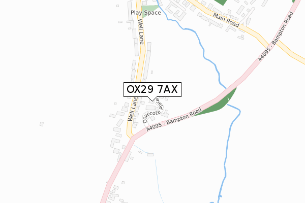
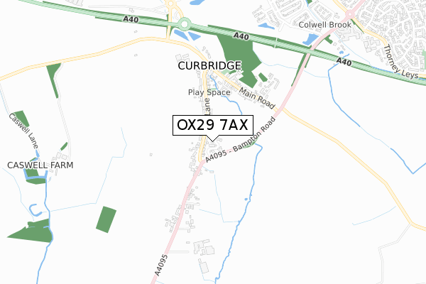
OX29 7AX is located in the Ducklington electoral ward, within the local authority district of West Oxfordshire and the English Parliamentary constituency of Witney. The Sub Integrated Care Board (ICB) Location is NHS Buckinghamshire, Oxfordshire and Berkshire West ICB - 10Q and the police force is Thames Valley. This postcode has been in use since July 2018.


GetTheData
Source: OS Open Zoomstack (Ordnance Survey)
Licence: Open Government Licence (requires attribution)
Attribution: Contains OS data © Crown copyright and database right 2024
Source: Open Postcode Geo
Licence: Open Government Licence (requires attribution)
Attribution: Contains OS data © Crown copyright and database right 2024; Contains Royal Mail data © Royal Mail copyright and database right 2024; Source: Office for National Statistics licensed under the Open Government Licence v.3.0
| Easting | 433069 |
| Northing | 208366 |
| Latitude | 51.773001 |
| Longitude | -1.522119 |
GetTheData
Source: Open Postcode Geo
Licence: Open Government Licence
| Country | England |
| Postcode District | OX29 |
| ➜ OX29 open data dashboard ➜ See where OX29 is on a map ➜ Where is Curbridge? | |
GetTheData
Source: Land Registry Price Paid Data
Licence: Open Government Licence
| Ward | Ducklington |
| Constituency | Witney |
GetTheData
Source: ONS Postcode Database
Licence: Open Government Licence
6, DOVECOTE PLACE, CURBRIDGE, WITNEY, OX29 7AX 2019 22 FEB £625,000 |
7, DOVECOTE PLACE, CURBRIDGE, WITNEY, OX29 7AX 2018 14 DEC £540,000 |
4, DOVECOTE PLACE, CURBRIDGE, WITNEY, OX29 7AX 2018 30 NOV £725,000 |
15, DOVECOTE PLACE, CURBRIDGE, WITNEY, OX29 7AX 2018 16 NOV £505,000 |
9, DOVECOTE PLACE, CURBRIDGE, WITNEY, OX29 7AX 2018 25 OCT £510,000 |
2, DOVECOTE PLACE, CURBRIDGE, WITNEY, OX29 7AX 2018 12 JUL £750,000 |
GetTheData
Source: HM Land Registry Price Paid Data
Licence: Contains HM Land Registry data © Crown copyright and database right 2024. This data is licensed under the Open Government Licence v3.0.
| June 2022 | Public order | On or near Main Road | 387m |
| May 2022 | Other theft | On or near Well Lane | 164m |
| May 2022 | Public order | On or near Sports/Recreation Area | 254m |
| ➜ Get more crime data in our Crime section | |||
GetTheData
Source: data.police.uk
Licence: Open Government Licence
| Manor Farm (Main Road) | Curbridge | 380m |
| Manor Farm (Main Road) | Curbridge | 383m |
| Well Lane (Main Road) | Curbridge | 481m |
| Well Lane (Main Road) | Curbridge | 496m |
| Thorney Leys (Curbridge Road) | Witney | 1,154m |
GetTheData
Source: NaPTAN
Licence: Open Government Licence
➜ Broadband speed and availability dashboard for OX29 7AX
| Percentage of properties with Next Generation Access | 100.0% |
| Percentage of properties with Superfast Broadband | 100.0% |
| Percentage of properties with Ultrafast Broadband | 0.0% |
| Percentage of properties with Full Fibre Broadband | 0.0% |
Superfast Broadband is between 30Mbps and 300Mbps
Ultrafast Broadband is > 300Mbps
| Median download speed | 39.1Mbps |
| Average download speed | 41.6Mbps |
| Maximum download speed | 68.68Mbps |
| Median upload speed | 8.6Mbps |
| Average upload speed | 8.8Mbps |
| Maximum upload speed | 20.00Mbps |
| Percentage of properties unable to receive 2Mbps | 0.0% |
| Percentage of properties unable to receive 5Mbps | 0.0% |
| Percentage of properties unable to receive 10Mbps | 0.0% |
| Percentage of properties unable to receive 30Mbps | 0.0% |
➜ Broadband speed and availability dashboard for OX29 7AX
GetTheData
Source: Ofcom
Licence: Ofcom Terms of Use (requires attribution)
GetTheData
Source: ONS Postcode Database
Licence: Open Government Licence


➜ Get more ratings from the Food Standards Agency
GetTheData
Source: Food Standards Agency
Licence: FSA terms & conditions
| Last Collection | |||
|---|---|---|---|
| Location | Mon-Fri | Sat | Distance |
| Burwell Farm Post Office | 17:00 | 12:00 | 1,885m |
| Lew | 16:00 | 07:30 | 1,992m |
| Thorney Leys | 17:15 | 08:00 | 2,027m |
GetTheData
Source: Dracos
Licence: Creative Commons Attribution-ShareAlike
| Facility | Distance |
|---|---|
| Windrush Church Of England Primary School Isabelle Spencer Way, Witney Grass Pitches | 1km |
| Burwell Recreation Ground Thorney Leys, Witney Grass Pitches | 1.4km |
| The Polythene Uk Stadium (Closed) Downs Road, Curbridge, Witney Grass Pitches | 1.6km |
GetTheData
Source: Active Places
Licence: Open Government Licence
| School | Phase of Education | Distance |
|---|---|---|
| Windrush Church of England Primary School Isabelle Spencer Way, Witney, OX29 7DL | Primary | 1km |
| Our Lady of Lourdes Catholic Primary School, Witney Curbridge Road, Witney, OX28 5JZ | Primary | 1.6km |
| West Witney Primary School & Nursery Edington Road, Witney, OX28 5FZ | Primary | 1.8km |
GetTheData
Source: Edubase
Licence: Open Government Licence
The below table lists the International Territorial Level (ITL) codes (formerly Nomenclature of Territorial Units for Statistics (NUTS) codes) and Local Administrative Units (LAU) codes for OX29 7AX:
| ITL 1 Code | Name |
|---|---|
| TLJ | South East (England) |
| ITL 2 Code | Name |
| TLJ1 | Berkshire, Buckinghamshire and Oxfordshire |
| ITL 3 Code | Name |
| TLJ14 | Oxfordshire CC |
| LAU 1 Code | Name |
| E07000181 | West Oxfordshire |
GetTheData
Source: ONS Postcode Directory
Licence: Open Government Licence
The below table lists the Census Output Area (OA), Lower Layer Super Output Area (LSOA), and Middle Layer Super Output Area (MSOA) for OX29 7AX:
| Code | Name | |
|---|---|---|
| OA | E00146610 | |
| LSOA | E01028784 | West Oxfordshire 007A |
| MSOA | E02005999 | West Oxfordshire 007 |
GetTheData
Source: ONS Postcode Directory
Licence: Open Government Licence
| OX29 7PF | Bampton Road | 57m |
| OX29 7PB | Well Lane | 177m |
| OX29 7PA | Well Lane | 192m |
| OX29 7PD | Lew Road | 363m |
| OX29 7NT | Main Road | 365m |
| OX29 7NU | Church Row | 383m |
| OX29 7NW | Orchard Mews | 404m |
| OX29 7PE | Elm Terrace | 474m |
| OX29 7NY | Main Road | 501m |
| OX29 7NR | Curbridge Road | 936m |
GetTheData
Source: Open Postcode Geo; Land Registry Price Paid Data
Licence: Open Government Licence