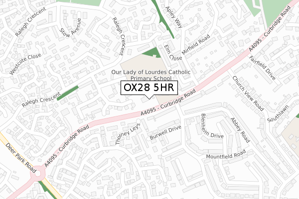
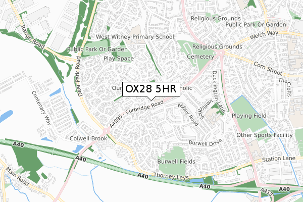
OX28 5HR is located in the Witney Central electoral ward, within the local authority district of West Oxfordshire and the English Parliamentary constituency of Witney. The Sub Integrated Care Board (ICB) Location is NHS Buckinghamshire, Oxfordshire and Berkshire West ICB - 10Q and the police force is Thames Valley. This postcode has been in use since April 2018.


GetTheData
Source: OS Open Zoomstack (Ordnance Survey)
Licence: Open Government Licence (requires attribution)
Attribution: Contains OS data © Crown copyright and database right 2024
Source: Open Postcode Geo
Licence: Open Government Licence (requires attribution)
Attribution: Contains OS data © Crown copyright and database right 2024; Contains Royal Mail data © Royal Mail copyright and database right 2024; Source: Office for National Statistics licensed under the Open Government Licence v.3.0
| Easting | 434245 |
| Northing | 209367 |
| Latitude | 51.781930 |
| Longitude | -1.504978 |
GetTheData
Source: Open Postcode Geo
Licence: Open Government Licence
| Country | England |
| Postcode District | OX28 |
| ➜ OX28 open data dashboard ➜ See where OX28 is on a map ➜ Where is Witney? | |
GetTheData
Source: Land Registry Price Paid Data
Licence: Open Government Licence
| Ward | Witney Central |
| Constituency | Witney |
GetTheData
Source: ONS Postcode Database
Licence: Open Government Licence
| January 2024 | Violence and sexual offences | On or near Thorney Leys | 376m |
| December 2023 | Public order | On or near Thorney Leys | 376m |
| November 2023 | Violence and sexual offences | On or near Thorney Leys | 376m |
| ➜ Get more crime data in our Crime section | |||
GetTheData
Source: data.police.uk
Licence: Open Government Licence
| Abbey Road (Burwell Drive) | Witney | 114m |
| Abbey Road (Burwell Drive) | Witney | 123m |
| Cornfield Close (Apley Way) | Witney | 164m |
| Cornfield Close (Apley Way) | Witney | 170m |
| Bourton Close (Ralegh Crescent) | Witney | 178m |
GetTheData
Source: NaPTAN
Licence: Open Government Licence
| Percentage of properties with Next Generation Access | 100.0% |
| Percentage of properties with Superfast Broadband | 100.0% |
| Percentage of properties with Ultrafast Broadband | 0.0% |
| Percentage of properties with Full Fibre Broadband | 0.0% |
Superfast Broadband is between 30Mbps and 300Mbps
Ultrafast Broadband is > 300Mbps
| Percentage of properties unable to receive 2Mbps | 0.0% |
| Percentage of properties unable to receive 5Mbps | 0.0% |
| Percentage of properties unable to receive 10Mbps | 0.0% |
| Percentage of properties unable to receive 30Mbps | 0.0% |
GetTheData
Source: Ofcom
Licence: Ofcom Terms of Use (requires attribution)
GetTheData
Source: ONS Postcode Database
Licence: Open Government Licence


➜ Get more ratings from the Food Standards Agency
GetTheData
Source: Food Standards Agency
Licence: FSA terms & conditions
| Last Collection | |||
|---|---|---|---|
| Location | Mon-Fri | Sat | Distance |
| Burwell Farm Post Office | 17:00 | 12:00 | 618m |
| Ducklington Lane | 16:00 | 09:00 | 1,079m |
| Corn Street | 17:00 | 12:00 | 1,106m |
GetTheData
Source: Dracos
Licence: Creative Commons Attribution-ShareAlike
| Facility | Distance |
|---|---|
| Ralegh Crescent Park Ralegh Crescent, Witney Grass Pitches | 441m |
| Burwell Recreation Ground Thorney Leys, Witney Grass Pitches | 542m |
| The Henry Box School Playing Fields Ducklington Lane, Witney Grass Pitches | 765m |
GetTheData
Source: Active Places
Licence: Open Government Licence
| School | Phase of Education | Distance |
|---|---|---|
| Our Lady of Lourdes Catholic Primary School, Witney Curbridge Road, Witney, OX28 5JZ | Primary | 69m |
| West Witney Primary School & Nursery Edington Road, Witney, OX28 5FZ | Primary | 520m |
| Queen Emma's Primary School Burwell Drive, Witney, OX28 5JW | Primary | 553m |
GetTheData
Source: Edubase
Licence: Open Government Licence
The below table lists the International Territorial Level (ITL) codes (formerly Nomenclature of Territorial Units for Statistics (NUTS) codes) and Local Administrative Units (LAU) codes for OX28 5HR:
| ITL 1 Code | Name |
|---|---|
| TLJ | South East (England) |
| ITL 2 Code | Name |
| TLJ1 | Berkshire, Buckinghamshire and Oxfordshire |
| ITL 3 Code | Name |
| TLJ14 | Oxfordshire CC |
| LAU 1 Code | Name |
| E07000181 | West Oxfordshire |
GetTheData
Source: ONS Postcode Directory
Licence: Open Government Licence
The below table lists the Census Output Area (OA), Lower Layer Super Output Area (LSOA), and Middle Layer Super Output Area (MSOA) for OX28 5HR:
| Code | Name | |
|---|---|---|
| OA | E00146723 | |
| LSOA | E01028809 | West Oxfordshire 009A |
| MSOA | E02006001 | West Oxfordshire 009 |
GetTheData
Source: ONS Postcode Directory
Licence: Open Government Licence
| OX28 5JY | Curbridge Road | 69m |
| OX28 5FJ | Barrington Close | 113m |
| OX28 5PA | Thorney Leys | 125m |
| OX28 5BU | Cornfield Close | 142m |
| OX28 5JN | Burwell Close | 143m |
| OX28 5BT | Elm Close | 157m |
| OX28 5NY | Thorney Leys | 168m |
| OX28 5LD | Abbey Road | 169m |
| OX28 5LY | Burwell Drive | 179m |
| OX28 5JX | Curbridge Road | 188m |
GetTheData
Source: Open Postcode Geo; Land Registry Price Paid Data
Licence: Open Government Licence