OX18 2FQ open data databoard
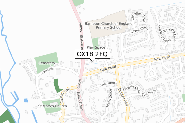
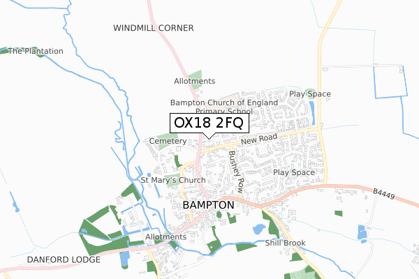
OX18 2FQ is located in the Bampton and Clanfield electoral ward, within the local authority district of West Oxfordshire and the English Parliamentary constituency of Witney. The Sub Integrated Care Board (ICB) Location is NHS Buckinghamshire, Oxfordshire and Berkshire West ICB - 10Q and the police force is Thames Valley. This postcode has been in use since January 2020.
OX18 2FQ maps


Licence: Open Government Licence (requires attribution)
Attribution: Contains OS data © Crown copyright and database right 2025
Source: Open Postcode Geo
Licence: Open Government Licence (requires attribution)
Attribution: Contains OS data © Crown copyright and database right 2025; Contains Royal Mail data © Royal Mail copyright and database right 2025; Source: Office for National Statistics licensed under the Open Government Licence v.3.0
OX18 2FQ geodata
| Easting | 431467 |
| Northing | 203583 |
| Latitude | 51.730089 |
| Longitude | -1.545768 |
Where is OX18 2FQ?
| Country | England |
| Postcode District | OX18 |
Politics
| Ward | Bampton And Clanfield |
|---|---|
| Constituency | Witney |
House Prices
Sales of detached houses in OX18 2FQ
2023 14 SEP £545,000 |
5, TANNERY GARDENS, BAMPTON, OX18 2FQ 2021 16 JUN £495,000 |
1, TANNERY GARDENS, BAMPTON, OX18 2FQ 2021 23 APR £515,000 |
7, TANNERY GARDENS, BAMPTON, OX18 2FQ 2021 8 MAR £700,000 |
6, TANNERY GARDENS, BAMPTON, OX18 2FQ 2020 23 DEC £525,000 |
3, TANNERY GARDENS, BAMPTON, OX18 2FQ 2020 21 DEC £510,000 |
8, TANNERY GARDENS, BAMPTON, OX18 2FQ 2020 1 DEC £530,000 |
2020 17 NOV £487,000 |
9, TANNERY GARDENS, BAMPTON, OX18 2FQ 2020 3 NOV £535,000 |
2020 1 MAY £590,000 |
Licence: Contains HM Land Registry data © Crown copyright and database right 2025. This data is licensed under the Open Government Licence v3.0.
Transport
Nearest bus stops to OX18 2FQ
| The Lanes (Bushey Row) | Bampton | 151m |
| Church View (Broad Street) | Bampton | 154m |
| The Lanes (Bushey Row) | Bampton | 162m |
| Church View (Broad Street) | Bampton | 170m |
| New Road | Bampton | 376m |
Deprivation
27% of English postcodes are less deprived than OX18 2FQ:Food Standards Agency
Three nearest food hygiene ratings to OX18 2FQ (metres)


➜ Get more ratings from the Food Standards Agency
Nearest post box to OX18 2FQ
| Last Collection | |||
|---|---|---|---|
| Location | Mon-Fri | Sat | Distance |
| Lew | 16:00 | 07:30 | 3,052m |
| Thorney Leys | 17:15 | 08:00 | 3,326m |
| Carterton Sorting Office | 18:00 | 11:30 | 4,476m |
OX18 2FQ ITL and OX18 2FQ LAU
The below table lists the International Territorial Level (ITL) codes (formerly Nomenclature of Territorial Units for Statistics (NUTS) codes) and Local Administrative Units (LAU) codes for OX18 2FQ:
| ITL 1 Code | Name |
|---|---|
| TLJ | South East (England) |
| ITL 2 Code | Name |
| TLJ1 | Berkshire, Buckinghamshire and Oxfordshire |
| ITL 3 Code | Name |
| TLJ14 | Oxfordshire CC |
| LAU 1 Code | Name |
| E07000181 | West Oxfordshire |
OX18 2FQ census areas
The below table lists the Census Output Area (OA), Lower Layer Super Output Area (LSOA), and Middle Layer Super Output Area (MSOA) for OX18 2FQ:
| Code | Name | |
|---|---|---|
| OA | E00146506 | |
| LSOA | E01028765 | West Oxfordshire 015B |
| MSOA | E02006007 | West Oxfordshire 015 |
Nearest postcodes to OX18 2FQ
| OX18 2LF | New Road | 93m |
| OX18 2EZ | Pembroke Place | 107m |
| OX18 2LQ | Station Road | 115m |
| OX18 2LA | 119m | |
| OX18 2NJ | Bowling Green Close | 162m |
| OX18 2JG | The Lanes | 181m |
| OX18 2LU | Broad Street | 219m |
| OX18 2NU | Pollard Place | 228m |
| OX18 2LS | Broad Street | 235m |
| OX18 2LY | Broad Street | 245m |