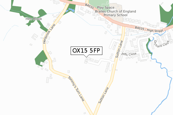
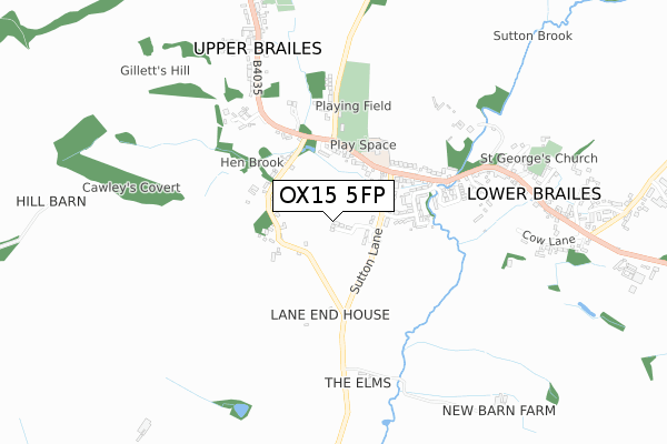
OX15 5FP is located in the Brailes & Compton electoral ward, within the local authority district of Stratford-on-Avon and the English Parliamentary constituency of Stratford-on-Avon. The Sub Integrated Care Board (ICB) Location is NHS Coventry and Warwickshire ICB - B2M3M and the police force is Warwickshire. This postcode has been in use since April 2018.


GetTheData
Source: OS Open Zoomstack (Ordnance Survey)
Licence: Open Government Licence (requires attribution)
Attribution: Contains OS data © Crown copyright and database right 2024
Source: Open Postcode Geo
Licence: Open Government Licence (requires attribution)
Attribution: Contains OS data © Crown copyright and database right 2024; Contains Royal Mail data © Royal Mail copyright and database right 2024; Source: Office for National Statistics licensed under the Open Government Licence v.3.0
| Easting | 430776 |
| Northing | 239066 |
| Latitude | 52.049147 |
| Longitude | -1.552620 |
GetTheData
Source: Open Postcode Geo
Licence: Open Government Licence
| Country | England |
| Postcode District | OX15 |
| ➜ OX15 open data dashboard ➜ See where OX15 is on a map ➜ Where is Lower Brailes? | |
GetTheData
Source: Land Registry Price Paid Data
Licence: Open Government Licence
| Ward | Brailes & Compton |
| Constituency | Stratford-on-avon |
GetTheData
Source: ONS Postcode Database
Licence: Open Government Licence
2021 24 SEP £780,000 |
3, GILKES ROAD, LOWER BRAILES, BANBURY, OX15 5FP 2020 21 DEC £699,950 |
2020 18 DEC £605,000 |
4, GILKES ROAD, LOWER BRAILES, BANBURY, OX15 5FP 2020 11 DEC £565,000 |
2020 11 DEC £535,000 |
GetTheData
Source: HM Land Registry Price Paid Data
Licence: Contains HM Land Registry data © Crown copyright and database right 2024. This data is licensed under the Open Government Licence v3.0.
| October 2023 | Burglary | On or near Jeffs Close | 299m |
| September 2022 | Vehicle crime | On or near Jeffs Close | 299m |
| July 2022 | Vehicle crime | On or near Jeffs Close | 299m |
| ➜ Get more crime data in our Crime section | |||
GetTheData
Source: data.police.uk
Licence: Open Government Licence
| Sutton Lane (High Street) | Upper Brailes | 293m |
| Sutton Lane (High Street) | Lower Brailes | 307m |
| The George (High Street) | Lower Brailes | 676m |
| Church (High Street) | Lower Brailes | 710m |
| The Gate (Main Road) | Upper Brailes | 817m |
GetTheData
Source: NaPTAN
Licence: Open Government Licence
GetTheData
Source: ONS Postcode Database
Licence: Open Government Licence


➜ Get more ratings from the Food Standards Agency
GetTheData
Source: Food Standards Agency
Licence: FSA terms & conditions
| Last Collection | |||
|---|---|---|---|
| Location | Mon-Fri | Sat | Distance |
| Brailes Post Office | 16:15 | 09:30 | 649m |
| Stourton | 16:40 | 09:30 | 2,552m |
| Whichford | 16:15 | 07:30 | 4,451m |
GetTheData
Source: Dracos
Licence: Creative Commons Attribution-ShareAlike
| Facility | Distance |
|---|---|
| Brailes Ce Primary School Lower Brailes, Banbury Grass Pitches | 343m |
| Brailes Village Hall Castle Hill Lane, Upper Brailes, Banbury Grass Pitches | 389m |
| Feldon Valley Golf Club Sutton Lane, Lower Brailes, Banbury Golf | 1.3km |
GetTheData
Source: Active Places
Licence: Open Government Licence
| School | Phase of Education | Distance |
|---|---|---|
| Brailes Church of England Primary School Lower Brailes, Banbury, OX15 5AP | Primary | 343m |
| Sibford Gower Endowed Primary School Acre Ditch, Sibford Gower, Banbury, OX15 5RW | Primary | 4.8km |
GetTheData
Source: Edubase
Licence: Open Government Licence
The below table lists the International Territorial Level (ITL) codes (formerly Nomenclature of Territorial Units for Statistics (NUTS) codes) and Local Administrative Units (LAU) codes for OX15 5FP:
| ITL 1 Code | Name |
|---|---|
| TLG | West Midlands (England) |
| ITL 2 Code | Name |
| TLG1 | Herefordshire, Worcestershire and Warwickshire |
| ITL 3 Code | Name |
| TLG13 | Warwickshire CC |
| LAU 1 Code | Name |
| E07000221 | Stratford-on-Avon |
GetTheData
Source: ONS Postcode Directory
Licence: Open Government Licence
The below table lists the Census Output Area (OA), Lower Layer Super Output Area (LSOA), and Middle Layer Super Output Area (MSOA) for OX15 5FP:
| Code | Name | |
|---|---|---|
| OA | E00159010 | |
| LSOA | E01031193 | Stratford-on-Avon 015A |
| MSOA | E02006518 | Stratford-on-Avon 015 |
GetTheData
Source: ONS Postcode Directory
Licence: Open Government Licence
| OX15 5AN | Sutton Lane | 205m |
| OX15 5AW | Sutton Lane | 247m |
| OX15 5BA | 250m | |
| OX15 5AR | 283m | |
| OX15 5AL | Jeffs Close | 304m |
| OX15 5AJ | Jeffs Close | 305m |
| OX15 5AQ | High Street | 359m |
| OX15 5AH | Orchard Close | 468m |
| OX15 5AG | 476m | |
| OX15 5AS | Castle Hill Lane | 500m |
GetTheData
Source: Open Postcode Geo; Land Registry Price Paid Data
Licence: Open Government Licence