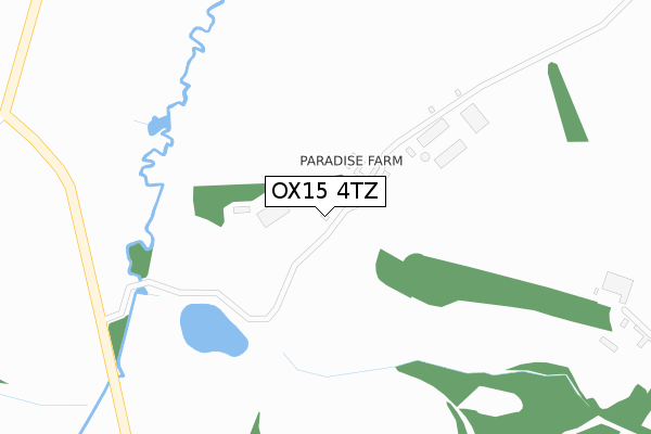
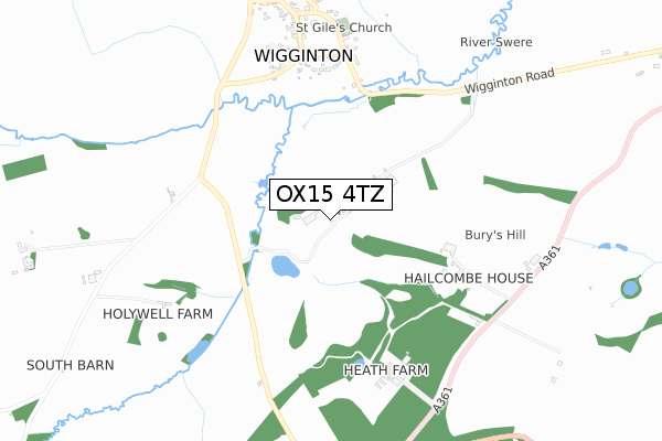
OX15 4TZ is located in the Deddington electoral ward, within the local authority district of Cherwell and the English Parliamentary constituency of Banbury. The Sub Integrated Care Board (ICB) Location is NHS Buckinghamshire, Oxfordshire and Berkshire West ICB - 10Q and the police force is Thames Valley. This postcode has been in use since December 2017.


GetTheData
Source: OS Open Zoomstack (Ordnance Survey)
Licence: Open Government Licence (requires attribution)
Attribution: Contains OS data © Crown copyright and database right 2024
Source: Open Postcode Geo
Licence: Open Government Licence (requires attribution)
Attribution: Contains OS data © Crown copyright and database right 2024; Contains Royal Mail data © Royal Mail copyright and database right 2024; Source: Office for National Statistics licensed under the Open Government Licence v.3.0
| Easting | 438943 |
| Northing | 232575 |
| Latitude | 51.990278 |
| Longitude | -1.434268 |
GetTheData
Source: Open Postcode Geo
Licence: Open Government Licence
| Country | England |
| Postcode District | OX15 |
| ➜ OX15 open data dashboard ➜ See where OX15 is on a map | |
GetTheData
Source: Land Registry Price Paid Data
Licence: Open Government Licence
| Ward | Deddington |
| Constituency | Banbury |
GetTheData
Source: ONS Postcode Database
Licence: Open Government Licence
| The White Swan Inn Ph (Village Road) | Wigginton | 902m |
| The White Swan Inn Ph (Village Road) | Wigginton | 902m |
| Post Box (Chapel Hill) | Swerford | 1,768m |
| Post Box (Chapel Hill) | Swerford | 1,780m |
GetTheData
Source: NaPTAN
Licence: Open Government Licence
GetTheData
Source: ONS Postcode Database
Licence: Open Government Licence


➜ Get more ratings from the Food Standards Agency
GetTheData
Source: Food Standards Agency
Licence: FSA terms & conditions
| Last Collection | |||
|---|---|---|---|
| Location | Mon-Fri | Sat | Distance |
| Great Tew Post Office | 16:15 | 09:30 | 3,338m |
| Netting Street | 16:15 | 08:00 | 3,657m |
| Bloxham Post Office | 17:00 | 09:30 | 5,409m |
GetTheData
Source: Dracos
Licence: Creative Commons Attribution-ShareAlike
| Facility | Distance |
|---|---|
| Rye Hill Golf Club Milcombe, Banbury Golf | 2.6km |
| Tadmarton Heath Golf Club Tadmarton Heath, Banbury Golf | 3.1km |
| Hook Norton Primary School Sibford Road, Hook Norton, Banbury Grass Pitches | 3.5km |
GetTheData
Source: Active Places
Licence: Open Government Licence
| School | Phase of Education | Distance |
|---|---|---|
| Great Tew County Primary School Great Tew, Chipping Norton, OX7 4DB | Primary | 3.4km |
| Hook Norton Church of England Primary School Sibford Road, Hook Norton, Banbury, OX15 5JS | Primary | 3.5km |
| Bloxham Church of England Primary School Tadmarton Road, Bloxham, Banbury, OX15 4HP | Primary | 4.8km |
GetTheData
Source: Edubase
Licence: Open Government Licence
The below table lists the International Territorial Level (ITL) codes (formerly Nomenclature of Territorial Units for Statistics (NUTS) codes) and Local Administrative Units (LAU) codes for OX15 4TZ:
| ITL 1 Code | Name |
|---|---|
| TLJ | South East (England) |
| ITL 2 Code | Name |
| TLJ1 | Berkshire, Buckinghamshire and Oxfordshire |
| ITL 3 Code | Name |
| TLJ14 | Oxfordshire CC |
| LAU 1 Code | Name |
| E07000177 | Cherwell |
GetTheData
Source: ONS Postcode Directory
Licence: Open Government Licence
The below table lists the Census Output Area (OA), Lower Layer Super Output Area (LSOA), and Middle Layer Super Output Area (MSOA) for OX15 4TZ:
| Code | Name | |
|---|---|---|
| OA | E00145145 | |
| LSOA | E01028486 | Cherwell 009C |
| MSOA | E02005929 | Cherwell 009 |
GetTheData
Source: ONS Postcode Directory
Licence: Open Government Licence
| OX15 4JX | School Lane | 609m |
| OX15 4JT | Mill Lane | 614m |
| OX15 4JY | Oxhey Rise | 621m |
| OX15 4LG | 679m | |
| OX15 4JZ | 696m | |
| OX15 4JU | 700m | |
| OX15 4LA | 766m | |
| OX15 4JP | 848m | |
| OX15 4LD | 849m | |
| OX15 4LE | 915m |
GetTheData
Source: Open Postcode Geo; Land Registry Price Paid Data
Licence: Open Government Licence