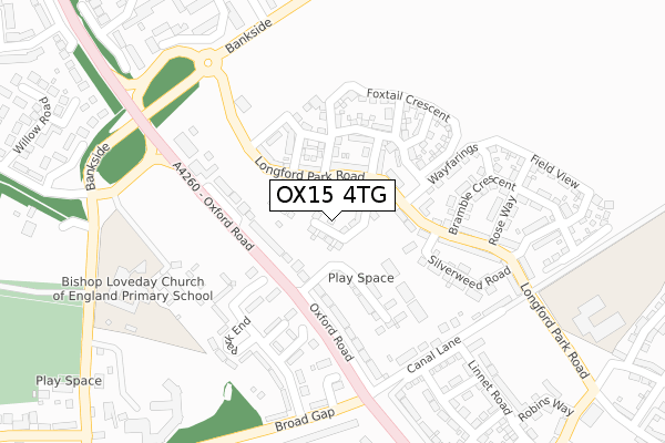
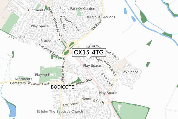
OX15 4TG is located in the Banbury Calthorpe and Easington electoral ward, within the local authority district of Cherwell and the English Parliamentary constituency of Banbury. The Sub Integrated Care Board (ICB) Location is NHS Buckinghamshire, Oxfordshire and Berkshire West ICB - 10Q and the police force is Thames Valley. This postcode has been in use since October 2019.


GetTheData
Source: OS Open Zoomstack (Ordnance Survey)
Licence: Open Government Licence (requires attribution)
Attribution: Contains OS data © Crown copyright and database right 2024
Source: Open Postcode Geo
Licence: Open Government Licence (requires attribution)
Attribution: Contains OS data © Crown copyright and database right 2024; Contains Royal Mail data © Royal Mail copyright and database right 2024; Source: Office for National Statistics licensed under the Open Government Licence v.3.0
| Easting | 446425 |
| Northing | 238367 |
| Latitude | 52.041776 |
| Longitude | -1.324531 |
GetTheData
Source: Open Postcode Geo
Licence: Open Government Licence
| Country | England |
| Postcode District | OX15 |
| ➜ OX15 open data dashboard ➜ See where OX15 is on a map ➜ Where is Bodicote? | |
GetTheData
Source: Land Registry Price Paid Data
Licence: Open Government Licence
| Ward | Banbury Calthorpe And Easington |
| Constituency | Banbury |
GetTheData
Source: ONS Postcode Database
Licence: Open Government Licence
11, REEDMACE ROAD, BODICOTE, BANBURY, OX15 4TG 2020 25 SEP £364,995 |
12, REEDMACE ROAD, BODICOTE, BANBURY, OX15 4TG 2020 19 JUN £369,995 |
7, REEDMACE ROAD, BODICOTE, BANBURY, OX15 4TG 2020 17 JAN £399,995 |
9, REEDMACE ROAD, BODICOTE, BANBURY, OX15 4TG 2019 18 DEC £439,995 |
5, REEDMACE ROAD, BODICOTE, BANBURY, OX15 4TG 2019 25 NOV £439,995 |
GetTheData
Source: HM Land Registry Price Paid Data
Licence: Contains HM Land Registry data © Crown copyright and database right 2024. This data is licensed under the Open Government Licence v3.0.
| May 2023 | Anti-social behaviour | On or near Maple Close | 435m |
| April 2023 | Anti-social behaviour | On or near Willow Road | 500m |
| October 2022 | Robbery | On or near Maple Close | 435m |
| ➜ Get more crime data in our Crime section | |||
GetTheData
Source: data.police.uk
Licence: Open Government Licence
| Broad Gap (Oxford Road) | Bodicote | 163m |
| Broad Gap (Oxford Road) | Bodicote | 287m |
| Elton Road (Chatsworth Drive) | Cherwell Heights | 391m |
| Elton Road (Chatsworth Drive) | Cherwell Heights | 427m |
| Bodicote House (White Post Road) | Bodicote | 439m |
| Banbury Station | 2.1km |
| Kings Sutton Station | 3.8km |
GetTheData
Source: NaPTAN
Licence: Open Government Licence
GetTheData
Source: ONS Postcode Database
Licence: Open Government Licence


➜ Get more ratings from the Food Standards Agency
GetTheData
Source: Food Standards Agency
Licence: FSA terms & conditions
| Last Collection | |||
|---|---|---|---|
| Location | Mon-Fri | Sat | Distance |
| Chatsworth Drive Post Office | 17:40 | 12:00 | 808m |
| The Hawthorns | 17:00 | 08:00 | 1,047m |
| Wood End | 17:00 | 08:00 | 1,134m |
GetTheData
Source: Dracos
Licence: Creative Commons Attribution-ShareAlike
| Facility | Distance |
|---|---|
| Longford Park Football Club Longford Park Road, Banbury Grass Pitches | 248m |
| Bishop Loveday C Of E Primary School White Post Road, Bodicote, Banbury Grass Pitches | 347m |
| Bodicote Sports Ground White Post Road, Bodicote Grass Pitches | 518m |
GetTheData
Source: Active Places
Licence: Open Government Licence
| School | Phase of Education | Distance |
|---|---|---|
| Bishop Loveday Church of England Primary School White Post Road, Bodicote, Banbury, OX15 4BN | Primary | 345m |
| Longford Park Primary School Longford Park Road, Bodicote, Longford Park, Banbury, OX15 4FU | Primary | 426m |
| The Grange Community Primary School Avocet Way, Banbury, OX16 9YA | Primary | 996m |
GetTheData
Source: Edubase
Licence: Open Government Licence
The below table lists the International Territorial Level (ITL) codes (formerly Nomenclature of Territorial Units for Statistics (NUTS) codes) and Local Administrative Units (LAU) codes for OX15 4TG:
| ITL 1 Code | Name |
|---|---|
| TLJ | South East (England) |
| ITL 2 Code | Name |
| TLJ1 | Berkshire, Buckinghamshire and Oxfordshire |
| ITL 3 Code | Name |
| TLJ14 | Oxfordshire CC |
| LAU 1 Code | Name |
| E07000177 | Cherwell |
GetTheData
Source: ONS Postcode Directory
Licence: Open Government Licence
The below table lists the Census Output Area (OA), Lower Layer Super Output Area (LSOA), and Middle Layer Super Output Area (MSOA) for OX15 4TG:
| Code | Name | |
|---|---|---|
| OA | E00145095 | |
| LSOA | E01028475 | Cherwell 008C |
| MSOA | E02005928 | Cherwell 008 |
GetTheData
Source: ONS Postcode Directory
Licence: Open Government Licence
| OX15 4AB | Oxford Road | 95m |
| OX15 4GG | Merlin Close | 133m |
| OX15 4QL | Park End Close | 149m |
| OX15 4QN | Park End Court | 151m |
| OX15 4FU | Longford Park Road | 171m |
| OX15 4DG | Park End | 178m |
| OX15 4QW | Broad End | 205m |
| OX15 4AD | Canal Lane | 210m |
| OX15 4DH | Park End | 237m |
| OX15 4DF | Park End | 239m |
GetTheData
Source: Open Postcode Geo; Land Registry Price Paid Data
Licence: Open Government Licence