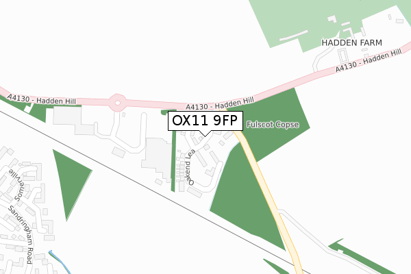
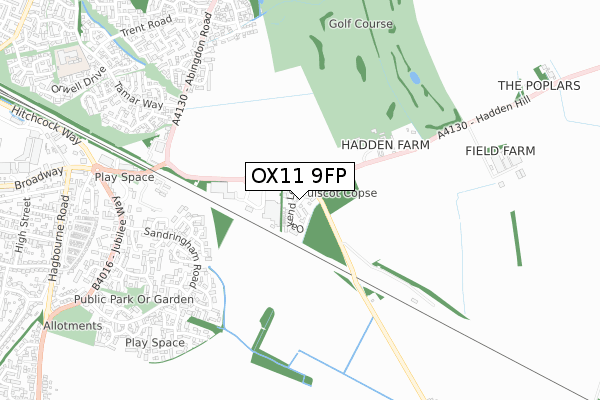
OX11 9FP is located in the Didcot North East electoral ward, within the local authority district of South Oxfordshire and the English Parliamentary constituency of Wantage. The Sub Integrated Care Board (ICB) Location is NHS Buckinghamshire, Oxfordshire and Berkshire West ICB - 10Q and the police force is Thames Valley. This postcode has been in use since September 2019.


GetTheData
Source: OS Open Zoomstack (Ordnance Survey)
Licence: Open Government Licence (requires attribution)
Attribution: Contains OS data © Crown copyright and database right 2024
Source: Open Postcode Geo
Licence: Open Government Licence (requires attribution)
Attribution: Contains OS data © Crown copyright and database right 2024; Contains Royal Mail data © Royal Mail copyright and database right 2024; Source: Office for National Statistics licensed under the Open Government Licence v.3.0
| Easting | 454150 |
| Northing | 189930 |
| Latitude | 51.605614 |
| Longitude | -1.219469 |
GetTheData
Source: Open Postcode Geo
Licence: Open Government Licence
| Country | England |
| Postcode District | OX11 |
| ➜ OX11 open data dashboard ➜ See where OX11 is on a map ➜ Where is Didcot? | |
GetTheData
Source: Land Registry Price Paid Data
Licence: Open Government Licence
| Ward | Didcot North East |
| Constituency | Wantage |
GetTheData
Source: ONS Postcode Database
Licence: Open Government Licence
32, COPSE VIEW, NORTH MORETON, DIDCOT, OX11 9FP 2020 31 JUL £335,000 |
26, COPSE VIEW, NORTH MORETON, DIDCOT, OX11 9FP 2020 17 JUL £365,050 |
15, COPSE VIEW, NORTH MORETON, DIDCOT, OX11 9FP 2019 20 DEC £360,240 |
11, COPSE VIEW, NORTH MORETON, DIDCOT, OX11 9FP 2019 20 DEC £360,240 |
9, COPSE VIEW, NORTH MORETON, DIDCOT, OX11 9FP 2019 20 DEC £330,520 |
7, COPSE VIEW, NORTH MORETON, DIDCOT, OX11 9FP 2019 20 DEC £330,520 |
5, COPSE VIEW, NORTH MORETON, DIDCOT, OX11 9FP 2019 20 DEC £330,520 |
3, COPSE VIEW, NORTH MORETON, DIDCOT, OX11 9FP 2019 8 NOV £400,000 |
GetTheData
Source: HM Land Registry Price Paid Data
Licence: Contains HM Land Registry data © Crown copyright and database right 2024. This data is licensed under the Open Government Licence v3.0.
| June 2022 | Public order | On or near Oriel Court | 469m |
| June 2022 | Violence and sexual offences | On or near Oriel Court | 469m |
| June 2022 | Shoplifting | On or near Oriel Court | 469m |
| ➜ Get more crime data in our Crime section | |||
GetTheData
Source: data.police.uk
Licence: Open Government Licence
| Tesco (A4130) | Didcot | 204m |
| Campion Hall Drive (Sandringham Road) | Didcot | 596m |
| Campion Hall Drive (Sandringham Road) | Didcot | 605m |
| Regent Gardens (Sandringham Road) | Didcot | 632m |
| Regent Gardens (Sandringham Road) | Didcot | 651m |
| Didcot Parkway Station | 1.7km |
| Appleford Station | 4.1km |
| Cholsey Station | 5.8km |
GetTheData
Source: NaPTAN
Licence: Open Government Licence
GetTheData
Source: ONS Postcode Database
Licence: Open Government Licence


➜ Get more ratings from the Food Standards Agency
GetTheData
Source: Food Standards Agency
Licence: FSA terms & conditions
| Last Collection | |||
|---|---|---|---|
| Location | Mon-Fri | Sat | Distance |
| Hagbourne Road | 17:30 | 08:30 | 776m |
| Wessex Road | 17:00 | 09:00 | 1,261m |
| Didcot Post Office | 17:00 | 11:30 | 1,371m |
GetTheData
Source: Dracos
Licence: Creative Commons Attribution-ShareAlike
| Facility | Distance |
|---|---|
| Hadden Hill Golf Course Hadden Hill, North Moreton, Didcot Golf | 401m |
| Re:defined Health & Fitness (Closed) Broadway, Didcot Health and Fitness Gym, Studio | 824m |
| Puregym (Didcot) Broadway, Broadway, Didcot Health and Fitness Gym | 1.4km |
GetTheData
Source: Active Places
Licence: Open Government Licence
| School | Phase of Education | Distance |
|---|---|---|
| All Saints Church of England Primary School Tamar Way, Didcot, OX11 7QH | Primary | 897m |
| Willowcroft Community School Mereland Road, Didcot, OX11 8BA | Primary | 1.6km |
| St Birinus School Mereland Road, Didcot, OX11 8AZ | Secondary | 1.6km |
GetTheData
Source: Edubase
Licence: Open Government Licence
The below table lists the International Territorial Level (ITL) codes (formerly Nomenclature of Territorial Units for Statistics (NUTS) codes) and Local Administrative Units (LAU) codes for OX11 9FP:
| ITL 1 Code | Name |
|---|---|
| TLJ | South East (England) |
| ITL 2 Code | Name |
| TLJ1 | Berkshire, Buckinghamshire and Oxfordshire |
| ITL 3 Code | Name |
| TLJ14 | Oxfordshire CC |
| LAU 1 Code | Name |
| E07000179 | South Oxfordshire |
GetTheData
Source: ONS Postcode Directory
Licence: Open Government Licence
The below table lists the Census Output Area (OA), Lower Layer Super Output Area (LSOA), and Middle Layer Super Output Area (MSOA) for OX11 9FP:
| Code | Name | |
|---|---|---|
| OA | E00145819 | |
| LSOA | E01028628 | South Oxfordshire 009D |
| MSOA | E02005966 | South Oxfordshire 009 |
GetTheData
Source: ONS Postcode Directory
Licence: Open Government Licence
| OX11 9BZ | Wallingford Road | 153m |
| OX11 8UQ | Magdalen Court | 441m |
| OX11 8UG | Oriel Court | 448m |
| OX11 8UF | Lincoln Gardens | 478m |
| OX11 8UH | Exeter Court | 501m |
| OX11 8UD | Somerville | 522m |
| OX11 9RW | Mansfield Gardens | 524m |
| OX11 8UE | Somerville | 532m |
| OX11 8UJ | Merton Close | 560m |
| OX11 8UR | Worcester Drive | 569m |
GetTheData
Source: Open Postcode Geo; Land Registry Price Paid Data
Licence: Open Government Licence