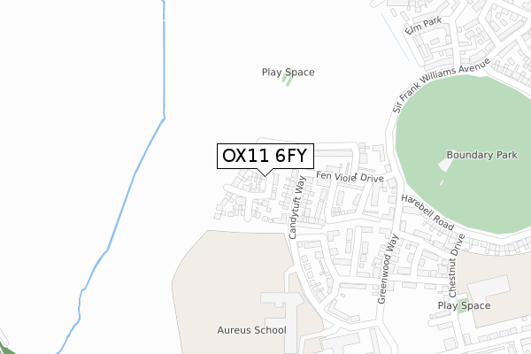
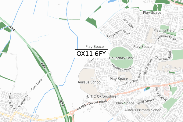
OX11 6FY is located in the Blewbury & Harwell electoral ward, within the local authority district of Vale of White Horse and the English Parliamentary constituency of Wantage. The Sub Integrated Care Board (ICB) Location is NHS Buckinghamshire, Oxfordshire and Berkshire West ICB - 10Q and the police force is Thames Valley. This postcode has been in use since January 2018.


GetTheData
Source: OS Open Zoomstack (Ordnance Survey)
Licence: Open Government Licence (requires attribution)
Attribution: Contains OS data © Crown copyright and database right 2024
Source: Open Postcode Geo
Licence: Open Government Licence (requires attribution)
Attribution: Contains OS data © Crown copyright and database right 2024; Contains Royal Mail data © Royal Mail copyright and database right 2024; Source: Office for National Statistics licensed under the Open Government Licence v.3.0
| Easting | 450337 |
| Northing | 190141 |
| Latitude | 51.607864 |
| Longitude | -1.274494 |
GetTheData
Source: Open Postcode Geo
Licence: Open Government Licence
| Country | England |
| Postcode District | OX11 |
| ➜ OX11 open data dashboard ➜ See where OX11 is on a map ➜ Where is Didcot? | |
GetTheData
Source: Land Registry Price Paid Data
Licence: Open Government Licence
| Ward | Blewbury & Harwell |
| Constituency | Wantage |
GetTheData
Source: ONS Postcode Database
Licence: Open Government Licence
2023 16 JUN £570,000 |
2022 18 NOV £385,000 |
2022 30 JUN £565,000 |
2022 8 APR £428,000 |
2021 28 JUN £400,000 |
77, PENNYROYAL PLACE, HARWELL, DIDCOT, OX11 6FY 2020 10 JUL £379,000 |
63, PENNYROYAL PLACE, HARWELL, DIDCOT, OX11 6FY 2019 11 OCT £375,000 |
12, PENNYROYAL PLACE, HARWELL, DIDCOT, OX11 6FY 2019 7 OCT £463,000 |
67, PENNYROYAL PLACE, HARWELL, DIDCOT, OX11 6FY 2019 7 OCT £495,000 |
2019 27 SEP £490,000 |
GetTheData
Source: HM Land Registry Price Paid Data
Licence: Contains HM Land Registry data © Crown copyright and database right 2024. This data is licensed under the Open Government Licence v3.0.
| Utc Oxfordshire (Greenwood Way) | Harwell | 404m |
| Juniper Way (Sir Frank Williams Avenue) | Didcot | 437m |
| Utc Oxfordshire (Greenwood Way) | Harwell | 448m |
| Utc Oxfordshire (Utc Access Road) | Harwell | 464m |
| Juniper Way (Sir Frank Williams Avenue) | Didcot | 492m |
| Didcot Parkway Station | 2.2km |
| Appleford Station | 4.2km |
GetTheData
Source: NaPTAN
Licence: Open Government Licence
| Percentage of properties with Next Generation Access | 100.0% |
| Percentage of properties with Superfast Broadband | 100.0% |
| Percentage of properties with Ultrafast Broadband | 100.0% |
| Percentage of properties with Full Fibre Broadband | 100.0% |
Superfast Broadband is between 30Mbps and 300Mbps
Ultrafast Broadband is > 300Mbps
| Percentage of properties unable to receive 2Mbps | 0.0% |
| Percentage of properties unable to receive 5Mbps | 0.0% |
| Percentage of properties unable to receive 10Mbps | 0.0% |
| Percentage of properties unable to receive 30Mbps | 0.0% |
GetTheData
Source: Ofcom
Licence: Ofcom Terms of Use (requires attribution)
GetTheData
Source: ONS Postcode Database
Licence: Open Government Licence


➜ Get more ratings from the Food Standards Agency
GetTheData
Source: Food Standards Agency
Licence: FSA terms & conditions
| Last Collection | |||
|---|---|---|---|
| Location | Mon-Fri | Sat | Distance |
| Didcot Sorting Office | 18:00 | 12:30 | 624m |
| Brasenose Road | 17:30 | 08:30 | 849m |
| Sheerwood Road | 17:00 | 11:30 | 1,075m |
GetTheData
Source: Dracos
Licence: Creative Commons Attribution-ShareAlike
| Facility | Distance |
|---|---|
| Aureus School Candytuft Way, Harwell, Didcot Sports Hall, Studio, Outdoor Tennis Courts, Grass Pitches | 273m |
| Boundary Park (Harwell) Greenwood Way, Harwell, Didcot Grass Pitches, Outdoor Tennis Courts | 284m |
| Gems Didcot Primary Academy Chestnut Drive, Harwell, Didcot Sports Hall | 469m |
GetTheData
Source: Active Places
Licence: Open Government Licence
| School | Phase of Education | Distance |
|---|---|---|
| Aureus School Candytuft Way, Great Western Park, Didcot, OX11 6FF | Secondary | 349m |
| Didcot Primary Academy Chestnut Drive, Great Western Park, Didcot, OX11 6DP | Primary | 469m |
| UTC Oxfordshire Greenwood Way, Harwell, Didcot, OX11 6BZ | Secondary | 478m |
GetTheData
Source: Edubase
Licence: Open Government Licence
The below table lists the International Territorial Level (ITL) codes (formerly Nomenclature of Territorial Units for Statistics (NUTS) codes) and Local Administrative Units (LAU) codes for OX11 6FY:
| ITL 1 Code | Name |
|---|---|
| TLJ | South East (England) |
| ITL 2 Code | Name |
| TLJ1 | Berkshire, Buckinghamshire and Oxfordshire |
| ITL 3 Code | Name |
| TLJ14 | Oxfordshire CC |
| LAU 1 Code | Name |
| E07000180 | Vale of White Horse |
GetTheData
Source: ONS Postcode Directory
Licence: Open Government Licence
The below table lists the Census Output Area (OA), Lower Layer Super Output Area (LSOA), and Middle Layer Super Output Area (MSOA) for OX11 6FY:
| Code | Name | |
|---|---|---|
| OA | E00146330 | |
| LSOA | E01028727 | Vale of White Horse 015B |
| MSOA | E02005992 | Vale of White Horse 015 |
GetTheData
Source: ONS Postcode Directory
Licence: Open Government Licence
| OX11 6DT | Raven Road | 439m |
| OX11 6DS | Elm Park | 442m |
| OX11 6DR | Sir Frank Williams Avenue | 473m |
| OX11 6DU | Kestrel Way | 494m |
| OX11 6BG | Greenfinch Road | 512m |
| OX11 6BH | Jackdaw Road | 527m |
| OX11 6BB | Sandpiper Walk | 555m |
| OX11 6DL | Didcot Road | 557m |
| OX11 6AX | Damson Drive | 562m |
| OX11 6EQ | Foxglove Way | 575m |
GetTheData
Source: Open Postcode Geo; Land Registry Price Paid Data
Licence: Open Government Licence