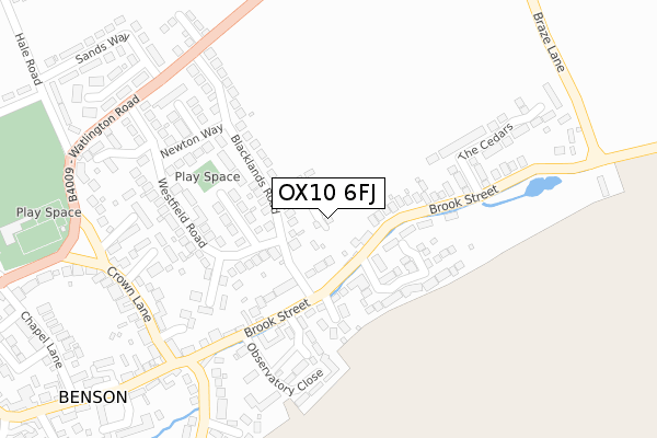
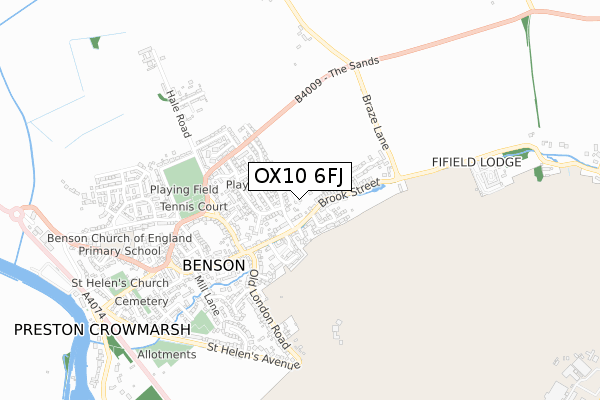
OX10 6FJ is located in the Benson & Crowmarsh electoral ward, within the local authority district of South Oxfordshire and the English Parliamentary constituency of Henley. The Sub Integrated Care Board (ICB) Location is NHS Buckinghamshire, Oxfordshire and Berkshire West ICB - 10Q and the police force is Thames Valley. This postcode has been in use since February 2020.


GetTheData
Source: OS Open Zoomstack (Ordnance Survey)
Licence: Open Government Licence (requires attribution)
Attribution: Contains OS data © Crown copyright and database right 2024
Source: Open Postcode Geo
Licence: Open Government Licence (requires attribution)
Attribution: Contains OS data © Crown copyright and database right 2024; Contains Royal Mail data © Royal Mail copyright and database right 2024; Source: Office for National Statistics licensed under the Open Government Licence v.3.0
| Easting | 462257 |
| Northing | 192011 |
| Latitude | 51.623487 |
| Longitude | -1.102051 |
GetTheData
Source: Open Postcode Geo
Licence: Open Government Licence
| Country | England |
| Postcode District | OX10 |
| ➜ OX10 open data dashboard ➜ See where OX10 is on a map ➜ Where is Benson? | |
GetTheData
Source: Land Registry Price Paid Data
Licence: Open Government Licence
| Ward | Benson & Crowmarsh |
| Constituency | Henley |
GetTheData
Source: ONS Postcode Database
Licence: Open Government Licence
7, WALNUT ACRE, BENSON, WALLINGFORD, OX10 6FJ 2021 1 APR £420,000 |
GetTheData
Source: HM Land Registry Price Paid Data
Licence: Contains HM Land Registry data © Crown copyright and database right 2024. This data is licensed under the Open Government Licence v3.0.
| January 2024 | Other theft | On or near Parking Area | 441m |
| January 2024 | Shoplifting | On or near Parking Area | 441m |
| January 2024 | Shoplifting | On or near Parking Area | 441m |
| ➜ Get more crime data in our Crime section | |||
GetTheData
Source: data.police.uk
Licence: Open Government Licence
| Blacklands Road (Brook Street) | Benson | 151m |
| Blacklands Road (Brook Street) | Benson | 162m |
| The Cedars (Brook Street) | Benson | 225m |
| The Cedars (Brook Street) | Benson | 227m |
| Sands Way (Watlington Road) | Benson | 323m |
GetTheData
Source: NaPTAN
Licence: Open Government Licence
GetTheData
Source: ONS Postcode Database
Licence: Open Government Licence


➜ Get more ratings from the Food Standards Agency
GetTheData
Source: Food Standards Agency
Licence: FSA terms & conditions
| Last Collection | |||
|---|---|---|---|
| Location | Mon-Fri | Sat | Distance |
| Brook Street | 16:00 | 07:30 | 250m |
| Westfield Road | 16:45 | 08:45 | 274m |
| Fyfield Manor | 16:30 | 07:00 | 377m |
GetTheData
Source: Dracos
Licence: Creative Commons Attribution-ShareAlike
| Facility | Distance |
|---|---|
| Sunnyside Recreation Ground Sunnyside, Benson, Wallingford Grass Pitches, Outdoor Tennis Courts, Sports Hall | 468m |
| China Piece Playing Field China Piece, Benson, Wallingford Grass Pitches | 950m |
| Raf Benson Golf Course Raf Benson, Wallingford Golf | 1.5km |
GetTheData
Source: Active Places
Licence: Open Government Licence
| School | Phase of Education | Distance |
|---|---|---|
| Benson Church of England Primary School Oxford Road, Benson, Wallingford, OX10 6LX | Primary | 737m |
| RAF Benson Community Primary School RAF Benson, Wallingford, OX10 6EP | Primary | 1.9km |
| Ewelme CofE Primary School Burrows Hill, Ewelme, Wallingford, OX10 6HU | Primary | 2.4km |
GetTheData
Source: Edubase
Licence: Open Government Licence
The below table lists the International Territorial Level (ITL) codes (formerly Nomenclature of Territorial Units for Statistics (NUTS) codes) and Local Administrative Units (LAU) codes for OX10 6FJ:
| ITL 1 Code | Name |
|---|---|
| TLJ | South East (England) |
| ITL 2 Code | Name |
| TLJ1 | Berkshire, Buckinghamshire and Oxfordshire |
| ITL 3 Code | Name |
| TLJ14 | Oxfordshire CC |
| LAU 1 Code | Name |
| E07000179 | South Oxfordshire |
GetTheData
Source: ONS Postcode Directory
Licence: Open Government Licence
The below table lists the Census Output Area (OA), Lower Layer Super Output Area (LSOA), and Middle Layer Super Output Area (MSOA) for OX10 6FJ:
| Code | Name | |
|---|---|---|
| OA | E00145696 | |
| LSOA | E01028600 | South Oxfordshire 007A |
| MSOA | E02005964 | South Oxfordshire 007 |
GetTheData
Source: ONS Postcode Directory
Licence: Open Government Licence
| OX10 6LH | Brook Street | 108m |
| OX10 6NW | Blacklands Road | 118m |
| OX10 6NH | Westfield Road | 123m |
| OX10 6NN | Green Close | 149m |
| OX10 6LD | Passey Crescent | 162m |
| OX10 6LW | Wychwood Close | 174m |
| OX10 6LN | Old Barn Close | 186m |
| OX10 6NS | Newton Way | 213m |
| OX10 6NT | Westfield Close | 227m |
| OX10 6LQ | Brook Street | 228m |
GetTheData
Source: Open Postcode Geo; Land Registry Price Paid Data
Licence: Open Government Licence