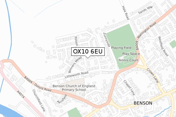
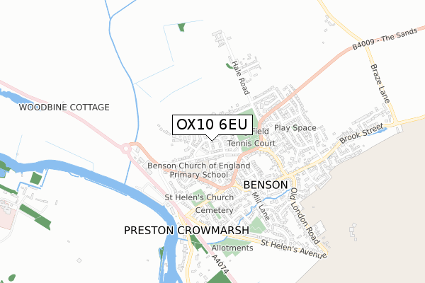
OX10 6EU is located in the Benson & Crowmarsh electoral ward, within the local authority district of South Oxfordshire and the English Parliamentary constituency of Henley. The Sub Integrated Care Board (ICB) Location is NHS Buckinghamshire, Oxfordshire and Berkshire West ICB - 10Q and the police force is Thames Valley. This postcode has been in use since January 2018.


GetTheData
Source: OS Open Zoomstack (Ordnance Survey)
Licence: Open Government Licence (requires attribution)
Attribution: Contains OS data © Crown copyright and database right 2024
Source: Open Postcode Geo
Licence: Open Government Licence (requires attribution)
Attribution: Contains OS data © Crown copyright and database right 2024; Contains Royal Mail data © Royal Mail copyright and database right 2024; Source: Office for National Statistics licensed under the Open Government Licence v.3.0
| Easting | 461592 |
| Northing | 191985 |
| Latitude | 51.623326 |
| Longitude | -1.111661 |
GetTheData
Source: Open Postcode Geo
Licence: Open Government Licence
| Country | England |
| Postcode District | OX10 |
| ➜ OX10 open data dashboard ➜ See where OX10 is on a map ➜ Where is Benson? | |
GetTheData
Source: Land Registry Price Paid Data
Licence: Open Government Licence
| Ward | Benson & Crowmarsh |
| Constituency | Henley |
GetTheData
Source: ONS Postcode Database
Licence: Open Government Licence
39, BONNERS MEAD, BENSON, WALLINGFORD, OX10 6EU 2018 31 AUG £650,000 |
33, BONNERS MEAD, BENSON, WALLINGFORD, OX10 6EU 2018 29 JUN £428,475 |
9, BONNERS MEAD, BENSON, WALLINGFORD, OX10 6EU 2018 29 MAR £735,000 |
7, BONNERS MEAD, BENSON, WALLINGFORD, OX10 6EU 2018 29 MAR £689,450 |
GetTheData
Source: HM Land Registry Price Paid Data
Licence: Contains HM Land Registry data © Crown copyright and database right 2024. This data is licensed under the Open Government Licence v3.0.
| January 2024 | Shoplifting | On or near Parking Area | 442m |
| January 2024 | Other theft | On or near Parking Area | 442m |
| January 2024 | Shoplifting | On or near Parking Area | 442m |
| ➜ Get more crime data in our Crime section | |||
GetTheData
Source: data.police.uk
Licence: Open Government Licence
| Horseshoes Lane (Oxford Road) | Benson | 235m |
| Horseshoes Lane (Oxford Road) | Benson | 256m |
| High Street | Benson | 411m |
| Church Road | Benson | 433m |
| Benson Marina (A4074) | Benson | 435m |
GetTheData
Source: NaPTAN
Licence: Open Government Licence
| Percentage of properties with Next Generation Access | 100.0% |
| Percentage of properties with Superfast Broadband | 100.0% |
| Percentage of properties with Ultrafast Broadband | 100.0% |
| Percentage of properties with Full Fibre Broadband | 100.0% |
Superfast Broadband is between 30Mbps and 300Mbps
Ultrafast Broadband is > 300Mbps
| Percentage of properties unable to receive 2Mbps | 0.0% |
| Percentage of properties unable to receive 5Mbps | 0.0% |
| Percentage of properties unable to receive 10Mbps | 0.0% |
| Percentage of properties unable to receive 30Mbps | 0.0% |
GetTheData
Source: Ofcom
Licence: Ofcom Terms of Use (requires attribution)
GetTheData
Source: ONS Postcode Database
Licence: Open Government Licence


➜ Get more ratings from the Food Standards Agency
GetTheData
Source: Food Standards Agency
Licence: FSA terms & conditions
| Last Collection | |||
|---|---|---|---|
| Location | Mon-Fri | Sat | Distance |
| Castle Square | 16:45 | 09:00 | 284m |
| Westfield Road | 16:45 | 08:45 | 419m |
| Benson Post Office | 17:00 | 10:40 | 436m |
GetTheData
Source: Dracos
Licence: Creative Commons Attribution-ShareAlike
| Facility | Distance |
|---|---|
| Sunnyside Recreation Ground Sunnyside, Benson, Wallingford Grass Pitches, Outdoor Tennis Courts, Sports Hall | 212m |
| China Piece Playing Field China Piece, Benson, Wallingford Grass Pitches | 284m |
| Body Training Studio (Closed) Wallingford Health and Fitness Gym | 1.9km |
GetTheData
Source: Active Places
Licence: Open Government Licence
| School | Phase of Education | Distance |
|---|---|---|
| Benson Church of England Primary School Oxford Road, Benson, Wallingford, OX10 6LX | Primary | 200m |
| St Laurence Church of England School 16 Thame Road, St Laurence School, Warborough, Wallingford, OX10 7DX | Primary | 2.2km |
| Wallingford School St George's Road, Wallingford, OX10 8HH | Secondary | 2.3km |
GetTheData
Source: Edubase
Licence: Open Government Licence
The below table lists the International Territorial Level (ITL) codes (formerly Nomenclature of Territorial Units for Statistics (NUTS) codes) and Local Administrative Units (LAU) codes for OX10 6EU:
| ITL 1 Code | Name |
|---|---|
| TLJ | South East (England) |
| ITL 2 Code | Name |
| TLJ1 | Berkshire, Buckinghamshire and Oxfordshire |
| ITL 3 Code | Name |
| TLJ14 | Oxfordshire CC |
| LAU 1 Code | Name |
| E07000179 | South Oxfordshire |
GetTheData
Source: ONS Postcode Directory
Licence: Open Government Licence
The below table lists the Census Output Area (OA), Lower Layer Super Output Area (LSOA), and Middle Layer Super Output Area (MSOA) for OX10 6EU:
| Code | Name | |
|---|---|---|
| OA | E00145695 | |
| LSOA | E01028599 | South Oxfordshire 011A |
| MSOA | E02005968 | South Oxfordshire 011 |
GetTheData
Source: ONS Postcode Directory
Licence: Open Government Licence
| OX10 6LY | Littleworth Road | 97m |
| OX10 6LZ | Sunnyside | 126m |
| OX10 6LT | Watlington Road | 195m |
| OX10 6LB | Horseshoes Lane | 209m |
| OX10 6EX | Forge Close | 216m |
| OX10 6LS | Watlington Road | 244m |
| OX10 6LX | Oxford Road | 248m |
| OX10 6NX | White Hart Close | 263m |
| OX10 6PA | One End Lane | 270m |
| OX10 6PD | Pensfield | 278m |
GetTheData
Source: Open Postcode Geo; Land Registry Price Paid Data
Licence: Open Government Licence