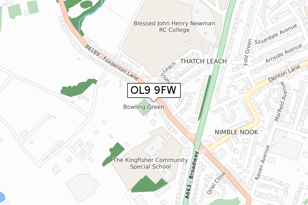
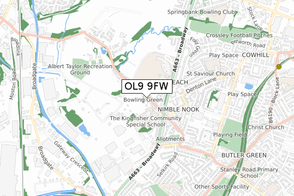
OL9 9FW is located in the Chadderton South electoral ward, within the metropolitan district of Oldham and the English Parliamentary constituency of Oldham West and Royton. The Sub Integrated Care Board (ICB) Location is NHS Greater Manchester ICB - 00Y and the police force is Greater Manchester. This postcode has been in use since May 2019.


GetTheData
Source: OS Open Zoomstack (Ordnance Survey)
Licence: Open Government Licence (requires attribution)
Attribution: Contains OS data © Crown copyright and database right 2024
Source: Open Postcode Geo
Licence: Open Government Licence (requires attribution)
Attribution: Contains OS data © Crown copyright and database right 2024; Contains Royal Mail data © Royal Mail copyright and database right 2024; Source: Office for National Statistics licensed under the Open Government Licence v.3.0
| Easting | 389847 |
| Northing | 404319 |
| Latitude | 53.535438 |
| Longitude | -2.154654 |
GetTheData
Source: Open Postcode Geo
Licence: Open Government Licence
| Country | England |
| Postcode District | OL9 |
| ➜ OL9 open data dashboard ➜ See where OL9 is on a map ➜ Where is Chadderton? | |
GetTheData
Source: Land Registry Price Paid Data
Licence: Open Government Licence
| Ward | Chadderton South |
| Constituency | Oldham West And Royton |
GetTheData
Source: ONS Postcode Database
Licence: Open Government Licence
| Foxdenton Ln/The Sportsman (Foxdenton Ln) | Nimble Nook | 88m |
| Foxdenton Ln/The Sportsman (Foxdenton Ln) | Nimble Nook | 125m |
| Broadway/The Sportsman (Broadway) | Nimble Nook | 159m |
| Foxdenton Ln/Foxdenton Hall Pk (Foxdenton Ln) | Thatch Leach | 199m |
| Broadway/Newman Rc College (Broadway) | Thatch Leach | 214m |
| Freehold (Manchester Metrolink) (Block Lane) | Chadderton | 1,119m |
| South Chadderton (Manchester Metrolink) (Canal St) | White Gate | 1,172m |
| Moston Station | 1.7km |
| Mills Hill (Manchester) Station | 2.1km |
| Ashton-under-Lyne Station | 6.3km |
GetTheData
Source: NaPTAN
Licence: Open Government Licence
GetTheData
Source: ONS Postcode Database
Licence: Open Government Licence


➜ Get more ratings from the Food Standards Agency
GetTheData
Source: Food Standards Agency
Licence: FSA terms & conditions
| Last Collection | |||
|---|---|---|---|
| Location | Mon-Fri | Sat | Distance |
| Sycamore Avenue | 17:35 | 12:10 | 801m |
| Dog Inn | 17:30 | 11:20 | 1,207m |
| Greengate | 1,348m | ||
GetTheData
Source: Dracos
Licence: Creative Commons Attribution-ShareAlike
| Facility | Distance |
|---|---|
| Newman Rc College Broadway, Chadderton, Oldham Sports Hall, Health and Fitness Gym, Artificial Grass Pitch, Grass Pitches | 309m |
| Foxdenton Park Foxdenton Lane, Chadderton Grass Pitches, Outdoor Tennis Courts | 563m |
| Saint Saviours Church Bishopgate St, Chadderton, Oldham Sports Hall | 586m |
GetTheData
Source: Active Places
Licence: Open Government Licence
| School | Phase of Education | Distance |
|---|---|---|
| Kingfisher Special School Foxdenton Lane, Chadderton, Oldham, OL9 9QR | Not applicable | 224m |
| Blessed John Henry Newman Roman Catholic College Broadway, Chadderton, Oldham, OL9 9QY | Secondary | 317m |
| Halcyon Way School Gordon Street, Chadderton, Oldham Ol9 9QE | Not applicable | 614m |
GetTheData
Source: Edubase
Licence: Open Government Licence
The below table lists the International Territorial Level (ITL) codes (formerly Nomenclature of Territorial Units for Statistics (NUTS) codes) and Local Administrative Units (LAU) codes for OL9 9FW:
| ITL 1 Code | Name |
|---|---|
| TLD | North West (England) |
| ITL 2 Code | Name |
| TLD3 | Greater Manchester |
| ITL 3 Code | Name |
| TLD37 | Greater Manchester North East |
| LAU 1 Code | Name |
| E08000004 | Oldham |
GetTheData
Source: ONS Postcode Directory
Licence: Open Government Licence
The below table lists the Census Output Area (OA), Lower Layer Super Output Area (LSOA), and Middle Layer Super Output Area (MSOA) for OL9 9FW:
| Code | Name | |
|---|---|---|
| OA | E00026994 | |
| LSOA | E01005330 | Oldham 015B |
| MSOA | E02001112 | Oldham 015 |
GetTheData
Source: ONS Postcode Directory
Licence: Open Government Licence
| OL9 9QS | Foxdenton Lane | 69m |
| OL9 9QT | Lyndhurst Avenue | 112m |
| OL9 9QX | Thatch Leach | 128m |
| OL9 9QR | Foxdenton Lane | 137m |
| OL9 9QU | Broadway | 156m |
| OL9 8RS | Broadway | 226m |
| OL9 9RD | Nimble Nook | 251m |
| OL9 9QP | Broadway | 276m |
| OL9 9EA | Denton Lane | 279m |
| OL9 8RN | Broadway | 300m |
GetTheData
Source: Open Postcode Geo; Land Registry Price Paid Data
Licence: Open Government Licence