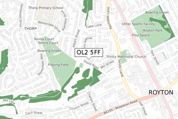
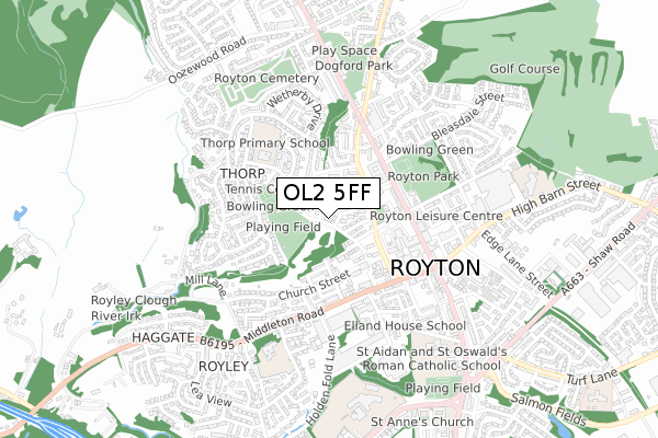
OL2 5FF is located in the Royton North electoral ward, within the metropolitan district of Oldham and the English Parliamentary constituency of Oldham West and Royton. The Sub Integrated Care Board (ICB) Location is NHS Greater Manchester ICB - 00Y and the police force is Greater Manchester. This postcode has been in use since July 2019.


GetTheData
Source: OS Open Zoomstack (Ordnance Survey)
Licence: Open Government Licence (requires attribution)
Attribution: Contains OS data © Crown copyright and database right 2024
Source: Open Postcode Geo
Licence: Open Government Licence (requires attribution)
Attribution: Contains OS data © Crown copyright and database right 2024; Contains Royal Mail data © Royal Mail copyright and database right 2024; Source: Office for National Statistics licensed under the Open Government Licence v.3.0
| Easting | 391630 |
| Northing | 407826 |
| Latitude | 53.566992 |
| Longitude | -2.127847 |
GetTheData
Source: Open Postcode Geo
Licence: Open Government Licence
| Country | England |
| Postcode District | OL2 |
| ➜ OL2 open data dashboard ➜ See where OL2 is on a map ➜ Where is Royton? | |
GetTheData
Source: Land Registry Price Paid Data
Licence: Open Government Licence
| Ward | Royton North |
| Constituency | Oldham West And Royton |
GetTheData
Source: ONS Postcode Database
Licence: Open Government Licence
| January 2022 | Violence and sexual offences | On or near Police Station | 422m |
| ➜ Get more crime data in our Crime section | |||
GetTheData
Source: data.police.uk
Licence: Open Government Licence
| Albert Street | Royton | 162m |
| Sandy Lane (Nbnd) (Sandy Lane) | Royton | 173m |
| Flake Lane (Eastbound) (Flake Lane) | Royton | 183m |
| Radcliffe Street (Nebnd) (Radcliffe St) | Royton | 194m |
| Flake Lane (Westbound) (Flake Lane) | Royton | 215m |
| Mills Hill (Manchester) Station | 3.4km |
| Castleton (Manchester) Station | 4.3km |
| Rochdale Station | 5.1km |
GetTheData
Source: NaPTAN
Licence: Open Government Licence
GetTheData
Source: ONS Postcode Database
Licence: Open Government Licence


➜ Get more ratings from the Food Standards Agency
GetTheData
Source: Food Standards Agency
Licence: FSA terms & conditions
| Last Collection | |||
|---|---|---|---|
| Location | Mon-Fri | Sat | Distance |
| Haggate Old Post Office | 17:00 | 11:20 | 690m |
| Woodland Park | 17:30 | 11:30 | 1,286m |
| Sheepfoot Lane | 17:30 | 11:15 | 1,478m |
GetTheData
Source: Dracos
Licence: Creative Commons Attribution-ShareAlike
| Facility | Distance |
|---|---|
| Royton Cricket Club Bransdale Avenue, Royton, Oldham Grass Pitches, Outdoor Tennis Courts | 173m |
| Royton Park Bleasdale Street, Royton, Oldham Outdoor Tennis Courts | 344m |
| Royton Leisure Centre Byron Street, Royton, Oldham Health and Fitness Gym, Swimming Pool, Studio | 413m |
GetTheData
Source: Active Places
Licence: Open Government Licence
| School | Phase of Education | Distance |
|---|---|---|
| Thorp Primary School Westerdale Drive, Royton, Oldham, OL2 5TY | Primary | 350m |
| Brookland School 13 Newhey Road, Milnrow, Rochdale, Royton, OL16 3NP | Not applicable | 498m |
| Ss Aidan and Oswald's Roman Catholic Primary School Roman Road, Royton, Oldham, OL2 5PQ | Primary | 540m |
GetTheData
Source: Edubase
Licence: Open Government Licence
The below table lists the International Territorial Level (ITL) codes (formerly Nomenclature of Territorial Units for Statistics (NUTS) codes) and Local Administrative Units (LAU) codes for OL2 5FF:
| ITL 1 Code | Name |
|---|---|
| TLD | North West (England) |
| ITL 2 Code | Name |
| TLD3 | Greater Manchester |
| ITL 3 Code | Name |
| TLD37 | Greater Manchester North East |
| LAU 1 Code | Name |
| E08000004 | Oldham |
GetTheData
Source: ONS Postcode Directory
Licence: Open Government Licence
The below table lists the Census Output Area (OA), Lower Layer Super Output Area (LSOA), and Middle Layer Super Output Area (MSOA) for OL2 5FF:
| Code | Name | |
|---|---|---|
| OA | E00027290 | |
| LSOA | E01005392 | Oldham 008B |
| MSOA | E02001105 | Oldham 008 |
GetTheData
Source: ONS Postcode Directory
Licence: Open Government Licence
| OL2 5RN | Leyburn Avenue | 78m |
| OL2 5RJ | Burnsall Grove | 86m |
| OL2 5QW | Mill Street | 91m |
| OL2 5UF | Albert Street | 98m |
| OL2 5RH | Richmond Avenue | 125m |
| OL2 5QU | Steeple View | 125m |
| OL2 5QL | Chapel Street | 129m |
| OL2 5TX | Bransdale Avenue | 158m |
| OL2 5RF | Flake Lane | 164m |
| OL2 5JT | Charles Street | 166m |
GetTheData
Source: Open Postcode Geo; Land Registry Price Paid Data
Licence: Open Government Licence