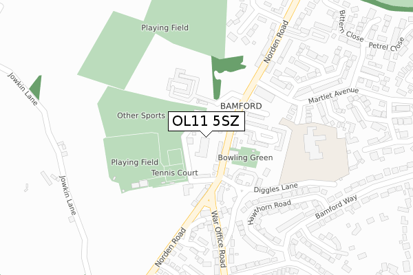
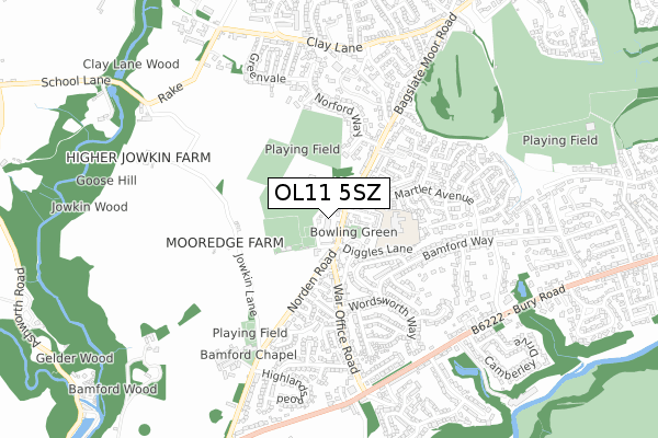
OL11 5SZ is located in the Bamford electoral ward, within the metropolitan district of Rochdale and the English Parliamentary constituency of Heywood and Middleton. The Sub Integrated Care Board (ICB) Location is NHS Greater Manchester ICB - 01D and the police force is Greater Manchester. This postcode has been in use since July 2019.


GetTheData
Source: OS Open Zoomstack (Ordnance Survey)
Licence: Open Government Licence (requires attribution)
Attribution: Contains OS data © Crown copyright and database right 2024
Source: Open Postcode Geo
Licence: Open Government Licence (requires attribution)
Attribution: Contains OS data © Crown copyright and database right 2024; Contains Royal Mail data © Royal Mail copyright and database right 2024; Source: Office for National Statistics licensed under the Open Government Licence v.3.0
| Easting | 386249 |
| Northing | 413037 |
| Latitude | 53.613715 |
| Longitude | -2.209326 |
GetTheData
Source: Open Postcode Geo
Licence: Open Government Licence
| Country | England |
| Postcode District | OL11 |
| ➜ OL11 open data dashboard ➜ See where OL11 is on a map ➜ Where is Rochdale? | |
GetTheData
Source: Land Registry Price Paid Data
Licence: Open Government Licence
| Ward | Bamford |
| Constituency | Heywood And Middleton |
GetTheData
Source: ONS Postcode Database
Licence: Open Government Licence
| January 2022 | Vehicle crime | On or near Porritt Close | 365m |
| ➜ Get more crime data in our Crime section | |||
GetTheData
Source: data.police.uk
Licence: Open Government Licence
| Norden Rd/Belgium St (Norden Rd) | Bamford | 105m |
| Norden Rd/War Office Rd (Norden Rd) | Bamford | 116m |
| Norden Rd/Belgium St (Norden Rd) | Bamford | 131m |
| War Office Rd/Norden Rd (War Office Rd) | Bamford | 190m |
| War Office Rd/Bamford P.o. (War Office Rd) | Bamford | 372m |
| Castleton (Manchester) Station | 3.2km |
| Rochdale Station | 3.7km |
GetTheData
Source: NaPTAN
Licence: Open Government Licence
| Percentage of properties with Next Generation Access | 100.0% |
| Percentage of properties with Superfast Broadband | 100.0% |
| Percentage of properties with Ultrafast Broadband | 100.0% |
| Percentage of properties with Full Fibre Broadband | 100.0% |
Superfast Broadband is between 30Mbps and 300Mbps
Ultrafast Broadband is > 300Mbps
| Percentage of properties unable to receive 2Mbps | 0.0% |
| Percentage of properties unable to receive 5Mbps | 0.0% |
| Percentage of properties unable to receive 10Mbps | 0.0% |
| Percentage of properties unable to receive 30Mbps | 0.0% |
GetTheData
Source: Ofcom
Licence: Ofcom Terms of Use (requires attribution)
GetTheData
Source: ONS Postcode Database
Licence: Open Government Licence


➜ Get more ratings from the Food Standards Agency
GetTheData
Source: Food Standards Agency
Licence: FSA terms & conditions
| Last Collection | |||
|---|---|---|---|
| Location | Mon-Fri | Sat | Distance |
| Bamford Precinct | 17:30 | 11:00 | 155m |
| War Office | 17:30 | 11:00 | 341m |
| Caldershaw Road | 17:30 | 11:00 | 1,454m |
GetTheData
Source: Dracos
Licence: Creative Commons Attribution-ShareAlike
| Facility | Distance |
|---|---|
| Top Of The Lane Playing Fields (Bridge Jfc) Hollin Lane, Rochdale Grass Pitches | 61m |
| Rochdale Tennis Club Hollin Lane, Rochdale Outdoor Tennis Courts | 99m |
| Bamford Fieldhouse Cricket Club Hollin Lane, Rochdale Grass Pitches | 188m |
GetTheData
Source: Active Places
Licence: Open Government Licence
| School | Phase of Education | Distance |
|---|---|---|
| Bamford Academy Belgium Street, Rochdale, Manchester, OL11 5PS | Primary | 247m |
| St Michael's Church of England Primary School, Bamford Bury and Rochdale Old Road, Heywood, OL10 4BB | Primary | 1.1km |
| Whittaker Moss Primary School Highwood, Whittaker Moss Primary School, Rochdale, OL11 5XP | Primary | 1.2km |
GetTheData
Source: Edubase
Licence: Open Government Licence
The below table lists the International Territorial Level (ITL) codes (formerly Nomenclature of Territorial Units for Statistics (NUTS) codes) and Local Administrative Units (LAU) codes for OL11 5SZ:
| ITL 1 Code | Name |
|---|---|
| TLD | North West (England) |
| ITL 2 Code | Name |
| TLD3 | Greater Manchester |
| ITL 3 Code | Name |
| TLD37 | Greater Manchester North East |
| LAU 1 Code | Name |
| E08000005 | Rochdale |
GetTheData
Source: ONS Postcode Directory
Licence: Open Government Licence
The below table lists the Census Output Area (OA), Lower Layer Super Output Area (LSOA), and Middle Layer Super Output Area (MSOA) for OL11 5SZ:
| Code | Name | |
|---|---|---|
| OA | E00028216 | |
| LSOA | E01005575 | Rochdale 011B |
| MSOA | E02001142 | Rochdale 011 |
GetTheData
Source: ONS Postcode Directory
Licence: Open Government Licence
| OL11 5PW | Hollin Lane | 95m |
| OL11 5NX | Bamford Mews | 126m |
| OL11 5PN | Norden Road | 127m |
| OL11 5PP | Dixon Fold | 136m |
| OL11 5AR | 137m | |
| OL11 5PS | Belgium Street | 145m |
| OL11 5PR | Mansfield Road | 145m |
| OL11 5HH | War Office Road | 185m |
| OL11 5JH | Burnthorpe Close | 222m |
| OL11 5JQ | Hawthorn Road | 235m |
GetTheData
Source: Open Postcode Geo; Land Registry Price Paid Data
Licence: Open Government Licence