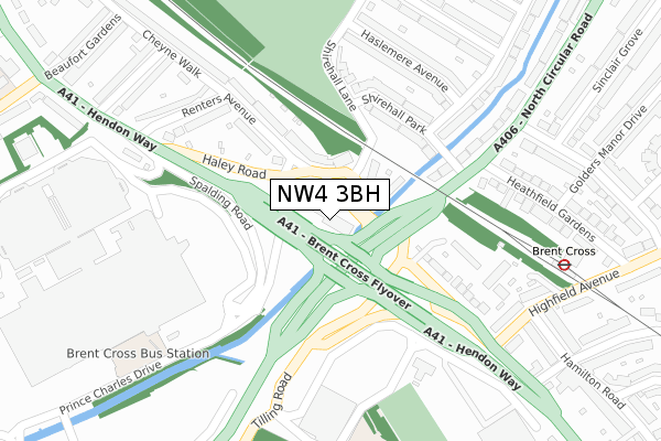
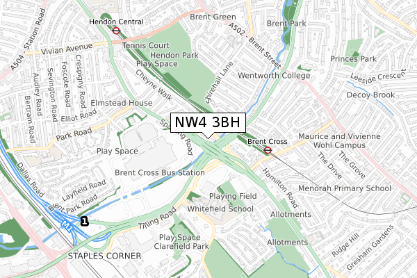
NW4 3BH is located in the Hendon electoral ward, within the London borough of Barnet and the English Parliamentary constituency of Hendon. The Sub Integrated Care Board (ICB) Location is NHS North Central London ICB - 93C and the police force is Metropolitan Police. This postcode has been in use since August 2018.


GetTheData
Source: OS Open Zoomstack (Ordnance Survey)
Licence: Open Government Licence (requires attribution)
Attribution: Contains OS data © Crown copyright and database right 2024
Source: Open Postcode Geo
Licence: Open Government Licence (requires attribution)
Attribution: Contains OS data © Crown copyright and database right 2024; Contains Royal Mail data © Royal Mail copyright and database right 2024; Source: Office for National Statistics licensed under the Open Government Licence v.3.0
| Easting | 523530 |
| Northing | 188007 |
| Latitude | 51.577403 |
| Longitude | -0.218691 |
GetTheData
Source: Open Postcode Geo
Licence: Open Government Licence
| Country | England |
| Postcode District | NW4 |
| ➜ NW4 open data dashboard ➜ See where NW4 is on a map ➜ Where is Hendon? | |
GetTheData
Source: Land Registry Price Paid Data
Licence: Open Government Licence
| Ward | Hendon |
| Constituency | Hendon |
GetTheData
Source: ONS Postcode Database
Licence: Open Government Licence
| January 2024 | Drugs | On or near Haslemere Avenue | 268m |
| January 2024 | Drugs | On or near Haslemere Avenue | 268m |
| January 2024 | Robbery | On or near Haslemere Avenue | 268m |
| ➜ Get more crime data in our Crime section | |||
GetTheData
Source: data.police.uk
Licence: Open Government Licence
| North Circular Rd Hendon Way | Brent Cross | 54m |
| Prince Charles Drive | Brent Cross | 102m |
| Brent Cross Centre North Circular Road (North Circular Road) | Brent Cross | 120m |
| Brent Cross Centre North Circular Road (North Circular Road) | Brent Cross | 138m |
| Prince Charles Drive | Brent Cross | 144m |
| Brent Cross Underground Station | Brent Cross | 363m |
| Hendon Central Underground Station | Hendon Central | 846m |
| Hendon Station | 1.4km |
| Cricklewood Station | 2.1km |
| West Hampstead Thameslink Station | 3.7km |
GetTheData
Source: NaPTAN
Licence: Open Government Licence
GetTheData
Source: ONS Postcode Database
Licence: Open Government Licence


➜ Get more ratings from the Food Standards Agency
GetTheData
Source: Food Standards Agency
Licence: FSA terms & conditions
| Last Collection | |||
|---|---|---|---|
| Location | Mon-Fri | Sat | Distance |
| Shirehall Lane | 17:30 | 12:00 | 100m |
| Renters Avenue | 17:30 | 12:00 | 245m |
| Shirehall Park | 17:30 | 12:00 | 332m |
GetTheData
Source: Dracos
Licence: Creative Commons Attribution-ShareAlike
| Facility | Distance |
|---|---|
| Mapledown School Claremont Road, London Sports Hall, Health and Fitness Gym | 388m |
| Whitefield School Claremont Road, London Artificial Grass Pitch, Health and Fitness Gym, Sports Hall, Studio | 424m |
| Hendon Leisure Centre Marble Drive, London Sports Hall, Health and Fitness Gym, Studio | 446m |
GetTheData
Source: Active Places
Licence: Open Government Licence
| School | Phase of Education | Distance |
|---|---|---|
| Mapledown School Claremont Road, Cricklewood, London, NW2 1TR | Not applicable | 400m |
| Whitefield School Claremont Road, Cricklewood, London, NW2 1TR | Secondary | 420m |
| WENTWORTH COLLEGE 6-10 Brentmead Place, London, NW11 9LH | Not applicable | 547m |
GetTheData
Source: Edubase
Licence: Open Government Licence
The below table lists the International Territorial Level (ITL) codes (formerly Nomenclature of Territorial Units for Statistics (NUTS) codes) and Local Administrative Units (LAU) codes for NW4 3BH:
| ITL 1 Code | Name |
|---|---|
| TLI | London |
| ITL 2 Code | Name |
| TLI7 | Outer London - West and North West |
| ITL 3 Code | Name |
| TLI71 | Barnet |
| LAU 1 Code | Name |
| E09000003 | Barnet |
GetTheData
Source: ONS Postcode Directory
Licence: Open Government Licence
The below table lists the Census Output Area (OA), Lower Layer Super Output Area (LSOA), and Middle Layer Super Output Area (MSOA) for NW4 3BH:
| Code | Name | |
|---|---|---|
| OA | E00001506 | |
| LSOA | E01000310 | Barnet 034C |
| MSOA | E02000057 | Barnet 034 |
GetTheData
Source: ONS Postcode Directory
Licence: Open Government Licence
| NW4 3RG | Shirehall Lane | 83m |
| NW4 3RD | Renters Avenue | 153m |
| NW4 3RE | Renters Avenue | 166m |
| NW4 2QU | Shirehall Park | 179m |
| NW2 1JR | Hendon Way | 212m |
| NW2 1JP | Brentfield Gardens | 214m |
| NW4 2QX | Shirehall Park | 216m |
| NW4 2PT | Shirehall Lane | 234m |
| NW4 2PU | Haslemere Avenue | 248m |
| NW4 3RB | Renters Avenue | 251m |
GetTheData
Source: Open Postcode Geo; Land Registry Price Paid Data
Licence: Open Government Licence