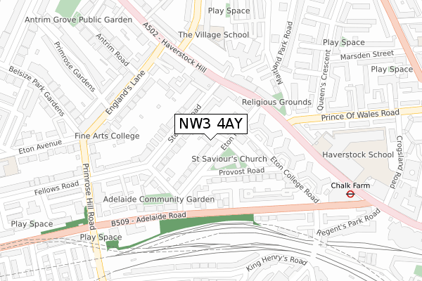
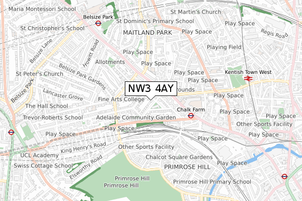
NW3 4AY is located in the Haverstock electoral ward, within the London borough of Camden and the English Parliamentary constituency of Holborn and St Pancras. The Sub Integrated Care Board (ICB) Location is NHS North Central London ICB - 93C and the police force is Metropolitan Police. This postcode has been in use since March 2019.


GetTheData
Source: OS Open Zoomstack (Ordnance Survey)
Licence: Open Government Licence (requires attribution)
Attribution: Contains OS data © Crown copyright and database right 2024
Source: Open Postcode Geo
Licence: Open Government Licence (requires attribution)
Attribution: Contains OS data © Crown copyright and database right 2024; Contains Royal Mail data © Royal Mail copyright and database right 2024; Source: Office for National Statistics licensed under the Open Government Licence v.3.0
| Easting | 527795 |
| Northing | 184549 |
| Latitude | 51.545376 |
| Longitude | -0.158432 |
GetTheData
Source: Open Postcode Geo
Licence: Open Government Licence
| Country | England |
| Postcode District | NW3 |
| ➜ NW3 open data dashboard ➜ See where NW3 is on a map ➜ Where is Hampstead? | |
GetTheData
Source: Land Registry Price Paid Data
Licence: Open Government Licence
| Ward | Haverstock |
| Constituency | Holborn And St Pancras |
GetTheData
Source: ONS Postcode Database
Licence: Open Government Licence
| December 2023 | Public order | On or near Regent'S Park Road | 382m |
| November 2023 | Bicycle theft | On or near Regent'S Park Road | 382m |
| October 2023 | Shoplifting | On or near Regent'S Park Road | 382m |
| ➜ Get more crime data in our Crime section | |||
GetTheData
Source: data.police.uk
Licence: Open Government Licence
| Steele's Roadsteele's Village (Haverstock Hill) | Gospel Oak | 134m |
| Haverstock Hill Steeles Village (Haverstock Hill) | Gospel Oak | 147m |
| Eton Road (Nw3) | Primrose Hill | 166m |
| Eton Road (Nw3) | Primrose Hill | 190m |
| Haverstock Hill | Kentish Town | 220m |
| Chalk Farm Underground Station | Chalk Farm | 378m |
| Belsize Park Underground Station | Belsize Park | 697m |
| Swiss Cottage Underground Station | Swiss Cottage | 1,156m |
| Camden Town Underground Station | Camden Town | 1,283m |
| Kentish Town Underground Station | Kentish Town | 1,346m |
| Kentish Town West Station | 0.8km |
| Hampstead Heath Station | 1.2km |
| Gospel Oak Station | 1.2km |
GetTheData
Source: NaPTAN
Licence: Open Government Licence
GetTheData
Source: ONS Postcode Database
Licence: Open Government Licence


➜ Get more ratings from the Food Standards Agency
GetTheData
Source: Food Standards Agency
Licence: FSA terms & conditions
| Last Collection | |||
|---|---|---|---|
| Location | Mon-Fri | Sat | Distance |
| Steeles Road | 17:30 | 12:00 | 133m |
| Adelaide Road | 17:30 | 12:00 | 180m |
| Englands Lane Post Office | 18:30 | 12:00 | 262m |
GetTheData
Source: Dracos
Licence: Creative Commons Attribution-ShareAlike
| Facility | Distance |
|---|---|
| Kajima Community At Haverstock School Haverstock Hill, London Health and Fitness Gym, Sports Hall, Studio, Artificial Grass Pitch | 377m |
| Fountain Mews Fountain Mews, Haverstock Hill, London Artificial Grass Pitch | 377m |
| Anytime Fitness (Chalk Farm) Crogsland Road, London Health and Fitness Gym | 433m |
GetTheData
Source: Active Places
Licence: Open Government Licence
| School | Phase of Education | Distance |
|---|---|---|
| The Village School 2 Parkhill Road, Belsize Park, London, NW3 2YN | Not applicable | 259m |
| Fine Arts College Centre Studios, 41-43 Englands Lane, Belsize Park, London, NW3 4YD | Not applicable | 262m |
| Haverstock School 24 Haverstock Hill, Chalk Farm, London, NW3 2BQ | Secondary | 368m |
GetTheData
Source: Edubase
Licence: Open Government Licence
The below table lists the International Territorial Level (ITL) codes (formerly Nomenclature of Territorial Units for Statistics (NUTS) codes) and Local Administrative Units (LAU) codes for NW3 4AY:
| ITL 1 Code | Name |
|---|---|
| TLI | London |
| ITL 2 Code | Name |
| TLI3 | Inner London - West |
| ITL 3 Code | Name |
| TLI31 | Camden and City of London |
| LAU 1 Code | Name |
| E09000007 | Camden |
GetTheData
Source: ONS Postcode Directory
Licence: Open Government Licence
The below table lists the Census Output Area (OA), Lower Layer Super Output Area (LSOA), and Middle Layer Super Output Area (MSOA) for NW3 4AY:
| Code | Name | |
|---|---|---|
| OA | E00004473 | |
| LSOA | E01000906 | Camden 012E |
| MSOA | E02000177 | Camden 012 |
GetTheData
Source: ONS Postcode Directory
Licence: Open Government Licence
| NW3 4SR | Eton Road | 25m |
| NW3 4SG | Eton Villas | 40m |
| NW3 4SY | Eton Road | 73m |
| NW3 4SH | Steeles Road | 74m |
| NW3 4SP | Eton Road | 75m |
| NW3 4SE | Steeles Road | 81m |
| NW3 4SJ | Steeles Mews South | 93m |
| NW3 4SS | Eton Road | 99m |
| NW3 4RE | Steeles Road | 100m |
| NW3 4RG | Steeles Road | 113m |
GetTheData
Source: Open Postcode Geo; Land Registry Price Paid Data
Licence: Open Government Licence