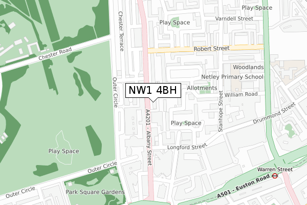
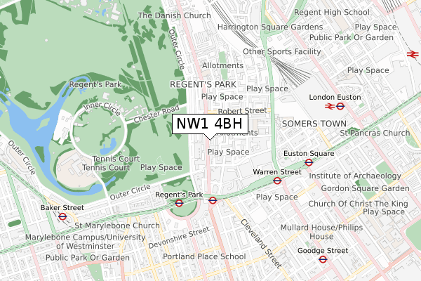
NW1 4BH is located in the Regent's Park electoral ward, within the London borough of Camden and the English Parliamentary constituency of Holborn and St Pancras. The Sub Integrated Care Board (ICB) Location is NHS North Central London ICB - 93C and the police force is Metropolitan Police. This postcode has been in use since September 2018.


GetTheData
Source: OS Open Zoomstack (Ordnance Survey)
Licence: Open Government Licence (requires attribution)
Attribution: Contains OS data © Crown copyright and database right 2024
Source: Open Postcode Geo
Licence: Open Government Licence (requires attribution)
Attribution: Contains OS data © Crown copyright and database right 2024; Contains Royal Mail data © Royal Mail copyright and database right 2024; Source: Office for National Statistics licensed under the Open Government Licence v.3.0
| Easting | 528847 |
| Northing | 182530 |
| Latitude | 51.526993 |
| Longitude | -0.144008 |
GetTheData
Source: Open Postcode Geo
Licence: Open Government Licence
| Country | England |
| Postcode District | NW1 |
| ➜ NW1 open data dashboard ➜ See where NW1 is on a map ➜ Where is London? | |
GetTheData
Source: Land Registry Price Paid Data
Licence: Open Government Licence
| Ward | Regent's Park |
| Constituency | Holborn And St Pancras |
GetTheData
Source: ONS Postcode Database
Licence: Open Government Licence
| January 2024 | Other theft | On or near Peto Place | 283m |
| January 2024 | Anti-social behaviour | On or near Starcross Street | 482m |
| January 2024 | Anti-social behaviour | On or near Conway Street | 489m |
| ➜ Get more crime data in our Crime section | |||
GetTheData
Source: data.police.uk
Licence: Open Government Licence
| Chester Gate (Albany Street) | Regent's Park | 45m |
| Chester Gate (Albany Street) | Regent's Park | 132m |
| Euston Road (Albany Street) | Great Portland Street | 199m |
| Robert Street Albany Street | Regent's Park | 223m |
| Albany Street | Regent's Park | 294m |
| Great Portland Street Underground Station | Great Portland Street | 351m |
| Regent's Park Underground Station | Regent's Park | 439m |
| Warren Street Underground Station | Warren Street | 457m |
| Euston Square Underground Station | Euston Square | 590m |
| Euston Underground Station | Euston | 720m |
| London Euston Station | 0.7km |
| London St Pancras International LL Station | 1.3km |
| London St Pancras International Station | 1.3km |
GetTheData
Source: NaPTAN
Licence: Open Government Licence
| Percentage of properties with Next Generation Access | 100.0% |
| Percentage of properties with Superfast Broadband | 100.0% |
| Percentage of properties with Ultrafast Broadband | 100.0% |
| Percentage of properties with Full Fibre Broadband | 0.0% |
Superfast Broadband is between 30Mbps and 300Mbps
Ultrafast Broadband is > 300Mbps
| Percentage of properties unable to receive 2Mbps | 0.0% |
| Percentage of properties unable to receive 5Mbps | 0.0% |
| Percentage of properties unable to receive 10Mbps | 0.0% |
| Percentage of properties unable to receive 30Mbps | 0.0% |
GetTheData
Source: Ofcom
Licence: Ofcom Terms of Use (requires attribution)
GetTheData
Source: ONS Postcode Database
Licence: Open Government Licence


➜ Get more ratings from the Food Standards Agency
GetTheData
Source: Food Standards Agency
Licence: FSA terms & conditions
| Last Collection | |||
|---|---|---|---|
| Location | Mon-Fri | Sat | Distance |
| 3 Cambridge Gate | 19:00 | 13:00 | 136m |
| Osnaburgh Street | 19:00 | 13:00 | 172m |
| Post Office | 19:00 | 13:00 | 209m |
GetTheData
Source: Dracos
Licence: Creative Commons Attribution-ShareAlike
| Facility | Distance |
|---|---|
| The Engine Room Little Albany Street, London Health and Fitness Gym, Studio | 33m |
| Regent's Place Health Club (Closed) Triton Square, London Health and Fitness Gym, Studio | 282m |
| Regent's Gym (Closed) Great Portland Street, London Health and Fitness Gym, Studio | 385m |
GetTheData
Source: Active Places
Licence: Open Government Licence
| School | Phase of Education | Distance |
|---|---|---|
| Camden Primary Pupil Referral Unit Robson House, Netley Campus, 74 Stanhope Street, London, NW1 3EX | Not applicable | 251m |
| Netley Primary School & Centre for Autism 74 Stanhope Street, Camden, London, NW1 3EX | Primary | 257m |
| Christ Church School Redhill Street, Camden, London, NW1 4BD | Primary | 462m |
GetTheData
Source: Edubase
Licence: Open Government Licence
The below table lists the International Territorial Level (ITL) codes (formerly Nomenclature of Territorial Units for Statistics (NUTS) codes) and Local Administrative Units (LAU) codes for NW1 4BH:
| ITL 1 Code | Name |
|---|---|
| TLI | London |
| ITL 2 Code | Name |
| TLI3 | Inner London - West |
| ITL 3 Code | Name |
| TLI31 | Camden and City of London |
| LAU 1 Code | Name |
| E09000007 | Camden |
GetTheData
Source: ONS Postcode Directory
Licence: Open Government Licence
The below table lists the Census Output Area (OA), Lower Layer Super Output Area (LSOA), and Middle Layer Super Output Area (MSOA) for NW1 4BH:
| Code | Name | |
|---|---|---|
| OA | E00004693 | |
| LSOA | E01000944 | Camden 023A |
| MSOA | E02000188 | Camden 023 |
GetTheData
Source: ONS Postcode Directory
Licence: Open Government Licence
| NW1 3PJ | Munster Square | 40m |
| NW1 3PN | Albany Street | 51m |
| NW1 4EB | Colosseum Terrace | 53m |
| NW1 4BT | Albany Street | 54m |
| NW1 4JJ | Cambridge Terrace Mews | 66m |
| NW1 4JH | Chester Gate | 77m |
| NW1 3PH | Munster Square | 78m |
| NW1 3PP | Munster Square | 85m |
| NW1 3LH | Clarence Gardens | 88m |
| NW1 4JL | Cambridge Terrace | 90m |
GetTheData
Source: Open Postcode Geo; Land Registry Price Paid Data
Licence: Open Government Licence