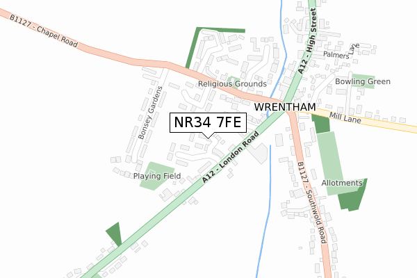
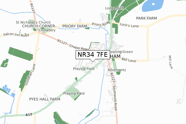
NR34 7FE is located in the Wrentham, Wangford & Westleton electoral ward, within the local authority district of East Suffolk and the English Parliamentary constituency of Suffolk Coastal. The Sub Integrated Care Board (ICB) Location is NHS Norfolk and Waveney ICB - 26A and the police force is Suffolk. This postcode has been in use since August 2018.


GetTheData
Source: OS Open Zoomstack (Ordnance Survey)
Licence: Open Government Licence (requires attribution)
Attribution: Contains OS data © Crown copyright and database right 2024
Source: Open Postcode Geo
Licence: Open Government Licence (requires attribution)
Attribution: Contains OS data © Crown copyright and database right 2024; Contains Royal Mail data © Royal Mail copyright and database right 2024; Source: Office for National Statistics licensed under the Open Government Licence v.3.0
| Easting | 649673 |
| Northing | 282562 |
| Latitude | 52.384144 |
| Longitude | 1.667481 |
GetTheData
Source: Open Postcode Geo
Licence: Open Government Licence
| Country | England |
| Postcode District | NR34 |
| ➜ NR34 open data dashboard ➜ See where NR34 is on a map ➜ Where is Wrentham? | |
GetTheData
Source: Land Registry Price Paid Data
Licence: Open Government Licence
| Ward | Wrentham, Wangford & Westleton |
| Constituency | Suffolk Coastal |
GetTheData
Source: ONS Postcode Database
Licence: Open Government Licence
2023 25 AUG £307,000 |
2023 2 AUG £412,500 |
8, MEADOWLANDS, WRENTHAM, BECCLES, NR34 7FE 2019 27 SEP £315,000 |
12, MEADOWLANDS, WRENTHAM, BECCLES, NR34 7FE 2019 21 JUN £275,000 |
15, MEADOWLANDS, WRENTHAM, BECCLES, NR34 7FE 2019 28 MAR £216,000 |
2018 6 DEC £224,950 |
2018 15 NOV £316,000 |
11, MEADOWLANDS, WRENTHAM, BECCLES, NR34 7FE 2018 27 JUL £275,000 |
GetTheData
Source: HM Land Registry Price Paid Data
Licence: Contains HM Land Registry data © Crown copyright and database right 2024. This data is licensed under the Open Government Licence v3.0.
| November 2023 | Vehicle crime | On or near Eagle Court | 356m |
| October 2023 | Shoplifting | On or near Parking Area | 196m |
| July 2023 | Burglary | On or near Parking Area | 196m |
| ➜ Get more crime data in our Crime section | |||
GetTheData
Source: data.police.uk
Licence: Open Government Licence
| Walker Gardens | Wrentham | 67m |
| Walker Gardens | Wrentham | 79m |
| Fire Station (Chapel Road) | Wrentham | 156m |
| Fire Station (Chapel Road) | Wrentham | 165m |
| Chapel Road (London Road) | Wrentham | 167m |
GetTheData
Source: NaPTAN
Licence: Open Government Licence
➜ Broadband speed and availability dashboard for NR34 7FE
| Percentage of properties with Next Generation Access | 100.0% |
| Percentage of properties with Superfast Broadband | 100.0% |
| Percentage of properties with Ultrafast Broadband | 0.0% |
| Percentage of properties with Full Fibre Broadband | 0.0% |
Superfast Broadband is between 30Mbps and 300Mbps
Ultrafast Broadband is > 300Mbps
| Median download speed | 66.5Mbps |
| Average download speed | 61.5Mbps |
| Maximum download speed | 78.12Mbps |
| Median upload speed | 14.8Mbps |
| Average upload speed | 14.8Mbps |
| Maximum upload speed | 19.53Mbps |
| Percentage of properties unable to receive 2Mbps | 0.0% |
| Percentage of properties unable to receive 5Mbps | 0.0% |
| Percentage of properties unable to receive 10Mbps | 0.0% |
| Percentage of properties unable to receive 30Mbps | 0.0% |
➜ Broadband speed and availability dashboard for NR34 7FE
GetTheData
Source: Ofcom
Licence: Ofcom Terms of Use (requires attribution)
GetTheData
Source: ONS Postcode Database
Licence: Open Government Licence


➜ Get more ratings from the Food Standards Agency
GetTheData
Source: Food Standards Agency
Licence: FSA terms & conditions
| Facility | Distance |
|---|---|
| Wrentham Playing Field London Road, Wrentham, Beccles Grass Pitches | 466m |
| Reydon Playing Fields Wangford Road, Reydon, Southwold Grass Pitches | 4.6km |
| Kessingland Beach Holiday Park Beach Road, Kessingland, Lowestoft Swimming Pool, Outdoor Tennis Courts | 4.6km |
GetTheData
Source: Active Places
Licence: Open Government Licence
| School | Phase of Education | Distance |
|---|---|---|
| The Old School Toad Row, Henstead, Beccles, NR34 7LG | Not applicable | 3.4km |
| Kessingland Church of England Primary Academy Field Lane, Kessingland, Lowestoft, NR33 7QA | Primary | 5.3km |
GetTheData
Source: Edubase
Licence: Open Government Licence
The below table lists the International Territorial Level (ITL) codes (formerly Nomenclature of Territorial Units for Statistics (NUTS) codes) and Local Administrative Units (LAU) codes for NR34 7FE:
| ITL 1 Code | Name |
|---|---|
| TLH | East |
| ITL 2 Code | Name |
| TLH1 | East Anglia |
| ITL 3 Code | Name |
| TLH14 | Suffolk CC |
| LAU 1 Code | Name |
| E07000244 | East Suffolk |
GetTheData
Source: ONS Postcode Directory
Licence: Open Government Licence
The below table lists the Census Output Area (OA), Lower Layer Super Output Area (LSOA), and Middle Layer Super Output Area (MSOA) for NR34 7FE:
| Code | Name | |
|---|---|---|
| OA | E00154539 | |
| LSOA | E01030295 | Waveney 014D |
| MSOA | E02006315 | Waveney 014 |
GetTheData
Source: ONS Postcode Directory
Licence: Open Government Licence
| NR34 7HQ | Walker Gardens | 59m |
| NR34 7NN | Oak Hill Close | 88m |
| NR34 7HE | London Road | 89m |
| NR34 7HF | The Lane | 95m |
| NR34 7LT | Chapel Road | 103m |
| NR34 7LU | Bonsey Gardens | 173m |
| NR34 7NX | Chatten Close | 192m |
| NR34 7EZ | The Chestnuts | 231m |
| NR34 7JG | Dyer Terrace | 251m |
| NR34 7BP | The Cedars | 277m |
GetTheData
Source: Open Postcode Geo; Land Registry Price Paid Data
Licence: Open Government Licence