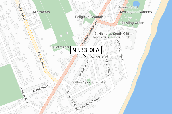
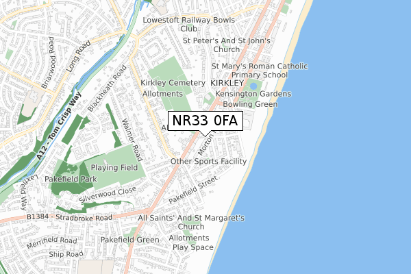
NR33 0FA is located in the Kirkley & Pakefield electoral ward, within the local authority district of East Suffolk and the English Parliamentary constituency of Waveney. The Sub Integrated Care Board (ICB) Location is NHS Norfolk and Waveney ICB - 26A and the police force is Suffolk. This postcode has been in use since February 2018.


GetTheData
Source: OS Open Zoomstack (Ordnance Survey)
Licence: Open Government Licence (requires attribution)
Attribution: Contains OS data © Crown copyright and database right 2024
Source: Open Postcode Geo
Licence: Open Government Licence (requires attribution)
Attribution: Contains OS data © Crown copyright and database right 2024; Contains Royal Mail data © Royal Mail copyright and database right 2024; Source: Office for National Statistics licensed under the Open Government Licence v.3.0
| Easting | 653921 |
| Northing | 291003 |
| Latitude | 52.457918 |
| Longitude | 1.736164 |
GetTheData
Source: Open Postcode Geo
Licence: Open Government Licence
| Country | England |
| Postcode District | NR33 |
| ➜ NR33 open data dashboard ➜ See where NR33 is on a map ➜ Where is Lowestoft? | |
GetTheData
Source: Land Registry Price Paid Data
Licence: Open Government Licence
| Ward | Kirkley & Pakefield |
| Constituency | Waveney |
GetTheData
Source: ONS Postcode Database
Licence: Open Government Licence
| January 2024 | Public order | On or near Park/Open Space | 430m |
| January 2024 | Public order | On or near Park/Open Space | 430m |
| December 2023 | Criminal damage and arson | On or near Kirkley Park Road | 479m |
| ➜ Get more crime data in our Crime section | |||
GetTheData
Source: data.police.uk
Licence: Open Government Licence
| Kendal Road (London Road South) | Kirkley | 55m |
| Kendal Road (London Road South) | Kirkley | 69m |
| The Avenue (London Road South) | Kirkley | 172m |
| The Avenue (London Road South) | Kirkley | 221m |
| Kensington Road (London Road South) | Kirkley | 306m |
| Lowestoft Station | 2.1km |
| Oulton Broad South Station | 2.3km |
| Oulton Broad North Station | 2.6km |
GetTheData
Source: NaPTAN
Licence: Open Government Licence
| Percentage of properties with Next Generation Access | 100.0% |
| Percentage of properties with Superfast Broadband | 100.0% |
| Percentage of properties with Ultrafast Broadband | 0.0% |
| Percentage of properties with Full Fibre Broadband | 0.0% |
Superfast Broadband is between 30Mbps and 300Mbps
Ultrafast Broadband is > 300Mbps
| Percentage of properties unable to receive 2Mbps | 0.0% |
| Percentage of properties unable to receive 5Mbps | 0.0% |
| Percentage of properties unable to receive 10Mbps | 0.0% |
| Percentage of properties unable to receive 30Mbps | 0.0% |
GetTheData
Source: Ofcom
Licence: Ofcom Terms of Use (requires attribution)
GetTheData
Source: ONS Postcode Database
Licence: Open Government Licence


➜ Get more ratings from the Food Standards Agency
GetTheData
Source: Food Standards Agency
Licence: FSA terms & conditions
| Last Collection | |||
|---|---|---|---|
| Location | Mon-Fri | Sat | Distance |
| London Road South | 17:45 | 12:30 | 67m |
| Pakefield Road | 17:30 | 11:30 | 248m |
| Beaconsfield Road | 17:30 | 12:00 | 354m |
GetTheData
Source: Dracos
Licence: Creative Commons Attribution-ShareAlike
| Facility | Distance |
|---|---|
| Kensington Gardens Kirkley Cliff Road, Kirkley Cliff Road, Lowestoft Outdoor Tennis Courts | 376m |
| St Mary's Roman Catholic Primary School Kirkley Cliff Road, Lowestoft Grass Pitches | 511m |
| Kirkley And Pakefield Sports And Social Club Walmer Road, Lowestoft Grass Pitches, Artificial Grass Pitch | 624m |
GetTheData
Source: Active Places
Licence: Open Government Licence
| School | Phase of Education | Distance |
|---|---|---|
| St Mary's Roman Catholic Primary School Kirkley Cliff Road, Lowestoft, NR33 0DG | Primary | 511m |
| Phoenix St Peter Academy Enstone Road, Lowestoft, Suffolk, NR33 0NE | Primary | 865m |
| Pakefield Primary School London Road, Pakefield, Lowestoft, NR33 7AQ | Primary | 985m |
GetTheData
Source: Edubase
Licence: Open Government Licence
The below table lists the International Territorial Level (ITL) codes (formerly Nomenclature of Territorial Units for Statistics (NUTS) codes) and Local Administrative Units (LAU) codes for NR33 0FA:
| ITL 1 Code | Name |
|---|---|
| TLH | East |
| ITL 2 Code | Name |
| TLH1 | East Anglia |
| ITL 3 Code | Name |
| TLH14 | Suffolk CC |
| LAU 1 Code | Name |
| E07000244 | East Suffolk |
GetTheData
Source: ONS Postcode Directory
Licence: Open Government Licence
The below table lists the Census Output Area (OA), Lower Layer Super Output Area (LSOA), and Middle Layer Super Output Area (MSOA) for NR33 0FA:
| Code | Name | |
|---|---|---|
| OA | E00154419 | |
| LSOA | E01030276 | Waveney 007E |
| MSOA | E02006308 | Waveney 007 |
GetTheData
Source: ONS Postcode Directory
Licence: Open Government Licence
| NR33 0JD | Kendal Road | 22m |
| NR33 0JF | Kendal Road | 71m |
| NR33 0PD | London Road South | 91m |
| NR33 0JH | Morton Road | 102m |
| NR33 0JR | Rochester Road | 102m |
| NR33 0JA | Wilson Road | 108m |
| NR33 0LE | London Road South | 109m |
| NR33 0JQ | Morton Road | 115m |
| NR33 0LB | London Road South | 117m |
| NR33 0JG | Kendal Road | 145m |
GetTheData
Source: Open Postcode Geo; Land Registry Price Paid Data
Licence: Open Government Licence