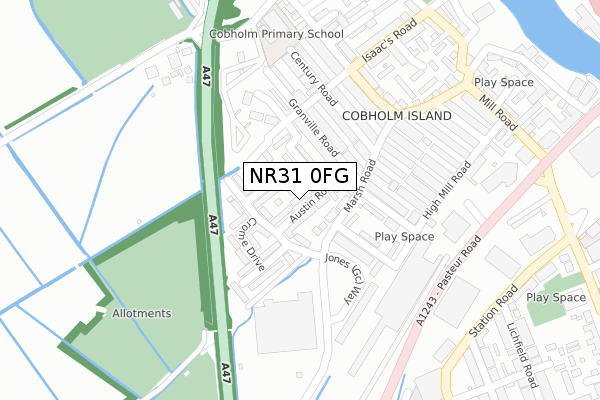
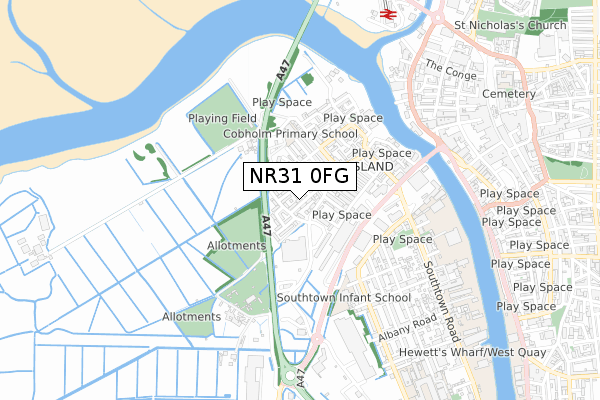
NR31 0FG is located in the Southtown and Cobholm electoral ward, within the local authority district of Great Yarmouth and the English Parliamentary constituency of Great Yarmouth. The Sub Integrated Care Board (ICB) Location is NHS Norfolk and Waveney ICB - 26A and the police force is Norfolk. This postcode has been in use since April 2020.


GetTheData
Source: OS Open Zoomstack (Ordnance Survey)
Licence: Open Government Licence (requires attribution)
Attribution: Contains OS data © Crown copyright and database right 2024
Source: Open Postcode Geo
Licence: Open Government Licence (requires attribution)
Attribution: Contains OS data © Crown copyright and database right 2024; Contains Royal Mail data © Royal Mail copyright and database right 2024; Source: Office for National Statistics licensed under the Open Government Licence v.3.0
| Easting | 652309 |
| Northing | 306295 |
| Latitude | 52.595848 |
| Longitude | 1.724088 |
GetTheData
Source: Open Postcode Geo
Licence: Open Government Licence
| Country | England |
| Postcode District | NR31 |
| ➜ NR31 open data dashboard ➜ See where NR31 is on a map ➜ Where is Great Yarmouth? | |
GetTheData
Source: Land Registry Price Paid Data
Licence: Open Government Licence
| Ward | Southtown And Cobholm |
| Constituency | Great Yarmouth |
GetTheData
Source: ONS Postcode Database
Licence: Open Government Licence
| June 2022 | Burglary | On or near Admirals Quay | 47m |
| June 2022 | Violence and sexual offences | On or near Admirals Quay | 47m |
| June 2022 | Public order | On or near Tollgate Road | 110m |
| ➜ Get more crime data in our Crime section | |||
GetTheData
Source: data.police.uk
Licence: Open Government Licence
| Rumbold Arms (Southtown Road) | Great Yarmouth | 77m |
| Rumbold Arms (Southdown Road) | Great Yarmouth | 88m |
| Waveney Road (Southtown Road) | Great Yarmouth | 240m |
| Waveney Road (Southtown Road) | Great Yarmouth | 277m |
| Suffolk Road | Great Yarmouth | 299m |
| Great Yarmouth Station | 1.8km |
GetTheData
Source: NaPTAN
Licence: Open Government Licence
GetTheData
Source: ONS Postcode Database
Licence: Open Government Licence


➜ Get more ratings from the Food Standards Agency
GetTheData
Source: Food Standards Agency
Licence: FSA terms & conditions
| Last Collection | |||
|---|---|---|---|
| Location | Mon-Fri | Sat | Distance |
| Southtown Road | 17:00 | 12:00 | 98m |
| Boundary Road | 17:30 | 12:30 | 552m |
| Blackfriars Road | 18:30 | 12:00 | 558m |
GetTheData
Source: Dracos
Licence: Creative Commons Attribution-ShareAlike
| Facility | Distance |
|---|---|
| East Coast College Sport And Wellbeing Centre Lichfield Road, Great Yarmouth Sports Hall, Health and Fitness Gym, Studio | 257m |
| Body Generation Gym Southgates Road, Great Yarmouth Health and Fitness Gym | 300m |
| Nr Health And Fitness (Great Yarmouth) Southtown Road, Great Yarmouth Health and Fitness Gym, Studio | 393m |
GetTheData
Source: Active Places
Licence: Open Government Licence
| School | Phase of Education | Distance |
|---|---|---|
| Edward Worlledge Ormiston Academy Suffolk Road, Great Yarmouth, NR31 0ER | Primary | 362m |
| Great Yarmouth Primary Academy Dickens Avenue, Great Yarmouth, NR30 3DT | Primary | 650m |
| Southtown Primary School Tamworth Lane, Southtown, Great Yarmouth, NR31 0HJ | Primary | 807m |
GetTheData
Source: Edubase
Licence: Open Government Licence
The below table lists the International Territorial Level (ITL) codes (formerly Nomenclature of Territorial Units for Statistics (NUTS) codes) and Local Administrative Units (LAU) codes for NR31 0FG:
| ITL 1 Code | Name |
|---|---|
| TLH | East |
| ITL 2 Code | Name |
| TLH1 | East Anglia |
| ITL 3 Code | Name |
| TLH15 | Norwich and East Norfolk |
| LAU 1 Code | Name |
| E07000145 | Great Yarmouth |
GetTheData
Source: ONS Postcode Directory
Licence: Open Government Licence
The below table lists the Census Output Area (OA), Lower Layer Super Output Area (LSOA), and Middle Layer Super Output Area (MSOA) for NR31 0FG:
| Code | Name | |
|---|---|---|
| OA | E00135341 | |
| LSOA | E01026633 | Great Yarmouth 007B |
| MSOA | E02005544 | Great Yarmouth 007 |
GetTheData
Source: ONS Postcode Directory
Licence: Open Government Licence
| NR31 0JT | Admirals Quay | 45m |
| NR31 0HE | Leys Close | 53m |
| NR31 0JX | Southtown Road | 55m |
| NR31 0JY | Boundary Road | 77m |
| NR31 0JZ | Southtown Road | 112m |
| NR31 0JU | Tollgate Road | 124m |
| NR31 0GX | Drifters Way | 156m |
| NR31 0QJ | Anchor Court | 231m |
| NR31 0LB | Waveney Road | 247m |
| NR31 0LA | Southtown Road | 264m |
GetTheData
Source: Open Postcode Geo; Land Registry Price Paid Data
Licence: Open Government Licence