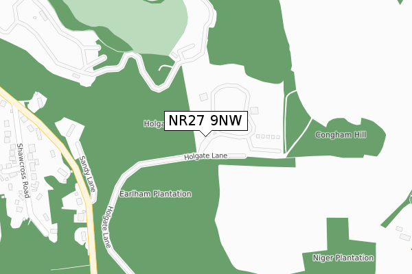
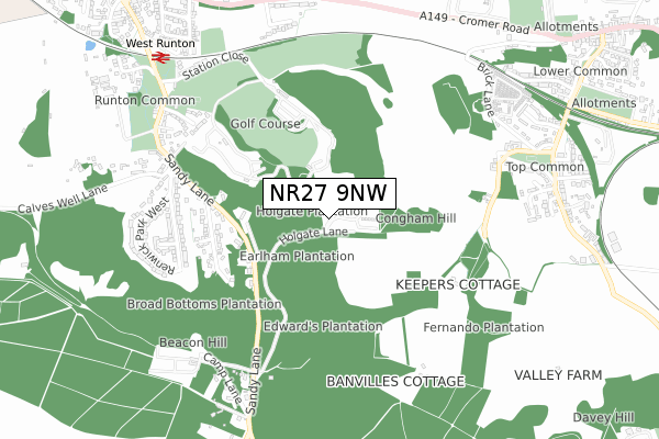
NR27 9NW is located in the Beeston Regis & The Runtons electoral ward, within the local authority district of North Norfolk and the English Parliamentary constituency of North Norfolk. The Sub Integrated Care Board (ICB) Location is NHS Norfolk and Waveney ICB - 26A and the police force is Norfolk. This postcode has been in use since June 2018.


GetTheData
Source: OS Open Zoomstack (Ordnance Survey)
Licence: Open Government Licence (requires attribution)
Attribution: Contains OS data © Crown copyright and database right 2024
Source: Open Postcode Geo
Licence: Open Government Licence (requires attribution)
Attribution: Contains OS data © Crown copyright and database right 2024; Contains Royal Mail data © Royal Mail copyright and database right 2024; Source: Office for National Statistics licensed under the Open Government Licence v.3.0
| Easting | 618861 |
| Northing | 341886 |
| Latitude | 52.929773 |
| Longitude | 1.254881 |
GetTheData
Source: Open Postcode Geo
Licence: Open Government Licence
| Country | England |
| Postcode District | NR27 |
| ➜ NR27 open data dashboard ➜ See where NR27 is on a map | |
GetTheData
Source: Land Registry Price Paid Data
Licence: Open Government Licence
| Ward | Beeston Regis & The Runtons |
| Constituency | North Norfolk |
GetTheData
Source: ONS Postcode Database
Licence: Open Government Licence
| Renwick Park (Sandy Lane) | West Runton | 624m |
| Renwick Park (Sandy Lane) | West Runton | 642m |
| Links Hotel (Sandy Lane) | West Runton | 766m |
| Links Hotel (Sandy Lane) | West Runton | 774m |
| Golf Close (Cromer Road) | West Runton | 854m |
| West Runton Station | 0.9km |
| Cromer Station | 2.6km |
| Sheringham Station | 3.3km |
GetTheData
Source: NaPTAN
Licence: Open Government Licence
GetTheData
Source: ONS Postcode Database
Licence: Open Government Licence

➜ Get more ratings from the Food Standards Agency
GetTheData
Source: Food Standards Agency
Licence: FSA terms & conditions
| Last Collection | |||
|---|---|---|---|
| Location | Mon-Fri | Sat | Distance |
| Sandy Lane | 16:15 | 07:45 | 432m |
| Sandy Lane | 17:45 | 09:00 | 629m |
| Roman Camp | 16:30 | 08:00 | 649m |
GetTheData
Source: Dracos
Licence: Creative Commons Attribution-ShareAlike
| Facility | Distance |
|---|---|
| Links Country Park Hotel And Golf Club Sandy Lane, West Runton, Cromer Health and Fitness Gym, Swimming Pool, Golf, Outdoor Tennis Courts | 749m |
| East Runton Playing Field Cromer Road, East Runton, Cromer Grass Pitches | 1.1km |
| Beeston Hall School Beeston Regis, Cromer Artificial Grass Pitch, Swimming Pool, Grass Pitches, Sports Hall, Outdoor Tennis Courts | 1.6km |
GetTheData
Source: Active Places
Licence: Open Government Licence
| School | Phase of Education | Distance |
|---|---|---|
| Argyll House 201 Holt Road, Cromer, NR27 9JN | Not applicable | 1.6km |
| Beeston Hall School West Runton, Cromer, Norfolk, Cromer, NR27 9NQ | Not applicable | 1.6km |
| St Andrew's School Aylmerton Hall, Holt Road, Aylmerton, Cromer, NR11 8QA | Not applicable | 2.2km |
GetTheData
Source: Edubase
Licence: Open Government Licence
The below table lists the International Territorial Level (ITL) codes (formerly Nomenclature of Territorial Units for Statistics (NUTS) codes) and Local Administrative Units (LAU) codes for NR27 9NW:
| ITL 1 Code | Name |
|---|---|
| TLH | East |
| ITL 2 Code | Name |
| TLH1 | East Anglia |
| ITL 3 Code | Name |
| TLH16 | North and West Norfolk |
| LAU 1 Code | Name |
| E07000147 | North Norfolk |
GetTheData
Source: ONS Postcode Directory
Licence: Open Government Licence
The below table lists the Census Output Area (OA), Lower Layer Super Output Area (LSOA), and Middle Layer Super Output Area (MSOA) for NR27 9NW:
| Code | Name | |
|---|---|---|
| OA | E00136182 | |
| LSOA | E01026781 | North Norfolk 005C |
| MSOA | E02005574 | North Norfolk 005 |
GetTheData
Source: ONS Postcode Directory
Licence: Open Government Licence
| NR27 9NB | Sandy Lane | 374m |
| NR27 9NA | Shawcross Road | 432m |
| NR27 9NN | Long Acre | 486m |
| NR27 9LY | Renwick Park East | 605m |
| NR27 9RN | Banville Lane | 606m |
| NR27 9QQ | Links Way | 661m |
| NR27 9LT | Sandy Lane | 699m |
| NR27 9LX | Renwick Park West | 700m |
| NR27 9PP | Top Common | 734m |
| NR27 9QB | Golf Close | 743m |
GetTheData
Source: Open Postcode Geo; Land Registry Price Paid Data
Licence: Open Government Licence