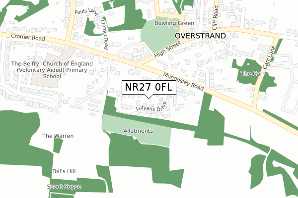
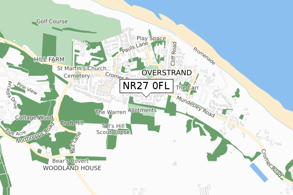
NR27 0FL is located in the Poppyland electoral ward, within the local authority district of North Norfolk and the English Parliamentary constituency of North Norfolk. The Sub Integrated Care Board (ICB) Location is NHS Norfolk and Waveney ICB - 26A and the police force is Norfolk. This postcode has been in use since November 2017.


GetTheData
Source: OS Open Zoomstack (Ordnance Survey)
Licence: Open Government Licence (requires attribution)
Attribution: Contains OS data © Crown copyright and database right 2024
Source: Open Postcode Geo
Licence: Open Government Licence (requires attribution)
Attribution: Contains OS data © Crown copyright and database right 2024; Contains Royal Mail data © Royal Mail copyright and database right 2024; Source: Office for National Statistics licensed under the Open Government Licence v.3.0
| Easting | 624612 |
| Northing | 340513 |
| Latitude | 52.915080 |
| Longitude | 1.339342 |
GetTheData
Source: Open Postcode Geo
Licence: Open Government Licence
| Country | England |
| Postcode District | NR27 |
| ➜ NR27 open data dashboard ➜ See where NR27 is on a map ➜ Where is Overstrand? | |
GetTheData
Source: Land Registry Price Paid Data
Licence: Open Government Licence
| Ward | Poppyland |
| Constituency | North Norfolk |
GetTheData
Source: ONS Postcode Database
Licence: Open Government Licence
2023 25 JUL £550,000 |
2022 19 DEC £650,000 |
2021 22 JAN £475,000 |
5, LUTYENS DRIVE, OVERSTRAND, CROMER, NR27 0FL 2019 21 OCT £392,000 |
48, LUTYENS DRIVE, OVERSTRAND, CROMER, NR27 0FL 2019 3 OCT £380,000 |
42, LUTYENS DRIVE, OVERSTRAND, CROMER, NR27 0FL 2019 30 JUL £360,000 |
7, LUTYENS DRIVE, OVERSTRAND, CROMER, NR27 0FL 2019 24 JUN £424,995 |
2, LUTYENS DRIVE, OVERSTRAND, CROMER, NR27 0FL 2019 30 APR £624,995 |
2019 29 MAR £394,995 |
9, LUTYENS DRIVE, OVERSTRAND, CROMER, NR27 0FL 2019 22 MAR £424,995 |
GetTheData
Source: HM Land Registry Price Paid Data
Licence: Contains HM Land Registry data © Crown copyright and database right 2024. This data is licensed under the Open Government Licence v3.0.
| June 2022 | Anti-social behaviour | On or near The Glade | 208m |
| June 2022 | Violence and sexual offences | On or near Carr Lane | 394m |
| June 2022 | Other crime | On or near Carr Lane | 394m |
| ➜ Get more crime data in our Crime section | |||
GetTheData
Source: data.police.uk
Licence: Open Government Licence
| Post Office (High Street) | Overstrand | 258m |
| Post Office (High Street) | Overstrand | 271m |
| Primary School (Cromer Road) | Overstrand | 280m |
| Primary School (Cromer Road) | Overstrand | 284m |
| Church (Cromer Road) | Overstrand | 654m |
| Roughton Road Station | 2.7km |
| Cromer Station | 3.5km |
GetTheData
Source: NaPTAN
Licence: Open Government Licence
| Percentage of properties with Next Generation Access | 100.0% |
| Percentage of properties with Superfast Broadband | 100.0% |
| Percentage of properties with Ultrafast Broadband | 100.0% |
| Percentage of properties with Full Fibre Broadband | 100.0% |
Superfast Broadband is between 30Mbps and 300Mbps
Ultrafast Broadband is > 300Mbps
| Percentage of properties unable to receive 2Mbps | 0.0% |
| Percentage of properties unable to receive 5Mbps | 0.0% |
| Percentage of properties unable to receive 10Mbps | 0.0% |
| Percentage of properties unable to receive 30Mbps | 0.0% |
GetTheData
Source: Ofcom
Licence: Ofcom Terms of Use (requires attribution)
GetTheData
Source: ONS Postcode Database
Licence: Open Government Licence


➜ Get more ratings from the Food Standards Agency
GetTheData
Source: Food Standards Agency
Licence: FSA terms & conditions
| Last Collection | |||
|---|---|---|---|
| Location | Mon-Fri | Sat | Distance |
| High Street Post Office | 16:15 | 10:00 | 395m |
| Church Street | 16:00 | 07:30 | 1,227m |
| Forest Park | 16:00 | 07:00 | 1,302m |
GetTheData
Source: Dracos
Licence: Creative Commons Attribution-ShareAlike
| Facility | Distance |
|---|---|
| Overstrand Sports Club High Street, Overstrand Grass Pitches | 153m |
| Northrepps Playing Field School Lane, Northrepps, Cromer Grass Pitches | 1.2km |
| Sidestrand Hall School Cromer Road, Sidestrand, Cromer Grass Pitches, Sports Hall | 1.4km |
GetTheData
Source: Active Places
Licence: Open Government Licence
| School | Phase of Education | Distance |
|---|---|---|
| Overstrand, the Belfry, Church of England Voluntary Aided Primary School 23 Cromer Road, Overstrand, Cromer, NR27 0NT | Primary | 333m |
| Northrepps Primary School Church Street, Northrepps, Cromer, NR27 0LG | Primary | 1.2km |
| Sidestrand Hall School Cromer Road, Sidestrand, Cromer, NR27 0NH | Not applicable | 1.4km |
GetTheData
Source: Edubase
Licence: Open Government Licence
The below table lists the International Territorial Level (ITL) codes (formerly Nomenclature of Territorial Units for Statistics (NUTS) codes) and Local Administrative Units (LAU) codes for NR27 0FL:
| ITL 1 Code | Name |
|---|---|
| TLH | East |
| ITL 2 Code | Name |
| TLH1 | East Anglia |
| ITL 3 Code | Name |
| TLH16 | North and West Norfolk |
| LAU 1 Code | Name |
| E07000147 | North Norfolk |
GetTheData
Source: ONS Postcode Directory
Licence: Open Government Licence
The below table lists the Census Output Area (OA), Lower Layer Super Output Area (LSOA), and Middle Layer Super Output Area (MSOA) for NR27 0FL:
| Code | Name | |
|---|---|---|
| OA | E00136064 | |
| LSOA | E01026762 | North Norfolk 005A |
| MSOA | E02005574 | North Norfolk 005 |
GetTheData
Source: ONS Postcode Directory
Licence: Open Government Licence
| NR27 0NU | Cromer Road | 136m |
| NR27 0PT | Beckhythe Gardens | 149m |
| NR27 0PY | The Glade | 232m |
| NR27 0NX | Cromer Road | 287m |
| NR27 0PN | Harbord Road | 290m |
| NR27 0AB | High Street | 328m |
| NR27 0NT | Cromer Road | 356m |
| NR27 0PE | Pauls Lane | 370m |
| NR27 0PS | Carr Lane | 375m |
| NR27 0PW | The Londs | 382m |
GetTheData
Source: Open Postcode Geo; Land Registry Price Paid Data
Licence: Open Government Licence