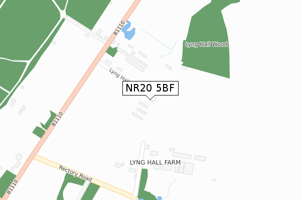
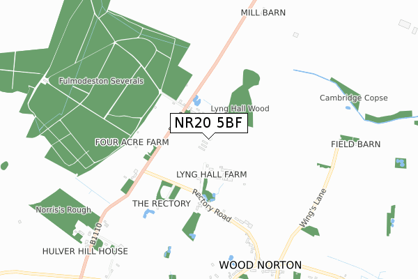
NR20 5BF is located in the Stibbard electoral ward, within the local authority district of North Norfolk and the English Parliamentary constituency of Broadland. The Sub Integrated Care Board (ICB) Location is NHS Norfolk and Waveney ICB - 26A and the police force is Norfolk. This postcode has been in use since February 2019.


GetTheData
Source: OS Open Zoomstack (Ordnance Survey)
Licence: Open Government Licence (requires attribution)
Attribution: Contains OS data © Crown copyright and database right 2024
Source: Open Postcode Geo
Licence: Open Government Licence (requires attribution)
Attribution: Contains OS data © Crown copyright and database right 2024; Contains Royal Mail data © Royal Mail copyright and database right 2024; Source: Office for National Statistics licensed under the Open Government Licence v.3.0
| Easting | 600928 |
| Northing | 328821 |
| Latitude | 52.819488 |
| Longitude | 0.980422 |
GetTheData
Source: Open Postcode Geo
Licence: Open Government Licence
| Country | England |
| Postcode District | NR20 |
| ➜ NR20 open data dashboard ➜ See where NR20 is on a map | |
GetTheData
Source: Land Registry Price Paid Data
Licence: Open Government Licence
| Ward | Stibbard |
| Constituency | Broadland |
GetTheData
Source: ONS Postcode Database
Licence: Open Government Licence
| March 2022 | Anti-social behaviour | On or near B1110 | 122m |
| February 2022 | Other theft | On or near B1110 | 122m |
| November 2021 | Violence and sexual offences | On or near B1110 | 122m |
| ➜ Get more crime data in our Crime section | |||
GetTheData
Source: data.police.uk
Licence: Open Government Licence
| Smiths Garage (Holt Road) | Wood Norton | 1,008m |
| Smiths Garage (Holt Road) | Wood Norton | 1,011m |
| Brush Hill (Holt Road) | Wood Norton | 1,171m |
| Brush Hill | Wood Norton | 1,177m |
GetTheData
Source: NaPTAN
Licence: Open Government Licence
| Percentage of properties with Next Generation Access | 100.0% |
| Percentage of properties with Superfast Broadband | 100.0% |
| Percentage of properties with Ultrafast Broadband | 0.0% |
| Percentage of properties with Full Fibre Broadband | 0.0% |
Superfast Broadband is between 30Mbps and 300Mbps
Ultrafast Broadband is > 300Mbps
| Percentage of properties unable to receive 2Mbps | 0.0% |
| Percentage of properties unable to receive 5Mbps | 0.0% |
| Percentage of properties unable to receive 10Mbps | 0.0% |
| Percentage of properties unable to receive 30Mbps | 0.0% |
GetTheData
Source: Ofcom
Licence: Ofcom Terms of Use (requires attribution)
GetTheData
Source: ONS Postcode Database
Licence: Open Government Licence
➜ Get more ratings from the Food Standards Agency
GetTheData
Source: Food Standards Agency
Licence: FSA terms & conditions
| Last Collection | |||
|---|---|---|---|
| Location | Mon-Fri | Sat | Distance |
| Fakenham Road Post Office | 16:30 | 11:00 | 3,441m |
| Guist Lane | 16:30 | 11:00 | 4,198m |
| High Street Post Office | 16:15 | 10:45 | 4,676m |
GetTheData
Source: Dracos
Licence: Creative Commons Attribution-ShareAlike
| Facility | Distance |
|---|---|
| Wood Norton Village Hall Stibbard Road, Wood Norton, Dereham Sports Hall | 990m |
| Hindolveston Recreation Ground The Street, Hindolveston Grass Pitches | 3.2km |
| Barney And Fulmodeston Cricket Club The Drift, Barney, Fakenham Grass Pitches | 3.9km |
GetTheData
Source: Active Places
Licence: Open Government Licence
| School | Phase of Education | Distance |
|---|---|---|
| All Saints Church of England CEVA Primary School Part of Flourish Federation Fulmodeston Road, Stibbard, Fakenham, NR21 0LT | Primary | 2.7km |
| Foulsham Primary School Academy High Street, Foulsham, Dereham, NR20 5RT | Primary | 4.6km |
| Astley Primary School Fakenham Road, Melton Constable, NR24 2HH | Primary | 6.1km |
GetTheData
Source: Edubase
Licence: Open Government Licence
The below table lists the International Territorial Level (ITL) codes (formerly Nomenclature of Territorial Units for Statistics (NUTS) codes) and Local Administrative Units (LAU) codes for NR20 5BF:
| ITL 1 Code | Name |
|---|---|
| TLH | East |
| ITL 2 Code | Name |
| TLH1 | East Anglia |
| ITL 3 Code | Name |
| TLH16 | North and West Norfolk |
| LAU 1 Code | Name |
| E07000147 | North Norfolk |
GetTheData
Source: ONS Postcode Directory
Licence: Open Government Licence
The below table lists the Census Output Area (OA), Lower Layer Super Output Area (LSOA), and Middle Layer Super Output Area (MSOA) for NR20 5BF:
| Code | Name | |
|---|---|---|
| OA | E00135870 | |
| LSOA | E01026729 | North Norfolk 008A |
| MSOA | E02005577 | North Norfolk 008 |
GetTheData
Source: ONS Postcode Directory
Licence: Open Government Licence
| NR20 5BL | Holt Road | 111m |
| NR20 5BJ | Lyng Hall Lane | 317m |
| NR20 5AZ | Rectory Road | 554m |
| NR20 5BA | Rectory Road | 786m |
| NR20 5AY | Holt Road | 833m |
| NR20 5BB | Stibbard Road | 949m |
| NR20 5AR | Church Road | 956m |
| NR20 5UB | Cricketers Close | 1003m |
| NR20 5UA | Blacksmiths Close | 1004m |
| NR20 5BD | Church Road | 1101m |
GetTheData
Source: Open Postcode Geo; Land Registry Price Paid Data
Licence: Open Government Licence