NR18 9FG maps, stats, and open data
NR18 9FG is located in the South Wymondham electoral ward, within the local authority district of South Norfolk and the English Parliamentary constituency of Mid Norfolk. The Sub Integrated Care Board (ICB) Location is NHS Norfolk and Waveney ICB - 26A and the police force is Norfolk. This postcode has been in use since December 2017.
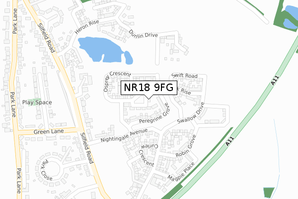
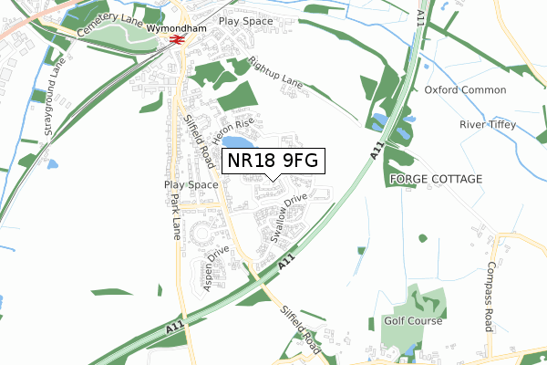
NR18 9FG maps


Licence: Open Government Licence (requires attribution)
Attribution: Contains OS data © Crown copyright and database right 2025
Source: Open Postcode Geo
Licence: Open Government Licence (requires attribution)
Attribution: Contains OS data © Crown copyright and database right 2025; Contains Royal Mail data © Royal Mail copyright and database right 2025; Source: Office for National Statistics licensed under the Open Government Licence v.3.0
NR18 9FG geodata
| Easting | 611907 |
| Northing | 300319 |
| Latitude | 52.559447 |
| Longitude | 1.124766 |
Where is NR18 9FG?
| Country | England |
| Postcode District | NR18 |
Politics
| Ward | South Wymondham |
|---|---|
| Constituency | Mid Norfolk |
House Prices
Sales of detached houses in NR18 9FG
2025 25 MAR £460,000 |
2025 14 FEB £330,000 |
2021 9 JUN £280,000 |
68, GOSHAWK RISE, WYMONDHAM, NR18 9FG 2020 15 JAN £279,995 |
27, GOSHAWK RISE, WYMONDHAM, NR18 9FG 2019 15 NOV £245,000 |
58, GOSHAWK RISE, WYMONDHAM, NR18 9FG 2019 31 OCT £272,500 |
56, GOSHAWK RISE, WYMONDHAM, NR18 9FG 2019 21 OCT £300,000 |
54, GOSHAWK RISE, WYMONDHAM, NR18 9FG 2019 11 OCT £305,000 |
2019 30 APR £325,000 |
19, GOSHAWK RISE, WYMONDHAM, NR18 9FG 2019 15 FEB £269,000 |
Licence: Contains HM Land Registry data © Crown copyright and database right 2025. This data is licensed under the Open Government Licence v3.0.
Transport
Nearest bus stops to NR18 9FG
| Silfield Avenue (Green Lane) | Silfield | 315m |
| Silfield Road | Silfield | 344m |
| Silfield Road | Silfield | 461m |
| Park Lane | Silfield | 484m |
| Park Lane | Silfield | 508m |
Nearest underground/metro/tram to NR18 9FG
| Wymondham Abbey (Mid Norfolk Railway) | Wymondham | 1,853m |
Nearest railway stations to NR18 9FG
| Wymondham Station | 0.8km |
| Spooner Row Station | 3.8km |
Broadband
Broadband access in NR18 9FG (2020 data)
| Percentage of properties with Next Generation Access | 100.0% |
| Percentage of properties with Superfast Broadband | 100.0% |
| Percentage of properties with Ultrafast Broadband | 77.8% |
| Percentage of properties with Full Fibre Broadband | 77.8% |
Superfast Broadband is between 30Mbps and 300Mbps
Ultrafast Broadband is > 300Mbps
Broadband limitations in NR18 9FG (2020 data)
| Percentage of properties unable to receive 2Mbps | 0.0% |
| Percentage of properties unable to receive 5Mbps | 0.0% |
| Percentage of properties unable to receive 10Mbps | 0.0% |
| Percentage of properties unable to receive 30Mbps | 0.0% |
Deprivation
64.1% of English postcodes are less deprived than NR18 9FG:Food Standards Agency
Three nearest food hygiene ratings to NR18 9FG (metres)


➜ Get more ratings from the Food Standards Agency
Nearest post box to NR18 9FG
| Last Collection | |||
|---|---|---|---|
| Location | Mon-Fri | Sat | Distance |
| Green Lane Post Office | 17:15 | 12:00 | 369m |
| The Lodge | 17:15 | 12:00 | 913m |
| Ayton Road | 17:30 | 12:00 | 1,045m |
NR18 9FG ITL and NR18 9FG LAU
The below table lists the International Territorial Level (ITL) codes (formerly Nomenclature of Territorial Units for Statistics (NUTS) codes) and Local Administrative Units (LAU) codes for NR18 9FG:
| ITL 1 Code | Name |
|---|---|
| TLH | East |
| ITL 2 Code | Name |
| TLH1 | East Anglia |
| ITL 3 Code | Name |
| TLH17 | Breckland and South Norfolk |
| LAU 1 Code | Name |
| E07000149 | South Norfolk |
NR18 9FG census areas
The below table lists the Census Output Area (OA), Lower Layer Super Output Area (LSOA), and Middle Layer Super Output Area (MSOA) for NR18 9FG:
| Code | Name | |
|---|---|---|
| OA | E00136738 | |
| LSOA | E01026884 | South Norfolk 007A |
| MSOA | E02005603 | South Norfolk 007 |
Nearest postcodes to NR18 9FG
| NR18 9AZ | Silfield Road | 327m |
| NR18 9AY | Silfield Road | 366m |
| NR18 9BD | Silfield Avenue | 369m |
| NR18 9AX | Silfield Road | 377m |
| NR18 9BA | Park Close | 385m |
| NR18 9AD | Green Lane | 392m |
| NR18 9NW | Silfield Road | 419m |
| NR18 9BE | Park Lane | 474m |
| NR18 9NG | Park Lane | 500m |
| NR18 9BG | Park Lane | 519m |