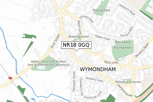
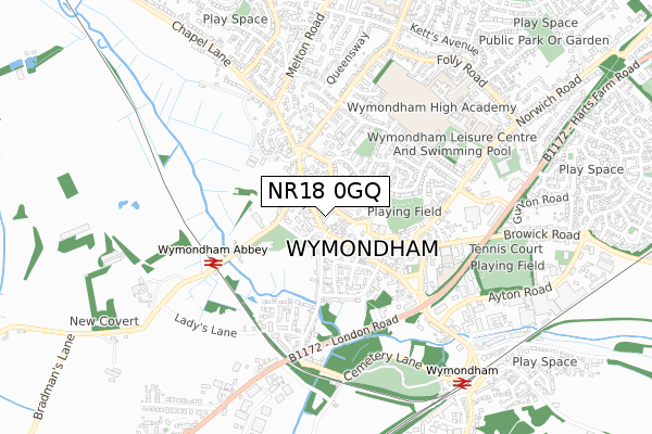
NR18 0GQ is located in the North Wymondham electoral ward, within the local authority district of South Norfolk and the English Parliamentary constituency of Mid Norfolk. The Sub Integrated Care Board (ICB) Location is NHS Norfolk and Waveney ICB - 26A and the police force is Norfolk. This postcode has been in use since September 2018.


GetTheData
Source: OS Open Zoomstack (Ordnance Survey)
Licence: Open Government Licence (requires attribution)
Attribution: Contains OS data © Crown copyright and database right 2024
Source: Open Postcode Geo
Licence: Open Government Licence (requires attribution)
Attribution: Contains OS data © Crown copyright and database right 2024; Contains Royal Mail data © Royal Mail copyright and database right 2024; Source: Office for National Statistics licensed under the Open Government Licence v.3.0
| Easting | 612877 |
| Northing | 303589 |
| Latitude | 52.588422 |
| Longitude | 1.141151 |
GetTheData
Source: Open Postcode Geo
Licence: Open Government Licence
| Country | England |
| Postcode District | NR18 |
| ➜ NR18 open data dashboard ➜ See where NR18 is on a map | |
GetTheData
Source: Land Registry Price Paid Data
Licence: Open Government Licence
| Ward | North Wymondham |
| Constituency | Mid Norfolk |
GetTheData
Source: ONS Postcode Database
Licence: Open Government Licence
| Spinks Lane (Norwich Common) | Wymondham | 694m |
| Spinks Lane (Norwich Common) | Wymondham | 741m |
| Elm Farm Business Park (Norwich Road) | Wymondham | 748m |
| Elm Farm Business Park (Norwich Road) | Wymondham | 750m |
| Tuttles Lane (Norwich Road) | Wymondham | 883m |
| Wymondham Station | 3km |
GetTheData
Source: NaPTAN
Licence: Open Government Licence
GetTheData
Source: ONS Postcode Database
Licence: Open Government Licence


➜ Get more ratings from the Food Standards Agency
GetTheData
Source: Food Standards Agency
Licence: FSA terms & conditions
| Last Collection | |||
|---|---|---|---|
| Location | Mon-Fri | Sat | Distance |
| Tuttles Lane East | 17:00 | 11:45 | 973m |
| Limetree Avenue Post Office | 17:00 | 12:00 | 1,389m |
| Ketts Oak | 17:30 | 08:00 | 1,622m |
GetTheData
Source: Dracos
Licence: Creative Commons Attribution-ShareAlike
| Facility | Distance |
|---|---|
| Wymondham Rugby Club Bray Drive, Wymondham Grass Pitches | 300m |
| Wymondham Rufc (Closed) Tuttles Lane East, Wymondham Grass Pitches | 938m |
| Ketts Park Community Recreation Centre Harts Farm Road, Wymondham Grass Pitches, Outdoor Tennis Courts, Artificial Grass Pitch | 1.6km |
GetTheData
Source: Active Places
Licence: Open Government Licence
| School | Phase of Education | Distance |
|---|---|---|
| Ashleigh Primary School and Nursery, Wymondham Sheffield Road, Wymondham, NR18 0HL | Primary | 1.4km |
| Robert Kett Primary School Hewitts Lane, Wymondham, NR18 0LS | Primary | 2km |
| Wymondham High Academy Folly Road, Wymondham, NR18 0QT | Secondary | 2.1km |
GetTheData
Source: Edubase
Licence: Open Government Licence
The below table lists the International Territorial Level (ITL) codes (formerly Nomenclature of Territorial Units for Statistics (NUTS) codes) and Local Administrative Units (LAU) codes for NR18 0GQ:
| ITL 1 Code | Name |
|---|---|
| TLH | East |
| ITL 2 Code | Name |
| TLH1 | East Anglia |
| ITL 3 Code | Name |
| TLH17 | Breckland and South Norfolk |
| LAU 1 Code | Name |
| E07000149 | South Norfolk |
GetTheData
Source: ONS Postcode Directory
Licence: Open Government Licence
The below table lists the Census Output Area (OA), Lower Layer Super Output Area (LSOA), and Middle Layer Super Output Area (MSOA) for NR18 0GQ:
| Code | Name | |
|---|---|---|
| OA | E00174630 | |
| LSOA | E01026933 | South Norfolk 007C |
| MSOA | E02005603 | South Norfolk 007 |
GetTheData
Source: ONS Postcode Directory
Licence: Open Government Licence
| NR18 0GD | Jeckyll Road | 347m |
| NR18 0WJ | Hendry Gardens | 352m |
| NR18 0XD | Pond Way | 357m |
| NR18 0WG | Carpenter Close | 361m |
| NR18 0WQ | Jeckyll Road | 366m |
| NR18 0US | Arundell Avenue | 377m |
| NR18 0UX | Blake Drive | 388m |
| NR18 0WH | Harvey Close | 399m |
| NR18 0UU | Beckets Grove | 401m |
| NR18 0XE | Simpson Way | 404m |
GetTheData
Source: Open Postcode Geo; Land Registry Price Paid Data
Licence: Open Government Licence