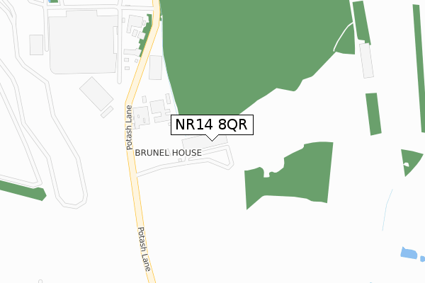
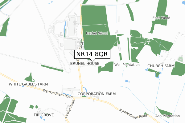
NR14 8QR is located in the Mulbarton & Stoke Holy Cross electoral ward, within the local authority district of South Norfolk and the English Parliamentary constituency of South Norfolk. The Sub Integrated Care Board (ICB) Location is NHS Norfolk and Waveney ICB - 26A and the police force is Norfolk. This postcode has been in use since March 2019.


GetTheData
Source: OS Open Zoomstack (Ordnance Survey)
Licence: Open Government Licence (requires attribution)
Attribution: Contains OS data © Crown copyright and database right 2024
Source: Open Postcode Geo
Licence: Open Government Licence (requires attribution)
Attribution: Contains OS data © Crown copyright and database right 2024; Contains Royal Mail data © Royal Mail copyright and database right 2024; Source: Office for National Statistics licensed under the Open Government Licence v.3.0
| Easting | 615912 |
| Northing | 300373 |
| Latitude | 52.558359 |
| Longitude | 1.183787 |
GetTheData
Source: Open Postcode Geo
Licence: Open Government Licence
| Country | England |
| Postcode District | NR14 |
| ➜ NR14 open data dashboard ➜ See where NR14 is on a map | |
GetTheData
Source: Land Registry Price Paid Data
Licence: Open Government Licence
| Ward | Mulbarton & Stoke Holy Cross |
| Constituency | South Norfolk |
GetTheData
Source: ONS Postcode Database
Licence: Open Government Licence
| Wymondham Station | 4.5km |
GetTheData
Source: NaPTAN
Licence: Open Government Licence
GetTheData
Source: ONS Postcode Database
Licence: Open Government Licence


➜ Get more ratings from the Food Standards Agency
GetTheData
Source: Food Standards Agency
Licence: FSA terms & conditions
| Last Collection | |||
|---|---|---|---|
| Location | Mon-Fri | Sat | Distance |
| School Lane | 15:45 | 08:00 | 1,696m |
| Ashwellthorpe Road | 16:00 | 08:45 | 1,835m |
| Wymondham Lodge | 16:00 | 11:00 | 2,223m |
GetTheData
Source: Dracos
Licence: Creative Commons Attribution-ShareAlike
| Facility | Distance |
|---|---|
| Ketteringham Hall Cricket Club Church Road, Ketteringham Grass Pitches | 2.2km |
| Mulbarton Common The Common, Mulbarton, Norwich Grass Pitches | 3.5km |
| Fitness Express At Park Farm Hotel Norwich Road, Hethersett, Norwich Swimming Pool, Health and Fitness Gym, Studio | 3.5km |
GetTheData
Source: Active Places
Licence: Open Government Licence
| School | Phase of Education | Distance |
|---|---|---|
| Wreningham VC Primary School Ashwellthorpe Road, Wreningham, Norwich, NR16 1AW | Primary | 1.8km |
| Mulbarton Primary School The Common, Mulbarton, Norwich, NR14 8JG | Primary | 3.5km |
| Hapton Church of England Voluntary Aided Primary School The Street, Hapton, Norwich, NR15 1AD | Primary | 4.1km |
GetTheData
Source: Edubase
Licence: Open Government Licence
The below table lists the International Territorial Level (ITL) codes (formerly Nomenclature of Territorial Units for Statistics (NUTS) codes) and Local Administrative Units (LAU) codes for NR14 8QR:
| ITL 1 Code | Name |
|---|---|
| TLH | East |
| ITL 2 Code | Name |
| TLH1 | East Anglia |
| ITL 3 Code | Name |
| TLH17 | Breckland and South Norfolk |
| LAU 1 Code | Name |
| E07000149 | South Norfolk |
GetTheData
Source: ONS Postcode Directory
Licence: Open Government Licence
The below table lists the Census Output Area (OA), Lower Layer Super Output Area (LSOA), and Middle Layer Super Output Area (MSOA) for NR14 8QR:
| Code | Name | |
|---|---|---|
| OA | E00136890 | |
| LSOA | E01026913 | South Norfolk 009A |
| MSOA | E02005605 | South Norfolk 009 |
GetTheData
Source: ONS Postcode Directory
Licence: Open Government Licence
| NR14 8EU | Wymondham Road | 473m |
| NR16 1BQ | Penny Green | 718m |
| NR16 1BE | Hethel Road | 980m |
| NR14 8HD | Rectory Lane | 1245m |
| NR14 8HA | Hall Road | 1251m |
| NR16 1BB | Hethel Road | 1328m |
| NR14 8HF | Brewertons Yard | 1444m |
| NR14 8HB | Cranes Road | 1540m |
| NR18 9RQ | St Thomas Lane | 1559m |
| NR16 1BA | Church Road | 1602m |
GetTheData
Source: Open Postcode Geo; Land Registry Price Paid Data
Licence: Open Government Licence