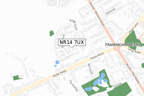
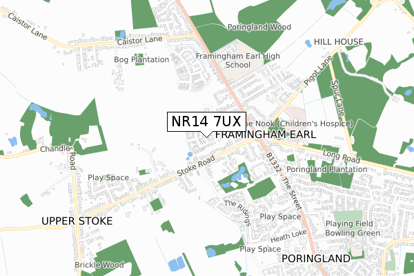
NR14 7UX is located in the Poringland, Framinghams & Trowse electoral ward, within the local authority district of South Norfolk and the English Parliamentary constituency of South Norfolk. The Sub Integrated Care Board (ICB) Location is NHS Norfolk and Waveney ICB - 26A and the police force is Norfolk. This postcode has been in use since June 2018.


GetTheData
Source: OS Open Zoomstack (Ordnance Survey)
Licence: Open Government Licence (requires attribution)
Attribution: Contains OS data © Crown copyright and database right 2024
Source: Open Postcode Geo
Licence: Open Government Licence (requires attribution)
Attribution: Contains OS data © Crown copyright and database right 2024; Contains Royal Mail data © Royal Mail copyright and database right 2024; Source: Office for National Statistics licensed under the Open Government Licence v.3.0
| Easting | 626145 |
| Northing | 302835 |
| Latitude | 52.576303 |
| Longitude | 1.336155 |
GetTheData
Source: Open Postcode Geo
Licence: Open Government Licence
| Country | England |
| Postcode District | NR14 |
| ➜ NR14 open data dashboard ➜ See where NR14 is on a map ➜ Where is Poringland? | |
GetTheData
Source: Land Registry Price Paid Data
Licence: Open Government Licence
| Ward | Poringland, Framinghams & Trowse |
| Constituency | South Norfolk |
GetTheData
Source: ONS Postcode Database
Licence: Open Government Licence
2022 7 OCT £325,000 |
4, REVEL BURROUGHS WAY, PORINGLAND, NORWICH, NR14 7UX 2019 8 JUL £430,000 |
2019 22 FEB £282,995 |
2, REVEL BURROUGHS WAY, PORINGLAND, NORWICH, NR14 7UX 2018 21 DEC £371,995 |
1, REVEL BURROUGHS WAY, PORINGLAND, NORWICH, NR14 7UX 2018 29 JUN £279,995 |
3, REVEL BURROUGHS WAY, PORINGLAND, NORWICH, NR14 7UX 2018 29 JUN £289,995 |
GetTheData
Source: HM Land Registry Price Paid Data
Licence: Contains HM Land Registry data © Crown copyright and database right 2024. This data is licensed under the Open Government Licence v3.0.
| December 2023 | Violence and sexual offences | On or near Petrol Station | 329m |
| November 2023 | Public order | On or near Petrol Station | 329m |
| July 2023 | Theft from the person | On or near Petrol Station | 329m |
| ➜ Get more crime data in our Crime section | |||
GetTheData
Source: data.police.uk
Licence: Open Government Licence
| Greenacres Drive (Norwich Road) | Poringland | 264m |
| Greenacres Drive (The Street) | Framingham Earl | 284m |
| Highgrove Court (Norwich Road) | Framingham Earl | 297m |
| Railway Tavern (The Street) | Poringland | 324m |
| Highgrove Court (Norwich Road) | Framingham Earl | 327m |
GetTheData
Source: NaPTAN
Licence: Open Government Licence
| Percentage of properties with Next Generation Access | 100.0% |
| Percentage of properties with Superfast Broadband | 100.0% |
| Percentage of properties with Ultrafast Broadband | 100.0% |
| Percentage of properties with Full Fibre Broadband | 100.0% |
Superfast Broadband is between 30Mbps and 300Mbps
Ultrafast Broadband is > 300Mbps
| Percentage of properties unable to receive 2Mbps | 0.0% |
| Percentage of properties unable to receive 5Mbps | 0.0% |
| Percentage of properties unable to receive 10Mbps | 0.0% |
| Percentage of properties unable to receive 30Mbps | 0.0% |
GetTheData
Source: Ofcom
Licence: Ofcom Terms of Use (requires attribution)
GetTheData
Source: ONS Postcode Database
Licence: Open Government Licence


➜ Get more ratings from the Food Standards Agency
GetTheData
Source: Food Standards Agency
Licence: FSA terms & conditions
| Last Collection | |||
|---|---|---|---|
| Location | Mon-Fri | Sat | Distance |
| Arminghall | 16:30 | 08:20 | 2,462m |
| Framingham Beck | 16:15 | 09:30 | 2,613m |
| Howe Church | 16:30 | 08:30 | 3,196m |
GetTheData
Source: Dracos
Licence: Creative Commons Attribution-ShareAlike
| Facility | Distance |
|---|---|
| Framingham Earl High School Sports Centre Norwich Road, Framingham Earl, Norwich Sports Hall, Grass Pitches, Studio, Artificial Grass Pitch | 529m |
| The Welcome Home And Memorial Playing Field The Footpath, Poringland Grass Pitches | 1km |
| Stoke Holy Cross Playing Field Long Lane, Stoke Holy Cross Grass Pitches | 2.6km |
GetTheData
Source: Active Places
Licence: Open Government Licence
| School | Phase of Education | Distance |
|---|---|---|
| Framingham Earl High School Norwich Road, Framingham Earl, Norwich, NR14 7QP | Secondary | 529m |
| Poringland Primary School The Footpath, Poringland, Norwich, NR14 7RF | Primary | 1.1km |
| Stoke Holy Cross Primary School Long Lane, Stoke Holy Cross, Norwich, NR14 8LY | Primary | 2.5km |
GetTheData
Source: Edubase
Licence: Open Government Licence
The below table lists the International Territorial Level (ITL) codes (formerly Nomenclature of Territorial Units for Statistics (NUTS) codes) and Local Administrative Units (LAU) codes for NR14 7UX:
| ITL 1 Code | Name |
|---|---|
| TLH | East |
| ITL 2 Code | Name |
| TLH1 | East Anglia |
| ITL 3 Code | Name |
| TLH17 | Breckland and South Norfolk |
| LAU 1 Code | Name |
| E07000149 | South Norfolk |
GetTheData
Source: ONS Postcode Directory
Licence: Open Government Licence
The below table lists the Census Output Area (OA), Lower Layer Super Output Area (LSOA), and Middle Layer Super Output Area (MSOA) for NR14 7UX:
| Code | Name | |
|---|---|---|
| OA | E00136969 | |
| LSOA | E01026926 | South Norfolk 006C |
| MSOA | E02005602 | South Norfolk 006 |
GetTheData
Source: ONS Postcode Directory
Licence: Open Government Licence
| NR14 7JL | Stoke Road | 137m |
| NR14 7JN | Stoke Road | 180m |
| NR14 7JH | Clearview Drive | 197m |
| NR14 7JG | Greenacres Drive | 205m |
| NR14 7JP | Mill Close | 216m |
| NR14 7RS | Highgrove Court | 239m |
| NR14 7JJ | Norwich Road | 247m |
| NR14 7AB | Norwich Road | 296m |
| NR14 7JW | Old Mill Road | 296m |
| NR14 7JD | Boundary Way | 317m |
GetTheData
Source: Open Postcode Geo; Land Registry Price Paid Data
Licence: Open Government Licence