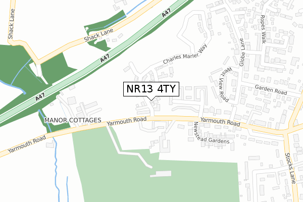
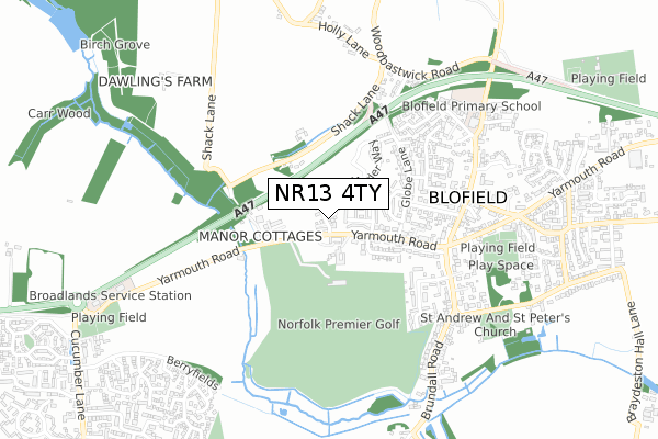
NR13 4TY is located in the Blofield with South Walsham electoral ward, within the local authority district of Broadland and the English Parliamentary constituency of Broadland. The Sub Integrated Care Board (ICB) Location is NHS Norfolk and Waveney ICB - 26A and the police force is Norfolk. This postcode has been in use since November 2019.


GetTheData
Source: OS Open Zoomstack (Ordnance Survey)
Licence: Open Government Licence (requires attribution)
Attribution: Contains OS data © Crown copyright and database right 2024
Source: Open Postcode Geo
Licence: Open Government Licence (requires attribution)
Attribution: Contains OS data © Crown copyright and database right 2024; Contains Royal Mail data © Royal Mail copyright and database right 2024; Source: Office for National Statistics licensed under the Open Government Licence v.3.0
| Easting | 632886 |
| Northing | 309628 |
| Latitude | 52.634420 |
| Longitude | 1.440227 |
GetTheData
Source: Open Postcode Geo
Licence: Open Government Licence
| Country | England |
| Postcode District | NR13 |
| ➜ NR13 open data dashboard ➜ See where NR13 is on a map ➜ Where is Blofield? | |
GetTheData
Source: Land Registry Price Paid Data
Licence: Open Government Licence
| Ward | Blofield With South Walsham |
| Constituency | Broadland |
GetTheData
Source: ONS Postcode Database
Licence: Open Government Licence
1, WILLIAM BROWN DRIVE, BLOFIELD, NORWICH, NR13 4TY 2021 25 JAN £450,000 |
9, WILLIAM BROWN DRIVE, BLOFIELD, NORWICH, NR13 4TY 2021 13 JAN £450,000 |
5, WILLIAM BROWN DRIVE, BLOFIELD, NORWICH, NR13 4TY 2020 1 OCT £295,000 |
7, WILLIAM BROWN DRIVE, BLOFIELD, NORWICH, NR13 4TY 2020 16 APR £299,995 |
3, WILLIAM BROWN DRIVE, BLOFIELD, NORWICH, NR13 4TY 2020 27 MAR £299,995 |
2, WILLIAM BROWN DRIVE, BLOFIELD, NORWICH, NR13 4TY 2019 22 NOV £339,995 |
4, WILLIAM BROWN DRIVE, BLOFIELD, NORWICH, NR13 4TY 2019 8 NOV £430,000 |
GetTheData
Source: HM Land Registry Price Paid Data
Licence: Contains HM Land Registry data © Crown copyright and database right 2024. This data is licensed under the Open Government Licence v3.0.
| June 2022 | Violence and sexual offences | On or near Brewster Court | 127m |
| June 2022 | Violence and sexual offences | On or near West View Road | 220m |
| June 2022 | Violence and sexual offences | On or near Highview Close | 471m |
| ➜ Get more crime data in our Crime section | |||
GetTheData
Source: data.police.uk
Licence: Open Government Licence
| Garden Road (The Street) | Blofield | 475m |
| Garden Road (The Street) | Blofield | 480m |
| Oakwood (Yarmouth Road) | Blofield | 550m |
| Oakwood (Yarmouth Road) | Blofield | 560m |
| Lower Globe Lane (Woodbastwick Road) | Blofield | 580m |
| Brundall Station | 1.7km |
| Brundall Gardens Station | 1.9km |
| Lingwood Station | 3.6km |
GetTheData
Source: NaPTAN
Licence: Open Government Licence
| Percentage of properties with Next Generation Access | 100.0% |
| Percentage of properties with Superfast Broadband | 100.0% |
| Percentage of properties with Ultrafast Broadband | 0.0% |
| Percentage of properties with Full Fibre Broadband | 0.0% |
Superfast Broadband is between 30Mbps and 300Mbps
Ultrafast Broadband is > 300Mbps
| Percentage of properties unable to receive 2Mbps | 0.0% |
| Percentage of properties unable to receive 5Mbps | 0.0% |
| Percentage of properties unable to receive 10Mbps | 0.0% |
| Percentage of properties unable to receive 30Mbps | 0.0% |
GetTheData
Source: Ofcom
Licence: Ofcom Terms of Use (requires attribution)
GetTheData
Source: ONS Postcode Database
Licence: Open Government Licence


➜ Get more ratings from the Food Standards Agency
GetTheData
Source: Food Standards Agency
Licence: FSA terms & conditions
| Last Collection | |||
|---|---|---|---|
| Location | Mon-Fri | Sat | Distance |
| 116/118 The Street | 16:10 | 08:45 | 1,238m |
| Hemblington Corner | 16:15 | 07:00 | 2,062m |
| Lt Plumstead Post Office | 16:00 | 09:30 | 2,737m |
GetTheData
Source: Dracos
Licence: Creative Commons Attribution-ShareAlike
| Facility | Distance |
|---|---|
| Norfolk Premier Golf Yarmouth Road, Blofield, Norwich Golf | 202m |
| Blofield Primary School North Street, Blofield, Norwich Grass Pitches, Swimming Pool, Sports Hall | 587m |
| Blofield Memorial Ground Yarmouth Road, Blofield, Norwich Grass Pitches, Outdoor Tennis Courts | 671m |
GetTheData
Source: Active Places
Licence: Open Government Licence
| School | Phase of Education | Distance |
|---|---|---|
| Blofield Primary School North Street, Blofield, Norwich, NR13 4RH | Primary | 612m |
| Brundall Primary School Braydeston Avenue, Brundall, Norwich, NR13 5JX | Primary | 1.4km |
| Hemblington Primary School Mill Road, Blofield Heath, Norwich, NR13 4QJ | Primary | 2km |
GetTheData
Source: Edubase
Licence: Open Government Licence
The below table lists the International Territorial Level (ITL) codes (formerly Nomenclature of Territorial Units for Statistics (NUTS) codes) and Local Administrative Units (LAU) codes for NR13 4TY:
| ITL 1 Code | Name |
|---|---|
| TLH | East |
| ITL 2 Code | Name |
| TLH1 | East Anglia |
| ITL 3 Code | Name |
| TLH15 | Norwich and East Norfolk |
| LAU 1 Code | Name |
| E07000144 | Broadland |
GetTheData
Source: ONS Postcode Directory
Licence: Open Government Licence
The below table lists the Census Output Area (OA), Lower Layer Super Output Area (LSOA), and Middle Layer Super Output Area (MSOA) for NR13 4TY:
| Code | Name | |
|---|---|---|
| OA | E00134690 | |
| LSOA | E01026505 | Broadland 014B |
| MSOA | E02005533 | Broadland 014 |
GetTheData
Source: ONS Postcode Directory
Licence: Open Government Licence
| NR13 4JS | Yarmouth Road | 162m |
| NR13 4DS | Yarmouth Road | 239m |
| NR13 4JR | West View Road | 239m |
| NR13 4JN | Globe Lane | 265m |
| NR13 4DT | Frogs Hole | 296m |
| NR13 4JW | Globe Lane | 299m |
| NR13 4JU | Yarmouth Road | 357m |
| NR13 4JX | St Andrews Close | 398m |
| NR13 4JD | Edrich Close | 402m |
| NR13 4JL | Garden Road | 403m |
GetTheData
Source: Open Postcode Geo; Land Registry Price Paid Data
Licence: Open Government Licence