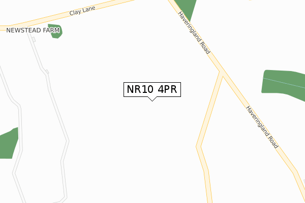
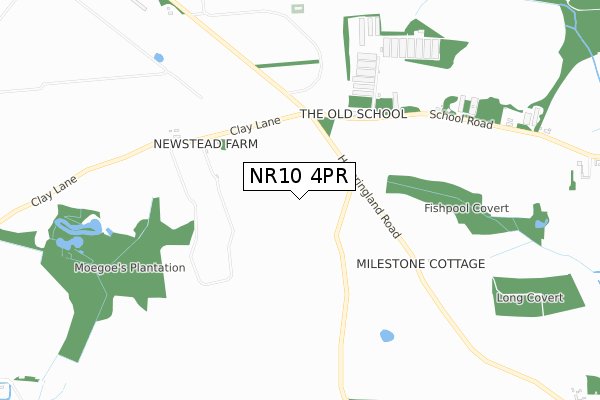
NR10 4PR is located in the Great Witchingham electoral ward, within the local authority district of Broadland and the English Parliamentary constituency of Broadland. The Sub Integrated Care Board (ICB) Location is NHS Norfolk and Waveney ICB - 26A and the police force is Norfolk. This postcode has been in use since March 2018.


GetTheData
Source: OS Open Zoomstack (Ordnance Survey)
Licence: Open Government Licence (requires attribution)
Attribution: Contains OS data © Crown copyright and database right 2024
Source: Open Postcode Geo
Licence: Open Government Licence (requires attribution)
Attribution: Contains OS data © Crown copyright and database right 2024; Contains Royal Mail data © Royal Mail copyright and database right 2024; Source: Office for National Statistics licensed under the Open Government Licence v.3.0
| Easting | 615151 |
| Northing | 320108 |
| Latitude | 52.735801 |
| Longitude | 1.185435 |
GetTheData
Source: Open Postcode Geo
Licence: Open Government Licence
| Country | England |
| Postcode District | NR10 |
| ➜ NR10 open data dashboard ➜ See where NR10 is on a map | |
GetTheData
Source: Land Registry Price Paid Data
Licence: Open Government Licence
| Ward | Great Witchingham |
| Constituency | Broadland |
GetTheData
Source: ONS Postcode Database
Licence: Open Government Licence
| Old Kings Head (Haveringland Road) | Haveringland | 1,500m |
| Old Kings Head (Haveringland Road) | Haveringland | 1,506m |
GetTheData
Source: NaPTAN
Licence: Open Government Licence
GetTheData
Source: ONS Postcode Database
Licence: Open Government Licence

➜ Get more ratings from the Food Standards Agency
GetTheData
Source: Food Standards Agency
Licence: FSA terms & conditions
| Last Collection | |||
|---|---|---|---|
| Location | Mon-Fri | Sat | Distance |
| Marsham Lodge Holt Road | 16:00 | 10:00 | 2,578m |
| The Street Former P.o. | 16:00 | 09:15 | 2,624m |
| Station Road P.o. | 16:30 | 13:00 | 3,572m |
GetTheData
Source: Dracos
Licence: Creative Commons Attribution-ShareAlike
| Facility | Distance |
|---|---|
| Watling Park Hall Lane, Felthorpe, Norwich Grass Pitches | 2.4km |
| Felthorpe Recreation Ground The Street, Felthorpe, Norwich Grass Pitches, Sports Hall | 2.7km |
| Cawston Primary School Aylsham Road, Cawston, Norwich Grass Pitches | 3.7km |
GetTheData
Source: Active Places
Licence: Open Government Licence
| School | Phase of Education | Distance |
|---|---|---|
| Cawston Church of England Primary Academy Aylsham Road, Cawston, Norwich, NR10 4AY | Primary | 3.7km |
| Hevingham Primary School New Road, Westgate, Hevingham, Norwich, NR10 5NH | Primary | 4.3km |
| Horsford CofE VA Primary School Mill Lane, Horsford, Norwich, NR10 3ES | Primary | 5.2km |
GetTheData
Source: Edubase
Licence: Open Government Licence
The below table lists the International Territorial Level (ITL) codes (formerly Nomenclature of Territorial Units for Statistics (NUTS) codes) and Local Administrative Units (LAU) codes for NR10 4PR:
| ITL 1 Code | Name |
|---|---|
| TLH | East |
| ITL 2 Code | Name |
| TLH1 | East Anglia |
| ITL 3 Code | Name |
| TLH15 | Norwich and East Norfolk |
| LAU 1 Code | Name |
| E07000144 | Broadland |
GetTheData
Source: ONS Postcode Directory
Licence: Open Government Licence
The below table lists the Census Output Area (OA), Lower Layer Super Output Area (LSOA), and Middle Layer Super Output Area (MSOA) for NR10 4PR:
| Code | Name | |
|---|---|---|
| OA | E00134782 | |
| LSOA | E01026525 | Broadland 002D |
| MSOA | E02005521 | Broadland 002 |
GetTheData
Source: ONS Postcode Directory
Licence: Open Government Licence
| NR10 4QE | School Road | 692m |
| NR10 4QF | School Road | 1181m |
| NR10 4QL | Quaker Court | 1274m |
| NR10 4PN | 1276m | |
| NR9 5NN | Church Lane | 1338m |
| NR10 4PY | Haveringland Road | 1535m |
| NR9 5NP | Church Lane | 1631m |
| NR10 4PZ | Blacksmiths Lane | 1682m |
| NR10 4PJ | 1715m | |
| NR10 4EZ | 1797m |
GetTheData
Source: Open Postcode Geo; Land Registry Price Paid Data
Licence: Open Government Licence