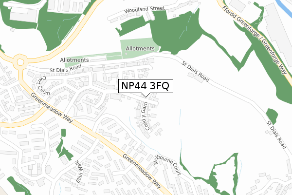
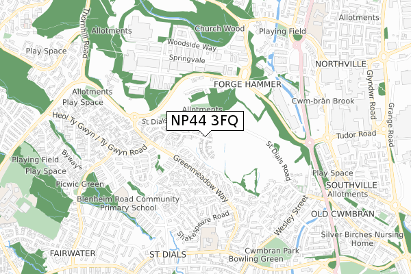
NP44 3FQ is located in the St. Dials electoral ward, within the unitary authority of Torfaen and the Welsh Parliamentary constituency of Torfaen. The Local Health Board is Aneurin Bevan University and the police force is Gwent. This postcode has been in use since September 2019.


GetTheData
Source: OS Open Zoomstack (Ordnance Survey)
Licence: Open Government Licence (requires attribution)
Attribution: Contains OS data © Crown copyright and database right 2024
Source: Open Postcode Geo
Licence: Open Government Licence (requires attribution)
Attribution: Contains OS data © Crown copyright and database right 2024; Contains Royal Mail data © Royal Mail copyright and database right 2024; Source: Office for National Statistics licensed under the Open Government Licence v.3.0
| Easting | 328662 |
| Northing | 195227 |
| Latitude | 51.651293 |
| Longitude | -3.032541 |
GetTheData
Source: Open Postcode Geo
Licence: Open Government Licence
| Country | Wales |
| Postcode District | NP44 |
| ➜ NP44 open data dashboard ➜ See where NP44 is on a map ➜ Where is Cwmbrân? | |
GetTheData
Source: Land Registry Price Paid Data
Licence: Open Government Licence
| Ward | St. Dials |
| Constituency | Torfaen |
GetTheData
Source: ONS Postcode Database
Licence: Open Government Licence
20, COED Y GARN, ST DIALS, CWMBRAN, NP44 3FQ 2023 28 JUL £295,000 |
26, COED Y GARN, ST DIALS, CWMBRAN, NP44 3FQ 2021 2 JUL £292,000 |
39, COED Y GARN, ST DIALS, CWMBRAN, NP44 3FQ 2021 30 JUN £292,595 |
38, COED Y GARN, ST DIALS, CWMBRAN, NP44 3FQ 2021 30 JUN £237,495 |
35, COED Y GARN, ST DIALS, CWMBRAN, NP44 3FQ 2021 29 JUN £278,345 |
36, COED Y GARN, ST DIALS, CWMBRAN, NP44 3FQ 2021 29 JUN £299,995 |
37, COED Y GARN, ST DIALS, CWMBRAN, NP44 3FQ 2021 25 JUN £285,500 |
34, COED Y GARN, ST DIALS, CWMBRAN, NP44 3FQ 2021 15 JUN £259,345 |
33, COED Y GARN, ST DIALS, CWMBRAN, NP44 3FQ 2021 15 JUN £259,345 |
31, COED Y GARN, ST DIALS, CWMBRAN, NP44 3FQ 2021 28 MAY £300,000 |
GetTheData
Source: HM Land Registry Price Paid Data
Licence: Contains HM Land Registry data © Crown copyright and database right 2024. This data is licensed under the Open Government Licence v3.0.
| January 2024 | Other theft | On or near Parking Area | 468m |
| December 2023 | Anti-social behaviour | On or near Melbourne Court | 256m |
| December 2023 | Criminal damage and arson | On or near Pen-Y-Waun Close | 412m |
| ➜ Get more crime data in our Crime section | |||
GetTheData
Source: data.police.uk
Licence: Open Government Licence
| Gileston Walk (Greenmeadow Way) | St Dials | 301m |
| Shakespeare Road (Greenmeadow Way) | St Dials | 354m |
| Old Police College (Greenmeadow Way) | Greenmeadow | 370m |
| St Joseph's (Blenheim Road) | St Dials | 393m |
| Shakespeare Road (Greenmeadow Way) | St Dials | 415m |
| Cwmbran Station | 1.3km |
| Risca & Pontymister Station | 6.5km |
GetTheData
Source: NaPTAN
Licence: Open Government Licence
GetTheData
Source: ONS Postcode Database
Licence: Open Government Licence


➜ Get more ratings from the Food Standards Agency
GetTheData
Source: Food Standards Agency
Licence: FSA terms & conditions
| Last Collection | |||
|---|---|---|---|
| Location | Mon-Fri | Sat | Distance |
| Radnor Way | 17:30 | 11:00 | 742m |
| Llantarnam Road | 17:30 | 11:00 | 1,472m |
| Five Locks Close | 17:30 | 11:00 | 1,561m |
GetTheData
Source: Dracos
Licence: Creative Commons Attribution-ShareAlike
| School | Phase of Education | Distance |
|---|---|---|
| Ysgol Gymraeg Cwmbran Henllys Way, St Dial's, Cwmbran, Torfaen, NP44 3NB | Not applicable | 615m |
| Our Lady of the Angels R.C School Victoria Street, Cwmbran, Torfaen, NP44 3JR | Not applicable | 733m |
| Blenheim Road Community Primary School Blenheim Road, St Dial's, Cwmbran, NP44 4SZ | Not applicable | 733m |
GetTheData
Source: Edubase
Licence: Open Government Licence
The below table lists the International Territorial Level (ITL) codes (formerly Nomenclature of Territorial Units for Statistics (NUTS) codes) and Local Administrative Units (LAU) codes for NP44 3FQ:
| ITL 1 Code | Name |
|---|---|
| TLL | Wales |
| ITL 2 Code | Name |
| TLL1 | West Wales and The Valleys |
| ITL 3 Code | Name |
| TLL16 | Gwent Valleys |
| LAU 1 Code | Name |
| W06000020 | Torfaen |
GetTheData
Source: ONS Postcode Directory
Licence: Open Government Licence
The below table lists the Census Output Area (OA), Lower Layer Super Output Area (LSOA), and Middle Layer Super Output Area (MSOA) for NP44 3FQ:
| Code | Name | |
|---|---|---|
| OA | W00007968 | |
| LSOA | W01001528 | Torfaen 010D |
| MSOA | W02000332 | Torfaen 010 |
GetTheData
Source: ONS Postcode Directory
Licence: Open Government Licence
| NP44 3AJ | Hodges Terrace | 82m |
| NP44 3EN | Salisbury Court | 261m |
| NP44 3ES | Melbourne Court | 262m |
| NP44 3ER | Salisbury Court | 278m |
| NP44 3AG | Glenview | 307m |
| NP44 3AL | St Dials Road | 313m |
| NP44 3AH | Woodland Street | 319m |
| NP44 3AR | Melbourne Court | 321m |
| NP44 3DH | Uplands Terrace | 324m |
| NP44 4PF | Ashton Houses | 327m |
GetTheData
Source: Open Postcode Geo; Land Registry Price Paid Data
Licence: Open Government Licence