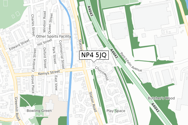
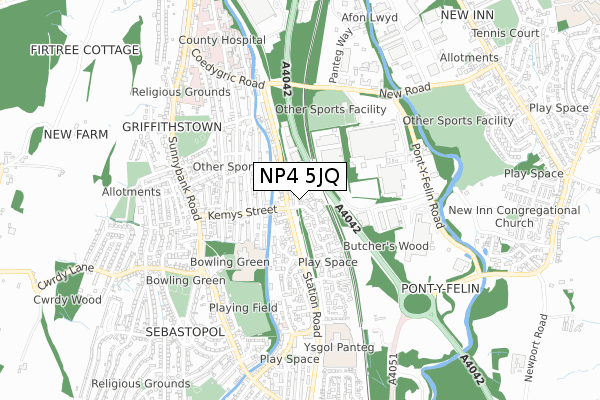
NP4 5JQ is located in the Panteg electoral ward, within the unitary authority of Torfaen and the Welsh Parliamentary constituency of Torfaen. The Local Health Board is Aneurin Bevan University and the police force is Gwent. This postcode has been in use since April 2020.


GetTheData
Source: OS Open Zoomstack (Ordnance Survey)
Licence: Open Government Licence (requires attribution)
Attribution: Contains OS data © Crown copyright and database right 2024
Source: Open Postcode Geo
Licence: Open Government Licence (requires attribution)
Attribution: Contains OS data © Crown copyright and database right 2024; Contains Royal Mail data © Royal Mail copyright and database right 2024; Source: Office for National Statistics licensed under the Open Government Licence v.3.0
| Easting | 329489 |
| Northing | 198997 |
| Latitude | 51.685288 |
| Longitude | -3.021351 |
GetTheData
Source: Open Postcode Geo
Licence: Open Government Licence
| Country | Wales |
| Postcode District | NP4 |
| ➜ NP4 open data dashboard ➜ See where NP4 is on a map ➜ Where is Pontypool? | |
GetTheData
Source: Land Registry Price Paid Data
Licence: Open Government Licence
| Ward | Panteg |
| Constituency | Torfaen |
GetTheData
Source: ONS Postcode Database
Licence: Open Government Licence
| January 2024 | Shoplifting | On or near Supermarket | 309m |
| January 2024 | Shoplifting | On or near Supermarket | 309m |
| January 2024 | Shoplifting | On or near Supermarket | 309m |
| ➜ Get more crime data in our Crime section | |||
GetTheData
Source: data.police.uk
Licence: Open Government Licence
| Kemys Street (Station Road) | Griffithstown | 87m |
| Kemys Street (Station Road) | Griffithstown | 94m |
| Glenville (Station Road) | Griffithstown | 188m |
| Glenville (Station Road) | Griffithstown | 223m |
| Giffithstown Rly Museum (Station Road) | Griffithstown | 321m |
| Pontypool & New Inn Station | 1.5km |
| Cwmbran Station | 3.2km |
GetTheData
Source: NaPTAN
Licence: Open Government Licence
GetTheData
Source: ONS Postcode Database
Licence: Open Government Licence


➜ Get more ratings from the Food Standards Agency
GetTheData
Source: Food Standards Agency
Licence: FSA terms & conditions
| Last Collection | |||
|---|---|---|---|
| Location | Mon-Fri | Sat | Distance |
| Hawthorn Road | 16:15 | 11:45 | 1,058m |
| Garn Yr Erw | 11:30 | 10:00 | 1,869m |
| Forgeside Post Office | 16:45 | 11:45 | 1,869m |
GetTheData
Source: Dracos
Licence: Creative Commons Attribution-ShareAlike
| School | Phase of Education | Distance |
|---|---|---|
| Griffithstown Primary Florence Place, Griffithstown, Pontypool, NP4 5DN | Not applicable | 363m |
| New Inn Primary School Off Golf Road, New Inn, Pontypool, Torfaen, NP4 0PR | Not applicable | 1.3km |
| West Monmouth Comprehensive School Blaendare Road, Pontypool, Torfaen, NP4 5YG | Not applicable | 1.7km |
GetTheData
Source: Edubase
Licence: Open Government Licence
The below table lists the International Territorial Level (ITL) codes (formerly Nomenclature of Territorial Units for Statistics (NUTS) codes) and Local Administrative Units (LAU) codes for NP4 5JQ:
| ITL 1 Code | Name |
|---|---|
| TLL | Wales |
| ITL 2 Code | Name |
| TLL1 | West Wales and The Valleys |
| ITL 3 Code | Name |
| TLL16 | Gwent Valleys |
| LAU 1 Code | Name |
| W06000020 | Torfaen |
GetTheData
Source: ONS Postcode Directory
Licence: Open Government Licence
The below table lists the Census Output Area (OA), Lower Layer Super Output Area (LSOA), and Middle Layer Super Output Area (MSOA) for NP4 5JQ:
| Code | Name | |
|---|---|---|
| OA | W00007911 | |
| LSOA | W01001515 | Torfaen 006B |
| MSOA | W02000328 | Torfaen 006 |
GetTheData
Source: ONS Postcode Directory
Licence: Open Government Licence
| NP4 5JH | Station Road | 99m |
| NP4 5JG | Station Road | 128m |
| NP4 5JP | Martindale Road | 151m |
| NP4 5JF | Commercial Street | 174m |
| NP4 5SY | Churchwood | 190m |
| NP4 5HR | Park Street | 238m |
| NP4 5JJ | Station Road | 240m |
| NP4 5LU | Open Hearth Close | 253m |
| NP4 5JE | Commercial Street | 278m |
| NP4 5DW | East View | 289m |
GetTheData
Source: Open Postcode Geo; Land Registry Price Paid Data
Licence: Open Government Licence