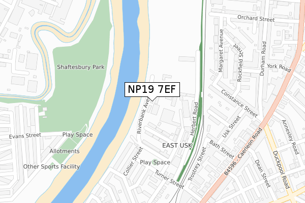
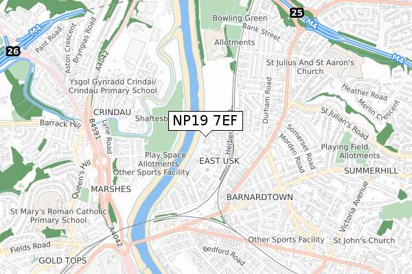
NP19 7EF is located in the St Julians electoral ward, within the unitary authority of Newport and the Welsh Parliamentary constituency of Newport East. The Local Health Board is Aneurin Bevan University and the police force is Gwent. This postcode has been in use since December 2018.


GetTheData
Source: OS Open Zoomstack (Ordnance Survey)
Licence: Open Government Licence (requires attribution)
Attribution: Contains OS data © Crown copyright and database right 2024
Source: Open Postcode Geo
Licence: Open Government Licence (requires attribution)
Attribution: Contains OS data © Crown copyright and database right 2024; Contains Royal Mail data © Royal Mail copyright and database right 2024; Source: Office for National Statistics licensed under the Open Government Licence v.3.0
| Easting | 331667 |
| Northing | 189214 |
| Latitude | 51.597609 |
| Longitude | -2.987937 |
GetTheData
Source: Open Postcode Geo
Licence: Open Government Licence
| Country | Wales |
| Postcode District | NP19 |
| ➜ NP19 open data dashboard ➜ See where NP19 is on a map ➜ Where is Newport? | |
GetTheData
Source: Land Registry Price Paid Data
Licence: Open Government Licence
| Ward | St Julians |
| Constituency | Newport East |
GetTheData
Source: ONS Postcode Database
Licence: Open Government Licence
| December 2023 | Other theft | On or near Orchard Street | 342m |
| November 2023 | Violence and sexual offences | On or near Pool Lane | 435m |
| September 2023 | Vehicle crime | On or near Orchard Street | 342m |
| ➜ Get more crime data in our Crime section | |||
GetTheData
Source: data.police.uk
Licence: Open Government Licence
| Durham Road | Newport | 335m |
| Durham Road | Shaftesbury | 344m |
| Annesley Road (Caerleon Road) | Barnardtown | 407m |
| Christadelphian Hall (Caerleon Road) | Barnardtown | 413m |
| Methodist Chuurch (Caerleon Road) | St Julians | 443m |
| Newport (S Wales) Station | 1.3km |
GetTheData
Source: NaPTAN
Licence: Open Government Licence
| Percentage of properties with Next Generation Access | 100.0% |
| Percentage of properties with Superfast Broadband | 100.0% |
| Percentage of properties with Ultrafast Broadband | 100.0% |
| Percentage of properties with Full Fibre Broadband | 100.0% |
Superfast Broadband is between 30Mbps and 300Mbps
Ultrafast Broadband is > 300Mbps
| Percentage of properties unable to receive 2Mbps | 0.0% |
| Percentage of properties unable to receive 5Mbps | 0.0% |
| Percentage of properties unable to receive 10Mbps | 0.0% |
| Percentage of properties unable to receive 30Mbps | 0.0% |
GetTheData
Source: Ofcom
Licence: Ofcom Terms of Use (requires attribution)
GetTheData
Source: ONS Postcode Database
Licence: Open Government Licence


➜ Get more ratings from the Food Standards Agency
GetTheData
Source: Food Standards Agency
Licence: FSA terms & conditions
| Last Collection | |||
|---|---|---|---|
| Location | Mon-Fri | Sat | Distance |
| Dos Road | 17:30 | 11:30 | 876m |
| Factory Road | 18:45 | 961m | |
| Bridge Street | 18:00 | 12:15 | 1,282m |
GetTheData
Source: Dracos
Licence: Creative Commons Attribution-ShareAlike
| School | Phase of Education | Distance |
|---|---|---|
| Newport Nursery School Church Road, Newport, NP19 7EJ | Not applicable | 580m |
| Crindau Junior & Infant School Ailesbury Street, Newport, NP20 5ND | Not applicable | 598m |
| St Joseph's R.C. Primary School Fairoak Avenue, Newport, NP19 8FW | Not applicable | 846m |
GetTheData
Source: Edubase
Licence: Open Government Licence
The below table lists the International Territorial Level (ITL) codes (formerly Nomenclature of Territorial Units for Statistics (NUTS) codes) and Local Administrative Units (LAU) codes for NP19 7EF:
| ITL 1 Code | Name |
|---|---|
| TLL | Wales |
| ITL 2 Code | Name |
| TLL2 | East Wales |
| ITL 3 Code | Name |
| TLL21 | Monmouthshire and Newport |
| LAU 1 Code | Name |
| W06000022 | Newport |
GetTheData
Source: ONS Postcode Directory
Licence: Open Government Licence
The below table lists the Census Output Area (OA), Lower Layer Super Output Area (LSOA), and Middle Layer Super Output Area (MSOA) for NP19 7EF:
| Code | Name | |
|---|---|---|
| OA | W00008692 | |
| LSOA | W01001676 | Newport 007B |
| MSOA | W02000353 | Newport 007 |
GetTheData
Source: ONS Postcode Directory
Licence: Open Government Licence
| NP19 7DF | Margaret Avenue | 211m |
| NP19 7DE | Margaret Avenue | 217m |
| NP19 7DD | Constance Street | 236m |
| NP19 7DG | Rockfield Street | 256m |
| NP19 7AY | Crawford Street | 258m |
| NP19 7AX | Morgan Street | 270m |
| NP19 7BG | Gore Street | 272m |
| NP19 7DJ | Elysia Street | 291m |
| NP19 7DL | Orchard Street | 292m |
| NP19 7DH | Cenfedd Street | 292m |
GetTheData
Source: Open Postcode Geo; Land Registry Price Paid Data
Licence: Open Government Licence