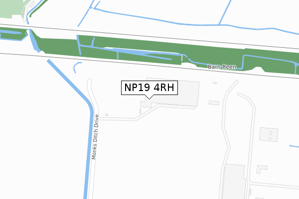
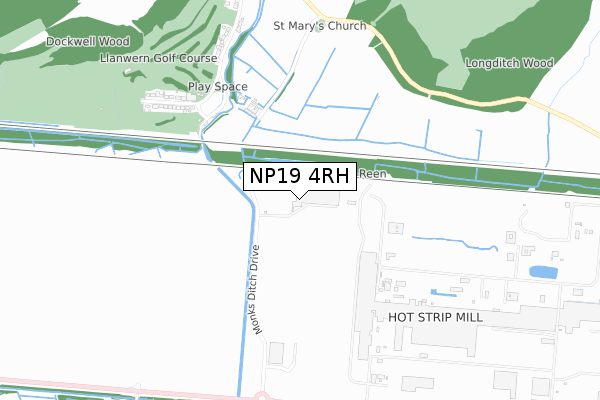
NP19 4RH is located in the Llanwern electoral ward, within the unitary authority of Newport and the Welsh Parliamentary constituency of Newport East. The Local Health Board is Aneurin Bevan University and the police force is Gwent. This postcode has been in use since June 2018.


GetTheData
Source: OS Open Zoomstack (Ordnance Survey)
Licence: Open Government Licence (requires attribution)
Attribution: Contains OS data © Crown copyright and database right 2025
Source: Open Postcode Geo
Licence: Open Government Licence (requires attribution)
Attribution: Contains OS data © Crown copyright and database right 2025; Contains Royal Mail data © Royal Mail copyright and database right 2025; Source: Office for National Statistics licensed under the Open Government Licence v.3.0
| Easting | 336983 |
| Northing | 187137 |
| Latitude | 51.579557 |
| Longitude | -2.910826 |
GetTheData
Source: Open Postcode Geo
Licence: Open Government Licence
| Country | Wales |
| Postcode District | NP19 |
➜ See where NP19 is on a map ➜ Where is Newport? | |
GetTheData
Source: Land Registry Price Paid Data
Licence: Open Government Licence
| Ward | Llanwern |
| Constituency | Newport East |
GetTheData
Source: ONS Postcode Database
Licence: Open Government Licence
| Llanwern Village (Station Road) | Llanwern | 628m |
| Queen`s Way | Llanwern | 842m |
| Queen`s Way | Llanwern | 858m |
| Corus (Grounds) | Llanwern | 956m |
| Queen`s Way | Llanwern | 1,098m |
GetTheData
Source: NaPTAN
Licence: Open Government Licence
GetTheData
Source: ONS Postcode Database
Licence: Open Government Licence


➜ Get more ratings from the Food Standards Agency
GetTheData
Source: Food Standards Agency
Licence: FSA terms & conditions
| Last Collection | |||
|---|---|---|---|
| Location | Mon-Fri | Sat | Distance |
| Nelson Drive | 17:30 | 11:45 | 1,941m |
| The Priory Langstone | 16:00 | 11:00 | 3,107m |
| Aberthaw Circle | 17:30 | 11:15 | 3,417m |
GetTheData
Source: Dracos
Licence: Creative Commons Attribution-ShareAlike
The below table lists the International Territorial Level (ITL) codes (formerly Nomenclature of Territorial Units for Statistics (NUTS) codes) and Local Administrative Units (LAU) codes for NP19 4RH:
| ITL 1 Code | Name |
|---|---|
| TLL | Wales |
| ITL 2 Code | Name |
| TLL2 | East Wales |
| ITL 3 Code | Name |
| TLL21 | Monmouthshire and Newport |
| LAU 1 Code | Name |
| W06000022 | Newport |
GetTheData
Source: ONS Postcode Directory
Licence: Open Government Licence
The below table lists the Census Output Area (OA), Lower Layer Super Output Area (LSOA), and Middle Layer Super Output Area (MSOA) for NP19 4RH:
| Code | Name | |
|---|---|---|
| OA | W00008568 | |
| LSOA | W01001649 | Newport 004D |
| MSOA | W02000350 | Newport 004 |
GetTheData
Source: ONS Postcode Directory
Licence: Open Government Licence
| NP18 2DY | Tennyson Avenue | 670m |
| NP18 2DX | Dockwell Terrace | 705m |
| NP18 2DW | Station Road | 848m |
| NP18 2DN | Bishton Road | 926m |
| NP18 2DU | Milton Hill | 1220m |
| NP18 2DS | 1240m | |
| NP18 2DQ | Lodge Hill | 1261m |
| NP18 2DR | Routes View | 1298m |
| NP19 4TN | Bessemer Drive | 1538m |
| NP19 4TQ | Billet Close | 1549m |
GetTheData
Source: Open Postcode Geo; Land Registry Price Paid Data
Licence: Open Government Licence