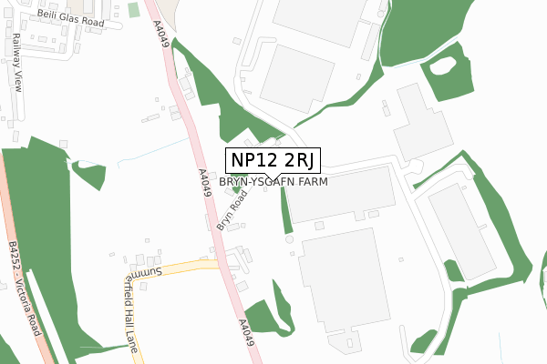
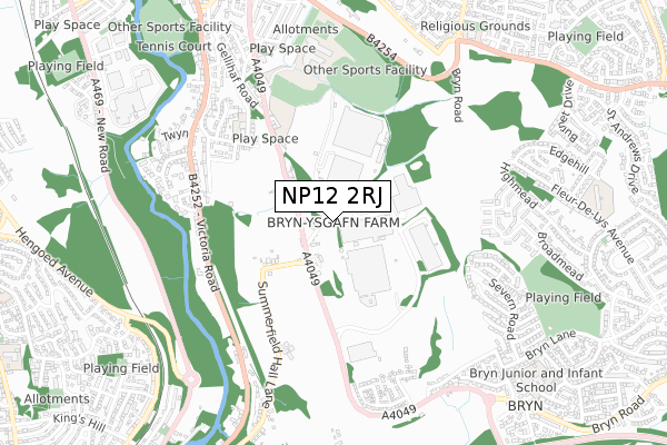
NP12 2RJ is located in the Penmaen electoral ward, within the unitary authority of Caerphilly and the Welsh Parliamentary constituency of Islwyn. The Local Health Board is Aneurin Bevan University and the police force is Gwent. This postcode has been in use since April 2020.


GetTheData
Source: OS Open Zoomstack (Ordnance Survey)
Licence: Open Government Licence (requires attribution)
Attribution: Contains OS data © Crown copyright and database right 2024
Source: Open Postcode Geo
Licence: Open Government Licence (requires attribution)
Attribution: Contains OS data © Crown copyright and database right 2024; Contains Royal Mail data © Royal Mail copyright and database right 2024; Source: Office for National Statistics licensed under the Open Government Licence v.3.0
| Easting | 318131 |
| Northing | 196700 |
| Latitude | 51.663096 |
| Longitude | -3.185073 |
GetTheData
Source: Open Postcode Geo
Licence: Open Government Licence
| Country | Wales |
| Postcode District | NP12 |
| ➜ NP12 open data dashboard ➜ See where NP12 is on a map ➜ Where is Blackwood? | |
GetTheData
Source: Land Registry Price Paid Data
Licence: Open Government Licence
| Ward | Penmaen |
| Constituency | Islwyn |
GetTheData
Source: ONS Postcode Database
Licence: Open Government Licence
| January 2024 | Criminal damage and arson | On or near Pleasant Close | 164m |
| January 2024 | Violence and sexual offences | On or near Yew Grove | 176m |
| December 2023 | Vehicle crime | On or near Woodfield Park Crescent | 158m |
| ➜ Get more crime data in our Crime section | |||
GetTheData
Source: data.police.uk
Licence: Open Government Licence
| Tir Philkins (Penmaen Road) | Woodfieldside | 58m |
| Pleasant Close (Penmaen Road) | Woodfieldside | 99m |
| Melrose House (Woodfield Terrace) | Woodfieldside | 195m |
| Melrose House (Woodfield Terrace) | Woodfieldside | 206m |
| Business Park (Penmaen Road) | Woodfieldside | 367m |
| Newbridge Station | 2.9km |
| Hengoed Station | 3.2km |
| Pengam Station | 3.2km |
GetTheData
Source: NaPTAN
Licence: Open Government Licence
GetTheData
Source: ONS Postcode Database
Licence: Open Government Licence


➜ Get more ratings from the Food Standards Agency
GetTheData
Source: Food Standards Agency
Licence: FSA terms & conditions
| Last Collection | |||
|---|---|---|---|
| Location | Mon-Fri | Sat | Distance |
| Blackwood Post Office | 18:00 | 12:30 | 747m |
| Bloomfield Road Post Office | 16:00 | 11:45 | 1,264m |
| Pentwynmawr | 16:00 | 11:30 | 1,571m |
GetTheData
Source: Dracos
Licence: Creative Commons Attribution-ShareAlike
| School | Phase of Education | Distance |
|---|---|---|
| Libanus Primary School Libanus Rd, Blackwood, Caerphilly, NP12 1EH | Not applicable | 631m |
| Pontllanfraith Primary School Penmaen Road, Pontllanfraith, Blackwood, NP12 2DN | Not applicable | 646m |
| Blackwood Primary School Apollo Way, Blackwood, NP12 1WA | Not applicable | 1.3km |
GetTheData
Source: Edubase
Licence: Open Government Licence
The below table lists the International Territorial Level (ITL) codes (formerly Nomenclature of Territorial Units for Statistics (NUTS) codes) and Local Administrative Units (LAU) codes for NP12 2RJ:
| ITL 1 Code | Name |
|---|---|
| TLL | Wales |
| ITL 2 Code | Name |
| TLL1 | West Wales and The Valleys |
| ITL 3 Code | Name |
| TLL16 | Gwent Valleys |
| LAU 1 Code | Name |
| W06000018 | Caerphilly |
GetTheData
Source: ONS Postcode Directory
Licence: Open Government Licence
The below table lists the Census Output Area (OA), Lower Layer Super Output Area (LSOA), and Middle Layer Super Output Area (MSOA) for NP12 2RJ:
| Code | Name | |
|---|---|---|
| OA | W00007291 | |
| LSOA | W01001392 | Caerphilly 009D |
| MSOA | W02000298 | Caerphilly 009 |
GetTheData
Source: ONS Postcode Directory
Licence: Open Government Licence
| NP12 2AR | 29m | |
| NP12 0BS | Church View | 69m |
| NP12 2LY | Tirfilkins Close | 87m |
| NP12 0BW | Smiths Terrace | 94m |
| NP12 0BZ | Ash Court | 109m |
| NP12 0BX | Woodfield Park Crescent | 150m |
| NP12 2GR | Maes Yr Afon | 150m |
| NP12 0BR | Woodfield Terrace | 163m |
| NP12 0BT | Woodfield Street | 166m |
| NP12 2GQ | Pleasant Close | 167m |
GetTheData
Source: Open Postcode Geo; Land Registry Price Paid Data
Licence: Open Government Licence