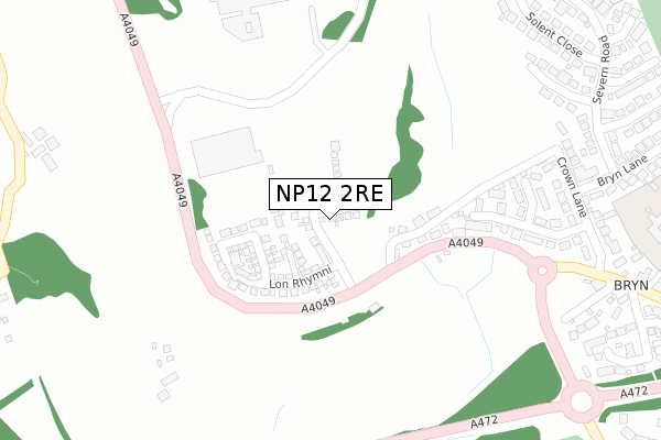
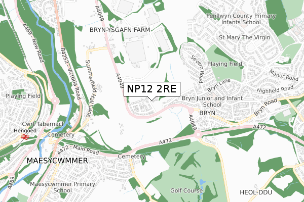
NP12 2RE is located in the Maesycwmmer electoral ward, within the unitary authority of Caerphilly and the Welsh Parliamentary constituency of Islwyn. The Local Health Board is Aneurin Bevan University and the police force is Gwent. This postcode has been in use since June 2018.


GetTheData
Source: OS Open Zoomstack (Ordnance Survey)
Licence: Open Government Licence (requires attribution)
Attribution: Contains OS data © Crown copyright and database right 2024
Source: Open Postcode Geo
Licence: Open Government Licence (requires attribution)
Attribution: Contains OS data © Crown copyright and database right 2024; Contains Royal Mail data © Royal Mail copyright and database right 2024; Source: Office for National Statistics licensed under the Open Government Licence v.3.0
| Easting | 316353 |
| Northing | 195292 |
| Latitude | 51.650178 |
| Longitude | -3.210436 |
GetTheData
Source: Open Postcode Geo
Licence: Open Government Licence
| Country | Wales |
| Postcode District | NP12 |
| ➜ NP12 open data dashboard ➜ See where NP12 is on a map ➜ Where is Pontllanfraith? | |
GetTheData
Source: Land Registry Price Paid Data
Licence: Open Government Licence
| Ward | Maesycwmmer |
| Constituency | Islwyn |
GetTheData
Source: ONS Postcode Database
Licence: Open Government Licence
1, RHODFA SIRHYWI, GELLIHAF, BLACKWOOD, NP12 2RE 2023 4 AUG £332,500 |
11, RHODFA SIRHYWI, GELLIHAF, BLACKWOOD, NP12 2RE 2022 5 AUG £350,000 |
27, RHODFA SIRHYWI, GELLIHAF, BLACKWOOD, NP12 2RE 2022 8 APR £349,995 |
25, RHODFA SIRHYWI, GELLIHAF, BLACKWOOD, NP12 2RE 2022 18 MAR £284,995 |
23, RHODFA SIRHYWI, GELLIHAF, BLACKWOOD, NP12 2RE 2022 18 MAR £299,995 |
9, RHODFA SIRHYWI, GELLIHAF, BLACKWOOD, NP12 2RE 2021 19 NOV £287,500 |
40, RHODFA SIRHYWI, GELLIHAF, BLACKWOOD, NP12 2RE 2021 10 SEP £248,995 |
32, RHODFA SIRHYWI, GELLIHAF, BLACKWOOD, NP12 2RE 2021 3 SEP £289,995 |
34, RHODFA SIRHYWI, GELLIHAF, BLACKWOOD, NP12 2RE 2021 19 AUG £279,995 |
38, RHODFA SIRHYWI, GELLIHAF, BLACKWOOD, NP12 2RE 2021 18 AUG £278,995 |
GetTheData
Source: HM Land Registry Price Paid Data
Licence: Contains HM Land Registry data © Crown copyright and database right 2024. This data is licensed under the Open Government Licence v3.0.
| June 2022 | Violence and sexual offences | On or near A4049 | 145m |
| June 2022 | Public order | On or near A4049 | 145m |
| June 2022 | Public order | On or near A4049 | 145m |
| ➜ Get more crime data in our Crime section | |||
GetTheData
Source: data.police.uk
Licence: Open Government Licence
| Shops (Bryn Lane) | Bryn | 378m |
| Shops (Bryn Lane) | Bryn | 387m |
| Crown (A4049) | Pontllanfraith | 443m |
| Crown (A4049) | Pontllanfraith | 520m |
| The Coal Hole (A4049) | Gelli-haf | 556m |
| Hengoed Station | 1km |
| Ystrad Mynach Station | 2.4km |
| Pengam Station | 2.6km |
GetTheData
Source: NaPTAN
Licence: Open Government Licence
| Percentage of properties with Next Generation Access | 87.5% |
| Percentage of properties with Superfast Broadband | 87.5% |
| Percentage of properties with Ultrafast Broadband | 87.5% |
| Percentage of properties with Full Fibre Broadband | 87.5% |
Superfast Broadband is between 30Mbps and 300Mbps
Ultrafast Broadband is > 300Mbps
| Percentage of properties unable to receive 2Mbps | 0.0% |
| Percentage of properties unable to receive 5Mbps | 12.5% |
| Percentage of properties unable to receive 10Mbps | 12.5% |
| Percentage of properties unable to receive 30Mbps | 12.5% |
GetTheData
Source: Ofcom
Licence: Ofcom Terms of Use (requires attribution)
GetTheData
Source: ONS Postcode Database
Licence: Open Government Licence


➜ Get more ratings from the Food Standards Agency
GetTheData
Source: Food Standards Agency
Licence: FSA terms & conditions
| Last Collection | |||
|---|---|---|---|
| Location | Mon-Fri | Sat | Distance |
| Bryn Road | 16:15 | 11:15 | 551m |
| Maesycymmer Post Office | 17:00 | 11:15 | 979m |
| Fleur De Lys Post Office | 17:00 | 12:00 | 1,498m |
GetTheData
Source: Dracos
Licence: Creative Commons Attribution-ShareAlike
| School | Phase of Education | Distance |
|---|---|---|
| Bryn Primary School Forest Hill, The Bryn, Pontllanfraith, Blackwood, NP12 2PL | Not applicable | 544m |
| Penllwyn Primary School Fleur-De-Lys Avenue, Pontllanfraith, Blackwood, NP12 2NT | Not applicable | 865m |
| Maesycwmmer Primary School Tabor Road, Maesycwmmer, Hengoed, CF82 7PU | Not applicable | 1km |
GetTheData
Source: Edubase
Licence: Open Government Licence
The below table lists the International Territorial Level (ITL) codes (formerly Nomenclature of Territorial Units for Statistics (NUTS) codes) and Local Administrative Units (LAU) codes for NP12 2RE:
| ITL 1 Code | Name |
|---|---|
| TLL | Wales |
| ITL 2 Code | Name |
| TLL1 | West Wales and The Valleys |
| ITL 3 Code | Name |
| TLL16 | Gwent Valleys |
| LAU 1 Code | Name |
| W06000018 | Caerphilly |
GetTheData
Source: ONS Postcode Directory
Licence: Open Government Licence
The below table lists the Census Output Area (OA), Lower Layer Super Output Area (LSOA), and Middle Layer Super Output Area (MSOA) for NP12 2RE:
| Code | Name | |
|---|---|---|
| OA | W00007170 | |
| LSOA | W01001369 | Caerphilly 012D |
| MSOA | W02000301 | Caerphilly 012 |
GetTheData
Source: ONS Postcode Directory
Licence: Open Government Licence
| NP12 2HD | The Bryn | 162m |
| NP12 2GD | Crown Lane | 313m |
| NP12 2FU | Tamar Close | 380m |
| NP12 2FT | Solent Close | 408m |
| NP12 2HA | Crown Lane | 412m |
| NP12 2HX | Trem Y Goron | 422m |
| NP12 2PG | Bryn Lane | 432m |
| NP12 2GA | Severn Road | 451m |
| NP12 2HF | Crown Cottages | 461m |
| NP12 2HZ | Clos Y Goron | 468m |
GetTheData
Source: Open Postcode Geo; Land Registry Price Paid Data
Licence: Open Government Licence