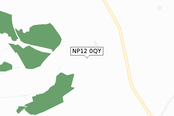
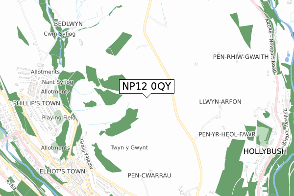
NP12 0QY is located in the New Tredegar electoral ward, within the unitary authority of Caerphilly and the Welsh Parliamentary constituency of Merthyr Tydfil and Rhymney. The Local Health Board is Aneurin Bevan University and the police force is Gwent. This postcode has been in use since August 2017.


GetTheData
Source: OS Open Zoomstack (Ordnance Survey)
Licence: Open Government Licence (requires attribution)
Attribution: Contains OS data © Crown copyright and database right 2024
Source: Open Postcode Geo
Licence: Open Government Licence (requires attribution)
Attribution: Contains OS data © Crown copyright and database right 2024; Contains Royal Mail data © Royal Mail copyright and database right 2024; Source: Office for National Statistics licensed under the Open Government Licence v.3.0
| Easting | 315390 |
| Northing | 203489 |
| Latitude | 51.723718 |
| Longitude | -3.226343 |
GetTheData
Source: Open Postcode Geo
Licence: Open Government Licence
| Country | Wales |
| Postcode District | NP12 |
| ➜ NP12 open data dashboard ➜ See where NP12 is on a map | |
GetTheData
Source: Land Registry Price Paid Data
Licence: Open Government Licence
| Ward | New Tredegar |
| Constituency | Merthyr Tydfil And Rhymney |
GetTheData
Source: ONS Postcode Database
Licence: Open Government Licence
| Bedwellty Road Garage (Bedwellty Road) | Elliotstown | 823m |
| Rose Villas (Bedwellty Road) | Elliotstown | 934m |
| Terminus (Bedlwyn Road) | Phillipstown | 938m |
| Glyn Syfi (Elliot Street) | Elliotstown | 940m |
| Abersyfi Cottages (Bedwellty Road) | Elliotstown | 941m |
| Tir-phil Station | 1.4km |
| Brithdir Station | 1.5km |
| Bargoed Station | 3.5km |
GetTheData
Source: NaPTAN
Licence: Open Government Licence
GetTheData
Source: ONS Postcode Database
Licence: Open Government Licence


➜ Get more ratings from the Food Standards Agency
GetTheData
Source: Food Standards Agency
Licence: FSA terms & conditions
| Last Collection | |||
|---|---|---|---|
| Location | Mon-Fri | Sat | Distance |
| Marine Street | 16:30 | 11:00 | 3,512m |
| Bargoed Post Office | 17:15 | 11:45 | 3,896m |
| Argoed Post Office | 17:00 | 12:00 | 4,278m |
GetTheData
Source: Dracos
Licence: Creative Commons Attribution-ShareAlike
| School | Phase of Education | Distance |
|---|---|---|
| Phillipstown Primary School Cefn Rhychdir Road, Phillipstown, New Tredegar, Caerphilly, NP24 6XE | Not applicable | 980m |
| Whiterose Primary White Rose Way, New Tredegar, NP24 6DF | Not applicable | 1.1km |
| Markham Primary School Pantycefn Road, Markham, Blackwood, NP12 0QD | Not applicable | 2.6km |
GetTheData
Source: Edubase
Licence: Open Government Licence
The below table lists the International Territorial Level (ITL) codes (formerly Nomenclature of Territorial Units for Statistics (NUTS) codes) and Local Administrative Units (LAU) codes for NP12 0QY:
| ITL 1 Code | Name |
|---|---|
| TLL | Wales |
| ITL 2 Code | Name |
| TLL1 | West Wales and The Valleys |
| ITL 3 Code | Name |
| TLL16 | Gwent Valleys |
| LAU 1 Code | Name |
| W06000018 | Caerphilly |
GetTheData
Source: ONS Postcode Directory
Licence: Open Government Licence
The below table lists the Census Output Area (OA), Lower Layer Super Output Area (LSOA), and Middle Layer Super Output Area (MSOA) for NP12 0QY:
| Code | Name | |
|---|---|---|
| OA | W00007249 | |
| LSOA | W01001384 | Caerphilly 002C |
| MSOA | W02000291 | Caerphilly 002 |
GetTheData
Source: ONS Postcode Directory
Licence: Open Government Licence
| NP24 6NS | Graig Y Bedw | 696m |
| NP24 6NR | Gorse Terrace | 727m |
| NP24 6NP | Brookland View | 741m |
| NP24 6NW | Bedwellty Road | 763m |
| NP24 6NY | Jubilee Road | 797m |
| NP24 6NX | Jubilee Road | 816m |
| NP24 6NT | Alexandra Road | 818m |
| NP24 6NL | Upper Stanley Terrace | 820m |
| NP24 6BQ | Fernhill Terrace | 826m |
| NP24 6NZ | Jubilee Road | 839m |
GetTheData
Source: Open Postcode Geo; Land Registry Price Paid Data
Licence: Open Government Licence