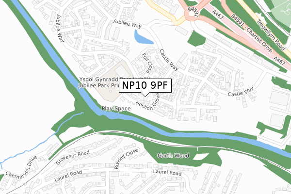
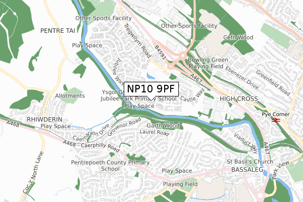
NP10 9PF is located in the Rogerstone West electoral ward, within the unitary authority of Newport and the Welsh Parliamentary constituency of Newport West. The Local Health Board is Aneurin Bevan University and the police force is Gwent. This postcode has been in use since August 2018.


GetTheData
Source: OS Open Zoomstack (Ordnance Survey)
Licence: Open Government Licence (requires attribution)
Attribution: Contains OS data © Crown copyright and database right 2024
Source: Open Postcode Geo
Licence: Open Government Licence (requires attribution)
Attribution: Contains OS data © Crown copyright and database right 2024; Contains Royal Mail data © Royal Mail copyright and database right 2024; Source: Office for National Statistics licensed under the Open Government Licence v.3.0
| Easting | 326927 |
| Northing | 187601 |
| Latitude | 51.582513 |
| Longitude | -3.056022 |
GetTheData
Source: Open Postcode Geo
Licence: Open Government Licence
| Country | Wales |
| Postcode District | NP10 |
| ➜ NP10 open data dashboard ➜ See where NP10 is on a map ➜ Where is Newport? | |
GetTheData
Source: Land Registry Price Paid Data
Licence: Open Government Licence
| Ward | Rogerstone West |
| Constituency | Newport West |
GetTheData
Source: ONS Postcode Database
Licence: Open Government Licence
2023 30 JAN £460,000 |
2022 8 JUL £390,000 |
14, HOELION GROVE, ROGERSTONE, NEWPORT, NP10 9PF 2020 18 FEB £331,000 |
10, HOELION GROVE, ROGERSTONE, NEWPORT, NP10 9PF 2019 31 MAY £423,995 |
2019 30 MAY £312,995 |
16, HOELION GROVE, ROGERSTONE, NEWPORT, NP10 9PF 2019 18 APR £374,995 |
14, HOELION GROVE, ROGERSTONE, NEWPORT, NP10 9PF 2019 12 APR £334,995 |
18, HOELION GROVE, ROGERSTONE, NEWPORT, NP10 9PF 2019 5 APR £329,995 |
8, HOELION GROVE, ROGERSTONE, NEWPORT, NP10 9PF 2019 8 MAR £310,000 |
15, HOELION GROVE, ROGERSTONE, NEWPORT, NP10 9PF 2019 31 JAN £429,995 |
GetTheData
Source: HM Land Registry Price Paid Data
Licence: Contains HM Land Registry data © Crown copyright and database right 2024. This data is licensed under the Open Government Licence v3.0.
| October 2023 | Violence and sexual offences | On or near Laurel Road | 359m |
| October 2023 | Violence and sexual offences | On or near Laurel Road | 359m |
| June 2022 | Violence and sexual offences | On or near Russell Close | 210m |
| ➜ Get more crime data in our Crime section | |||
GetTheData
Source: data.police.uk
Licence: Open Government Licence
| Channel View (Laurel Road) | Bassaleg | 259m |
| Channel View (Laurel Road) | Bassaleg | 262m |
| Library (Tregwilym Road) | Rogerstone | 384m |
| Wentworth Close (Laurel Road) | Bassaleg | 407m |
| Wentworth Close (Laurel Road) | Bassaleg | 425m |
| Rogerstone Station | 1.6km |
| Risca & Pontymister Station | 3.6km |
| Newport (S Wales) Station | 3.9km |
GetTheData
Source: NaPTAN
Licence: Open Government Licence
| Percentage of properties with Next Generation Access | 100.0% |
| Percentage of properties with Superfast Broadband | 100.0% |
| Percentage of properties with Ultrafast Broadband | 100.0% |
| Percentage of properties with Full Fibre Broadband | 100.0% |
Superfast Broadband is between 30Mbps and 300Mbps
Ultrafast Broadband is > 300Mbps
| Percentage of properties unable to receive 2Mbps | 0.0% |
| Percentage of properties unable to receive 5Mbps | 0.0% |
| Percentage of properties unable to receive 10Mbps | 0.0% |
| Percentage of properties unable to receive 30Mbps | 0.0% |
GetTheData
Source: Ofcom
Licence: Ofcom Terms of Use (requires attribution)
GetTheData
Source: ONS Postcode Database
Licence: Open Government Licence


➜ Get more ratings from the Food Standards Agency
GetTheData
Source: Food Standards Agency
Licence: FSA terms & conditions
| Last Collection | |||
|---|---|---|---|
| Location | Mon-Fri | Sat | Distance |
| Tregwilym Road | 16:00 | 11:15 | 352m |
| Tydu Rogerstone | 16:00 | 11:15 | 594m |
| Rogerstone Post Office | 17:30 | 12:00 | 1,071m |
GetTheData
Source: Dracos
Licence: Creative Commons Attribution-ShareAlike
| School | Phase of Education | Distance |
|---|---|---|
| Rogerstone Primary School Ebenezer Drive, Highcross Estate, Rogerstone, Newport, NP10 9YX | Not applicable | 624m |
| Pentrepoeth C.P. School Bryn Hedydd, Cwm Cwddy Drive, Bassaleg, Newport, NP10 8JN | Not applicable | 871m |
| Bassaleg School Forge Lane, Bassaleg, Newport, NP10 8NF | Not applicable | 1km |
GetTheData
Source: Edubase
Licence: Open Government Licence
The below table lists the International Territorial Level (ITL) codes (formerly Nomenclature of Territorial Units for Statistics (NUTS) codes) and Local Administrative Units (LAU) codes for NP10 9PF:
| ITL 1 Code | Name |
|---|---|
| TLL | Wales |
| ITL 2 Code | Name |
| TLL2 | East Wales |
| ITL 3 Code | Name |
| TLL21 | Monmouthshire and Newport |
| LAU 1 Code | Name |
| W06000022 | Newport |
GetTheData
Source: ONS Postcode Directory
Licence: Open Government Licence
The below table lists the Census Output Area (OA), Lower Layer Super Output Area (LSOA), and Middle Layer Super Output Area (MSOA) for NP10 9PF:
| Code | Name | |
|---|---|---|
| OA | W00008655 | |
| LSOA | W01001671 | Newport 016D |
| MSOA | W02000362 | Newport 016 |
GetTheData
Source: ONS Postcode Directory
Licence: Open Government Licence
| NP10 8PX | Russell Close | 188m |
| NP10 9NL | Jubilee Way | 197m |
| NP10 8PL | Laurel Road | 239m |
| NP10 8PY | Grosvenor Road | 252m |
| NP10 8PU | Lowndes Close | 291m |
| NP10 8NY | Laurel Road | 302m |
| NP10 8NZ | Channel View | 323m |
| NP10 9NA | Tregwilym Road | 327m |
| NP10 8PS | Laurel Road | 340m |
| NP10 8PP | Berkley Road | 346m |
GetTheData
Source: Open Postcode Geo; Land Registry Price Paid Data
Licence: Open Government Licence