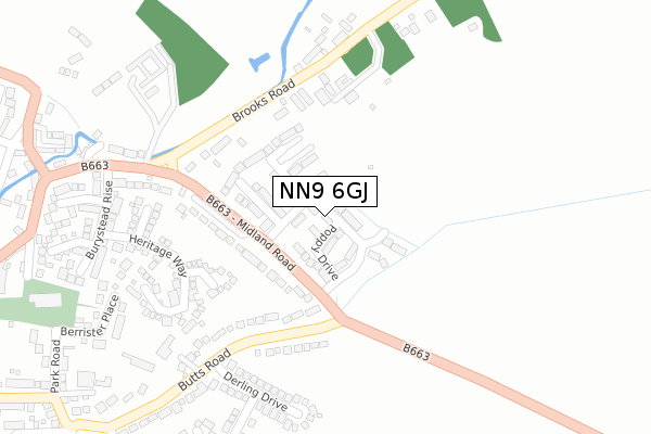
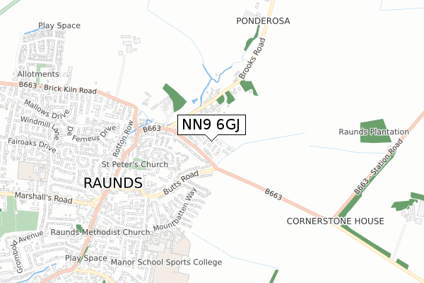
NN9 6GJ is located in the Raunds electoral ward, within the unitary authority of North Northamptonshire and the English Parliamentary constituency of Corby. The Sub Integrated Care Board (ICB) Location is NHS Northamptonshire ICB - 78H and the police force is Northamptonshire. This postcode has been in use since December 2018.


GetTheData
Source: OS Open Zoomstack (Ordnance Survey)
Licence: Open Government Licence (requires attribution)
Attribution: Contains OS data © Crown copyright and database right 2024
Source: Open Postcode Geo
Licence: Open Government Licence (requires attribution)
Attribution: Contains OS data © Crown copyright and database right 2024; Contains Royal Mail data © Royal Mail copyright and database right 2024; Source: Office for National Statistics licensed under the Open Government Licence v.3.0
| Easting | 500470 |
| Northing | 273209 |
| Latitude | 52.347773 |
| Longitude | -0.526454 |
GetTheData
Source: Open Postcode Geo
Licence: Open Government Licence
| Country | England |
| Postcode District | NN9 |
| ➜ NN9 open data dashboard ➜ See where NN9 is on a map ➜ Where is Raunds? | |
GetTheData
Source: Land Registry Price Paid Data
Licence: Open Government Licence
| Ward | Raunds |
| Constituency | Corby |
GetTheData
Source: ONS Postcode Database
Licence: Open Government Licence
2022 16 DEC £375,000 |
2022 3 MAR £276,000 |
2021 10 DEC £370,000 |
2021 30 SEP £360,000 |
33, HONEYSUCKLE WAY, RAUNDS, WELLINGBOROUGH, NN9 6GJ 2019 27 SEP £370,000 |
41, HONEYSUCKLE WAY, RAUNDS, WELLINGBOROUGH, NN9 6GJ 2019 20 SEP £375,000 |
31, HONEYSUCKLE WAY, RAUNDS, WELLINGBOROUGH, NN9 6GJ 2019 12 SEP £337,000 |
29, HONEYSUCKLE WAY, RAUNDS, WELLINGBOROUGH, NN9 6GJ 2019 6 SEP £337,000 |
3, HONEYSUCKLE WAY, RAUNDS, WELLINGBOROUGH, NN9 6GJ 2019 16 AUG £339,000 |
1, HONEYSUCKLE WAY, RAUNDS, WELLINGBOROUGH, NN9 6GJ 2019 9 AUG £350,000 |
GetTheData
Source: HM Land Registry Price Paid Data
Licence: Contains HM Land Registry data © Crown copyright and database right 2024. This data is licensed under the Open Government Licence v3.0.
| October 2022 | Violence and sexual offences | On or near Midland Road | 120m |
| June 2022 | Other theft | On or near Manor Farm Road | 475m |
| June 2022 | Violence and sexual offences | On or near North Street | 483m |
| ➜ Get more crime data in our Crime section | |||
GetTheData
Source: data.police.uk
Licence: Open Government Licence
| Park Road | Raunds | 550m |
| Broadlands (Mountbatten Way) | Raunds | 571m |
| Manor Street | Raunds | 577m |
| Enterprise Road (Brick Kiln Road) | Raunds | 578m |
| Enterprise Road (Brick Kiln Road) | Raunds | 612m |
GetTheData
Source: NaPTAN
Licence: Open Government Licence
➜ Broadband speed and availability dashboard for NN9 6GJ
| Percentage of properties with Next Generation Access | 100.0% |
| Percentage of properties with Superfast Broadband | 100.0% |
| Percentage of properties with Ultrafast Broadband | 100.0% |
| Percentage of properties with Full Fibre Broadband | 0.0% |
Superfast Broadband is between 30Mbps and 300Mbps
Ultrafast Broadband is > 300Mbps
| Median download speed | 55.0Mbps |
| Average download speed | 57.0Mbps |
| Maximum download speed | 75.62Mbps |
| Median upload speed | 10.0Mbps |
| Average upload speed | 14.1Mbps |
| Maximum upload speed | 19.53Mbps |
| Percentage of properties unable to receive 2Mbps | 0.0% |
| Percentage of properties unable to receive 5Mbps | 0.0% |
| Percentage of properties unable to receive 10Mbps | 0.0% |
| Percentage of properties unable to receive 30Mbps | 0.0% |
➜ Broadband speed and availability dashboard for NN9 6GJ
GetTheData
Source: Ofcom
Licence: Ofcom Terms of Use (requires attribution)
GetTheData
Source: ONS Postcode Database
Licence: Open Government Licence


➜ Get more ratings from the Food Standards Agency
GetTheData
Source: Food Standards Agency
Licence: FSA terms & conditions
| Last Collection | |||
|---|---|---|---|
| Location | Mon-Fri | Sat | Distance |
| Marshalls Road | 16:15 | 08:00 | 822m |
| Mallows Drive | 16:45 | 08:30 | 1,190m |
| Chelveston Tso | 16:15 | 10:45 | 3,876m |
GetTheData
Source: Dracos
Licence: Creative Commons Attribution-ShareAlike
| Facility | Distance |
|---|---|
| Manor Sport And Leisure Ltd Mountbatten Way, Raunds, Wellingborough Sports Hall, Health and Fitness Gym, Artificial Grass Pitch, Grass Pitches, Studio, Outdoor Tennis Courts | 696m |
| Windmill Primary School Windmill Lane, Raunds, Wellingborough Grass Pitches, Sports Hall | 1km |
| Raunds Cricket Club Marshalls Road, Raunds, Wellingborough Grass Pitches | 1.2km |
GetTheData
Source: Active Places
Licence: Open Government Licence
| School | Phase of Education | Distance |
|---|---|---|
| St Peter's Church of England Academy Mountbatten Way, Raunds, Wellingborough, NN9 6PA | Primary | 601m |
| Manor School Mountbatten Way, Raunds, Wellingborough, NN9 6PA | Secondary | 626m |
| Raunds Park Infant School Park Street, Raunds, Wellingborough, NN9 6NB | Primary | 673m |
GetTheData
Source: Edubase
Licence: Open Government Licence
The below table lists the International Territorial Level (ITL) codes (formerly Nomenclature of Territorial Units for Statistics (NUTS) codes) and Local Administrative Units (LAU) codes for NN9 6GJ:
| ITL 1 Code | Name |
|---|---|
| TLF | East Midlands (England) |
| ITL 2 Code | Name |
| TLF2 | Leicestershire, Rutland and Northamptonshire |
| ITL 3 Code | Name |
| TLF25 | North Northamptonshire |
| LAU 1 Code | Name |
| E07000152 | East Northamptonshire |
GetTheData
Source: ONS Postcode Directory
Licence: Open Government Licence
The below table lists the Census Output Area (OA), Lower Layer Super Output Area (LSOA), and Middle Layer Super Output Area (MSOA) for NN9 6GJ:
| Code | Name | |
|---|---|---|
| OA | E00137605 | |
| LSOA | E01027053 | East Northamptonshire 005C |
| MSOA | E02005633 | East Northamptonshire 005 |
GetTheData
Source: ONS Postcode Directory
Licence: Open Government Licence
| NN9 6RG | Matson Court | 197m |
| NN9 6JF | Midland Road | 225m |
| NN9 6RX | Heritage Way | 255m |
| NN9 6LF | Derling Drive | 275m |
| NN9 6RW | Wheelwright Close | 298m |
| NN9 6RH | Richardson Way | 313m |
| NN9 6JG | Butts Road | 313m |
| NN9 6NS | Brooks Road | 318m |
| NN9 6RZ | Burystead Rise | 376m |
| NN9 6JN | Berrister Place | 385m |
GetTheData
Source: Open Postcode Geo; Land Registry Price Paid Data
Licence: Open Government Licence